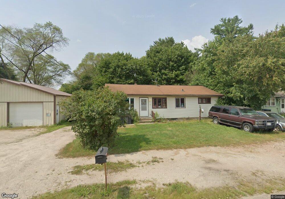
115 N Oborn St Waupaca, WI 54981
Estimated Value: $134,000 - $175,000
3
Beds
1
Bath
1,144
Sq Ft
$136/Sq Ft
Est. Value
About This Home
This home is located at 115 N Oborn St, Waupaca, WI 54981 and is currently estimated at $155,969, approximately $136 per square foot. 115 N Oborn St is a home located in Waupaca County with nearby schools including Waupaca Learning Center Elementary School, Waupaca Middle School, and Waupaca High School.
Ownership History
Date
Name
Owned For
Owner Type
Purchase Details
Closed on
Feb 16, 2024
Sold by
Cherny James A
Bought by
King Devin Charles
Current Estimated Value
Home Financials for this Owner
Home Financials are based on the most recent Mortgage that was taken out on this home.
Original Mortgage
$124,699
Outstanding Balance
$122,499
Interest Rate
6.62%
Mortgage Type
New Conventional
Estimated Equity
$33,470
Purchase Details
Closed on
Sep 11, 2012
Sold by
Lapp Tosha M and Cherny Tosha M
Bought by
Cherny James A
Create a Home Valuation Report for This Property
The Home Valuation Report is an in-depth analysis detailing your home's value as well as a comparison with similar homes in the area
Home Values in the Area
Average Home Value in this Area
Purchase History
| Date | Buyer | Sale Price | Title Company |
|---|---|---|---|
| King Devin Charles | $127,000 | Gowey Abstract & Title | |
| Cherny James A | -- | None Available |
Source: Public Records
Mortgage History
| Date | Status | Borrower | Loan Amount |
|---|---|---|---|
| Open | King Devin Charles | $124,699 |
Source: Public Records
Tax History Compared to Growth
Tax History
| Year | Tax Paid | Tax Assessment Tax Assessment Total Assessment is a certain percentage of the fair market value that is determined by local assessors to be the total taxable value of land and additions on the property. | Land | Improvement |
|---|---|---|---|---|
| 2024 | $2,039 | $123,600 | $21,300 | $102,300 |
| 2023 | $2,039 | $123,600 | $21,300 | $102,300 |
| 2022 | $1,603 | $75,900 | $14,300 | $61,600 |
| 2021 | $1,616 | $75,900 | $14,300 | $61,600 |
| 2020 | $1,746 | $75,900 | $14,300 | $61,600 |
| 2019 | $1,662 | $75,900 | $14,300 | $61,600 |
| 2018 | $1,808 | $75,900 | $14,300 | $61,600 |
| 2017 | $1,943 | $75,900 | $14,300 | $61,600 |
| 2016 | $1,804 | $75,900 | $14,300 | $61,600 |
| 2015 | $2,040 | $75,900 | $14,300 | $61,600 |
| 2014 | $1,988 | $75,900 | $14,300 | $61,600 |
| 2013 | $1,989 | $75,900 | $14,300 | $61,600 |
Source: Public Records
Map
Nearby Homes
- 113 N State St
- 0 Lake St Unit 50304618
- 903 Harding St
- 623 Oak St
- 108 E Lake St
- 600 Royalton St
- 401 Granite St
- 406 W Fulton St
- 0 N Hill Rd Unit 20803046
- 0 N Hill Rd Unit 20803055
- 0 N Hill Rd Unit 20803057
- 0 Feathers Ct Unit 20803048
- 0 Constance Rd Unit 20803051
- 0 Constance Rd Unit 50285836
- 0 Constance Rd Unit 20803050
- 578 Highland Dr
- 602 North St
- N3641 Ballard St
- 401 Bailey St
- 908 Honey Bear Ln