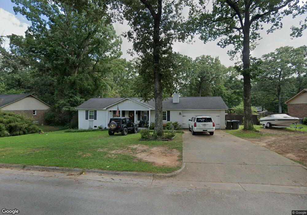
115 Oakcrest Rd Huntsville, AL 35811
Moores Mill NeighborhoodEstimated Value: $236,000 - $285,000
--
Bed
--
Bath
1,364
Sq Ft
$189/Sq Ft
Est. Value
About This Home
This home is located at 115 Oakcrest Rd, Huntsville, AL 35811 and is currently estimated at $258,302, approximately $189 per square foot. 115 Oakcrest Rd is a home with nearby schools including Mt Carmel Elementary School, Riverton Intermediate School, and Buckhorn Middle School.
Ownership History
Date
Name
Owned For
Owner Type
Purchase Details
Closed on
Apr 30, 2025
Sold by
Worley David E
Bought by
Worley Lori
Current Estimated Value
Purchase Details
Closed on
Apr 5, 2013
Sold by
Tipton Ollie Douglas and Tipton Carla Cole
Bought by
Wolry Ii David E and Wolry Lori
Home Financials for this Owner
Home Financials are based on the most recent Mortgage that was taken out on this home.
Original Mortgage
$127,551
Interest Rate
3.55%
Mortgage Type
New Conventional
Create a Home Valuation Report for This Property
The Home Valuation Report is an in-depth analysis detailing your home's value as well as a comparison with similar homes in the area
Home Values in the Area
Average Home Value in this Area
Purchase History
| Date | Buyer | Sale Price | Title Company |
|---|---|---|---|
| Worley Lori | $227,500 | None Listed On Document | |
| Wolry Ii David E | $125,000 | None Available |
Source: Public Records
Mortgage History
| Date | Status | Borrower | Loan Amount |
|---|---|---|---|
| Previous Owner | Wolry Ii David E | $127,551 |
Source: Public Records
Tax History Compared to Growth
Tax History
| Year | Tax Paid | Tax Assessment Tax Assessment Total Assessment is a certain percentage of the fair market value that is determined by local assessors to be the total taxable value of land and additions on the property. | Land | Improvement |
|---|---|---|---|---|
| 2024 | $742 | $22,000 | $4,500 | $17,500 |
| 2023 | $742 | $21,560 | $4,500 | $17,060 |
| 2022 | $613 | $18,360 | $3,000 | $15,360 |
| 2021 | $553 | $16,700 | $3,000 | $13,700 |
| 2020 | $403 | $12,520 | $2,000 | $10,520 |
| 2019 | $385 | $12,040 | $2,000 | $10,040 |
| 2018 | $363 | $11,420 | $0 | $0 |
| 2017 | $353 | $11,140 | $0 | $0 |
| 2016 | $353 | $11,140 | $0 | $0 |
| 2015 | $353 | $11,140 | $0 | $0 |
| 2014 | $349 | $11,040 | $0 | $0 |
Source: Public Records
Map
Nearby Homes
- 0.40 acres Laurel Oak Rd
- 154 Stone Hill Dr
- Raleigh Pennington Ave
- Cambridge Pennington Ave
- Charleston Pennington Ave
- Shelburne Pennington Ave
- Bennington Pennington Ave
- Blakley Pennington Ave
- The Cambridge Plan at Pennington
- The Raleigh Plan at Pennington
- The Manhattan Plan at Pennington
- The Lincoln Plan at Pennington
- The Winston Plan at Pennington
- The Bennington Plan at Pennington
- The Shelburne Plan at Pennington
- The Savannah Plan at Pennington
- The Charleston Plan at Pennington
- Winston Pennington Ave
- 242 Stone Hill Dr
- Independence II Plan at St. Clair Place - Ranchers
- 113 Oakcrest Rd
- 116 Oakcrest Rd
- 114 Oakcrest Rd
- 118 Oakcrest Rd
- 111 Oakcrest Rd
- 112 Oakcrest Rd
- 119 Oakcrest Rd
- 193 Robinson Rd
- 110 Oakcrest Rd
- 120 Oakcrest Rd
- 107 Oakcrest Rd
- 177 Robinson Rd
- 121 Oakcrest Rd
- 108 Oakcrest Rd
- 167 Robinson Rd
- 215 Robinson Rd
- 6656 Moores Mill Rd
- 159 Robinson Rd
- 103 Oakcrest Rd
- 106 Oakcrest Rd