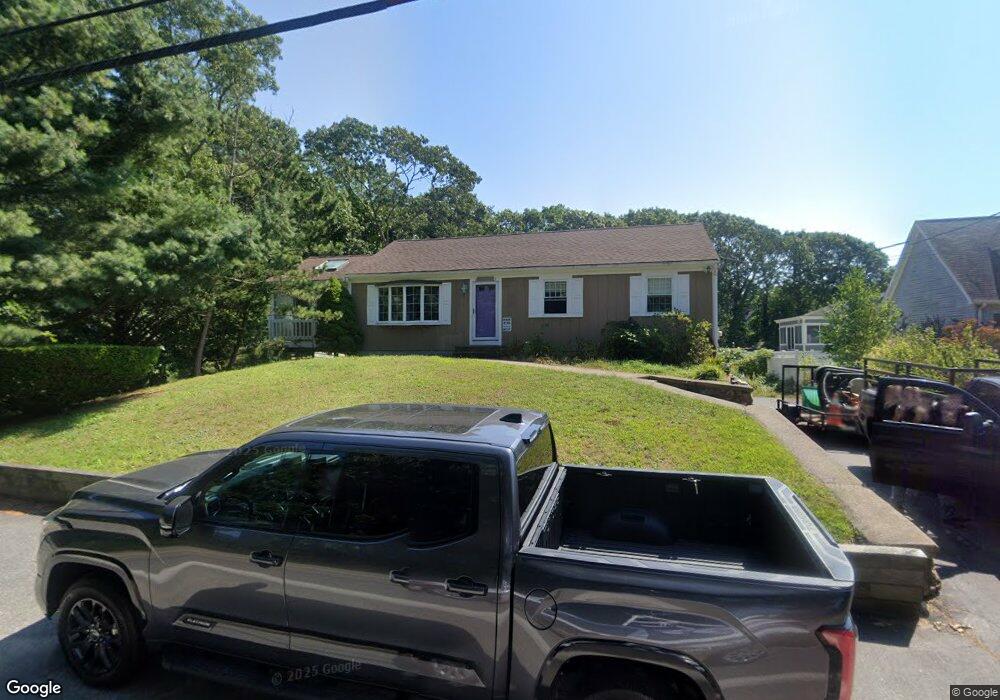
115 Presidents Rd Buzzards Bay, MA 02532
Estimated Value: $606,000 - $721,000
3
Beds
1
Bath
1,092
Sq Ft
$593/Sq Ft
Est. Value
About This Home
This home is located at 115 Presidents Rd, Buzzards Bay, MA 02532 and is currently estimated at $647,456, approximately $592 per square foot. 115 Presidents Rd is a home located in Barnstable County with nearby schools including Bourne High School, St Margaret Regional School, and Cadence Academy Preschool - Bourne.
Ownership History
Date
Name
Owned For
Owner Type
Purchase Details
Closed on
May 20, 2010
Sold by
Disalvo Joseph A
Bought by
Disalvo Mark J
Current Estimated Value
Home Financials for this Owner
Home Financials are based on the most recent Mortgage that was taken out on this home.
Original Mortgage
$275,000
Outstanding Balance
$184,526
Interest Rate
5.23%
Mortgage Type
Purchase Money Mortgage
Estimated Equity
$462,930
Create a Home Valuation Report for This Property
The Home Valuation Report is an in-depth analysis detailing your home's value as well as a comparison with similar homes in the area
Home Values in the Area
Average Home Value in this Area
Purchase History
| Date | Buyer | Sale Price | Title Company |
|---|---|---|---|
| Disalvo Mark J | $300,000 | -- | |
| Disalvo Mark J | $300,000 | -- |
Source: Public Records
Mortgage History
| Date | Status | Borrower | Loan Amount |
|---|---|---|---|
| Open | Disalvo Mark J | $275,000 | |
| Closed | Disalvo Mark J | $275,000 |
Source: Public Records
Tax History Compared to Growth
Tax History
| Year | Tax Paid | Tax Assessment Tax Assessment Total Assessment is a certain percentage of the fair market value that is determined by local assessors to be the total taxable value of land and additions on the property. | Land | Improvement |
|---|---|---|---|---|
| 2025 | $4,293 | $549,700 | $330,100 | $219,600 |
| 2024 | $4,198 | $523,400 | $314,300 | $209,100 |
| 2023 | $4,081 | $463,200 | $278,200 | $185,000 |
| 2022 | $3,965 | $393,000 | $246,200 | $146,800 |
| 2021 | $3,852 | $357,700 | $224,000 | $133,700 |
| 2020 | $3,749 | $349,100 | $221,900 | $127,200 |
| 2019 | $3,789 | $360,500 | $240,400 | $120,100 |
| 2018 | $3,200 | $303,600 | $193,800 | $109,800 |
| 2017 | $3,036 | $294,800 | $186,100 | $108,700 |
| 2016 | $2,835 | $279,000 | $186,100 | $92,900 |
| 2015 | $2,810 | $279,000 | $186,100 | $92,900 |
Source: Public Records
Map
Nearby Homes
- 203 County Rd
- 151 - 153 Main St
- 18 Carlton Rd
- 34 Washington Ave
- 46 Holt Rd
- 46 Holt Rd Unit A
- 13 Laurel Hill Ct
- 18 Douglas Ave
- 12 Beachwood Rd
- 56 Rip Van Winkle Way
- 5 Sea Knoll Ct
- 44 Cotuit Rd
- 14 Great Rock Rd
- 1 Pine Tree Dr
- 26 Carnoustie Rd
- 12 Turnberry Rd Unit 12
- 3 Fairway Dr Unit F
- 3 Wolf Rd
- 34 Turnberry Rd
- 121 Presidents Rd
- 121 Presidents Rd
- 11 Cleveland Cir
- 105 Presidents Rd
- 40 Sea Breeze Dr
- 125 Presidents Rd
- 100 Presidents Rd
- 100 Presidents Rd
- 42 Sea Breeze Dr
- 97 Presidents Rd
- 38 Sea Breeze Dr
- 38 Seabreeze Dr
- 97 Presidents Rd
- 18 Gilder Rd
- 134 Presidents Rd
- 24 Gilder Rd
- 24 Gilder Rd
- 6 Cleveland Cir
- 96 Presidents Rd
- 91 Presidents Rd