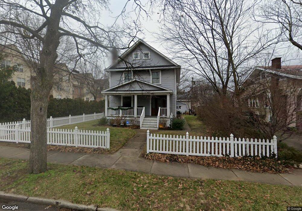
115 Rhode Island Ave Unit Bldg-Unit Royal Oak, MI 48067
Estimated Value: $517,000 - $667,000
3
Beds
3
Baths
1,838
Sq Ft
$304/Sq Ft
Est. Value
About This Home
This home is located at 115 Rhode Island Ave Unit Bldg-Unit, Royal Oak, MI 48067 and is currently estimated at $558,677, approximately $303 per square foot. 115 Rhode Island Ave Unit Bldg-Unit is a home located in Oakland County with nearby schools including Oakland Elementary School, Royal Oak Middle School, and Royal Oak High School.
Ownership History
Date
Name
Owned For
Owner Type
Purchase Details
Closed on
May 7, 2020
Sold by
Caldwell Jeffrey M
Bought by
Butler Susan B Eggleston
Current Estimated Value
Purchase Details
Closed on
Nov 2, 2018
Sold by
Dumont Jeffrey A
Bought by
Caldwell Jeffrey M
Purchase Details
Closed on
Nov 13, 2001
Sold by
Dumont Jeffrey A
Bought by
Dumont Jeffrey A
Purchase Details
Closed on
Sep 6, 2000
Sold by
Huebel Al
Bought by
Dumont Jeffrey A
Home Financials for this Owner
Home Financials are based on the most recent Mortgage that was taken out on this home.
Original Mortgage
$126,400
Interest Rate
7.98%
Create a Home Valuation Report for This Property
The Home Valuation Report is an in-depth analysis detailing your home's value as well as a comparison with similar homes in the area
Home Values in the Area
Average Home Value in this Area
Purchase History
| Date | Buyer | Sale Price | Title Company |
|---|---|---|---|
| Butler Susan B Eggleston | $420,000 | None Available | |
| Caldwell Jeffrey M | $380,000 | None Available | |
| Dumont Jeffrey A | -- | -- | |
| Dumont Jeffrey A | $158,000 | -- |
Source: Public Records
Mortgage History
| Date | Status | Borrower | Loan Amount |
|---|---|---|---|
| Previous Owner | Dumont Jeffrey A | $126,400 |
Source: Public Records
Tax History Compared to Growth
Tax History
| Year | Tax Paid | Tax Assessment Tax Assessment Total Assessment is a certain percentage of the fair market value that is determined by local assessors to be the total taxable value of land and additions on the property. | Land | Improvement |
|---|---|---|---|---|
| 2024 | $5,866 | $206,070 | $0 | $0 |
| 2022 | $6,930 | $185,640 | $0 | $0 |
| 2020 | $5,700 | $171,350 | $0 | $0 |
| 2018 | $6,930 | $114,740 | $0 | $0 |
| 2017 | $3,344 | $114,740 | $0 | $0 |
| 2015 | -- | $103,190 | $0 | $0 |
| 2014 | -- | $86,520 | $0 | $0 |
| 2011 | -- | $74,190 | $0 | $0 |
Source: Public Records
Map
Nearby Homes
- 129 E Maryland Ave
- 138 Tiffany Ln Unit 90
- 1443 S Washington Ave
- 162 S Georgetown Square
- 1455 Chesapeake
- 1552 Maryland Club Dr Unit 87
- 1576 Maryland Club Dr Unit 3
- 1468 Maryland Club Dr
- 1566 Maryland Club Dr
- 333 E Parent Ave Unit 32
- 333 E Parent Ave Unit 9
- 333 E Parent Ave Unit 14
- 333 E Parent Ave Unit 26
- 127 W Parent Ave
- 201 W Parent Ave
- 202 Stonebrooke Ct
- 207 W Parent Ave
- 322 E Harrison Ave Unit 18
- 322 E Harrison Ave Unit 1
- 1530 Maryland Club Dr
- 115 Rhode Island Ave
- 119 Rhode Island Ave
- 203 Rhode Island Ave Unit Bldg-Unit
- 203 Rhode Island Ave
- 116 California Ave
- 206 California Ave
- 1403 S Main St
- 208 California Ave
- 208 California Ave Unit A
- 118 Rhode Island Ave
- 114 Rhode Island Ave
- 206 Rhode Island Ave
- 221 Rhode Island Ave
- 220 California Ave
- 212 Rhode Island Ave
- 121 California Ave
- 1406 Delaware Ave
- 203 California Ave
- 125 E Maryland Ave
- 115 California Ave