Estimated Value: $265,000 - $289,446
3
Beds
2
Baths
1,981
Sq Ft
$141/Sq Ft
Est. Value
About This Home
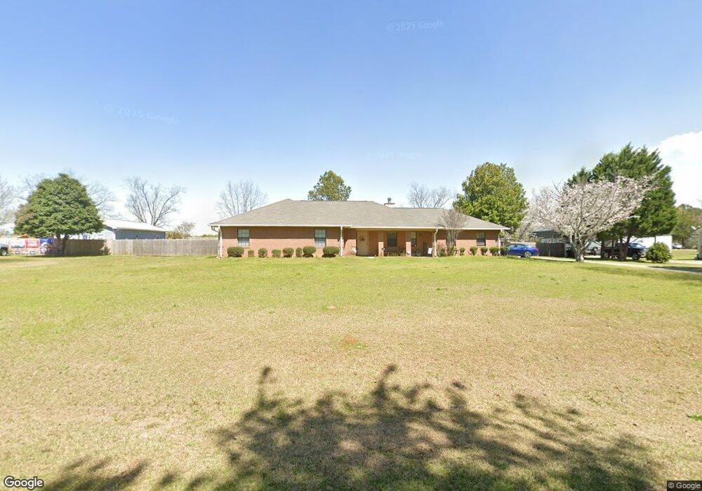
This home is located at 115 Robbie Dr, Byron, GA 31008 and is currently estimated at $278,362, approximately $140 per square foot. 115 Robbie Dr is a home located in Peach County with nearby schools including Kay Road Elementary School, Fort Valley Middle School, and Peach County High School.
Ownership History
Date
Name
Owned For
Owner Type
Purchase Details
Closed on
Dec 21, 2021
Sold by
Prats Gerald A
Bought by
Prats Charlotte B
Current Estimated Value
Home Financials for this Owner
Home Financials are based on the most recent Mortgage that was taken out on this home.
Original Mortgage
$30,500
Outstanding Balance
$19,181
Interest Rate
3.12%
Mortgage Type
Cash
Estimated Equity
$259,181
Purchase Details
Closed on
Oct 14, 1998
Bought by
Prats Gerald A and Prats Charlotte B
Purchase Details
Closed on
Aug 6, 1991
Bought by
Smith Vernon H and Smith Debbie T
Purchase Details
Closed on
Mar 5, 1990
Bought by
Jackson Henry F
Purchase Details
Closed on
Oct 8, 1985
Bought by
Peavy Huff E and Peavy Jr,
Create a Home Valuation Report for This Property
The Home Valuation Report is an in-depth analysis detailing your home's value as well as a comparison with similar homes in the area
Home Values in the Area
Average Home Value in this Area
Purchase History
| Date | Buyer | Sale Price | Title Company |
|---|---|---|---|
| Prats Charlotte B | -- | -- | |
| Prats Gerald A | -- | -- | |
| Smith Vernon H | $77,100 | -- | |
| Jackson Henry F | $9,500 | -- | |
| Peavy Huff E | -- | -- |
Source: Public Records
Mortgage History
| Date | Status | Borrower | Loan Amount |
|---|---|---|---|
| Open | Prats Charlotte B | $30,500 |
Source: Public Records
Tax History
| Year | Tax Paid | Tax Assessment Tax Assessment Total Assessment is a certain percentage of the fair market value that is determined by local assessors to be the total taxable value of land and additions on the property. | Land | Improvement |
|---|---|---|---|---|
| 2025 | $2,632 | $83,320 | $6,600 | $76,720 |
| 2024 | $2,694 | $80,920 | $6,840 | $74,080 |
| 2023 | $2,653 | $79,280 | $6,840 | $72,440 |
| 2022 | $1,676 | $69,480 | $6,840 | $62,640 |
| 2021 | $1,684 | $61,160 | $6,840 | $54,320 |
| 2020 | $1,819 | $65,480 | $6,840 | $58,640 |
| 2019 | $1,779 | $63,920 | $6,840 | $57,080 |
| 2018 | $1,788 | $63,920 | $6,840 | $57,080 |
| 2017 | $1,962 | $63,920 | $6,840 | $57,080 |
| 2016 | $1,954 | $63,920 | $6,840 | $57,080 |
| 2015 | $1,957 | $63,920 | $6,840 | $57,080 |
| 2014 | $1,960 | $63,920 | $6,840 | $57,080 |
| 2013 | -- | $63,920 | $6,840 | $57,080 |
Source: Public Records
Map
Nearby Homes
- 5035 Housers Mill Rd
- 4682 Housers Mill Rd
- 0 Housers Mill Rd Unit 5515996
- 0 Peavy Rd
- 252 Shantz Way Unit (LOT A43)
- 252 Shantz Way
- 250 Shantz Way
- 250 Shantz Way Unit LOT A42
- 206 Christopher Dr
- 248 Shantz Way Unit (LOT A41)
- 256 Shantz Way Unit (LOT A45)
- 246 Shantz Way Unit (LOT A40)
- 246 Shantz Way
- The McGinnis Plan at Bryson Farms
- The Lawson Plan at Bryson Farms
- The Coleman Plan at Bryson Farms
- The Piedmont Plan at Bryson Farms
- The Harrington Plan at Bryson Farms
- The Benson II Plan at Bryson Farms
- The Bradley Plan at Bryson Farms
- 119 Robbie Dr
- 109 Robbie Dr
- 123 Robbie Dr
- 105 Robbie Dr
- 114 Robbie Dr
- 118 Robbie Dr
- 122 Robbie Dr
- 15 Robbie Dr
- 5029 Housers Mill Rd
- 127 Robbie Dr
- 5155 Housers Mill Rd
- Lot 15 Robbie Dr
- 0 Robbie Dr Unit LOt 15 8651974
- 0 Robbie Dr Unit LOt 15 8515484
- 131 Robbie Dr
- 5000 Housers Mill Rd
- 135 Robbie Dr
- 130 Robbie Dr
- 4845 Housers Mill Rd
- 115 Erin Ct