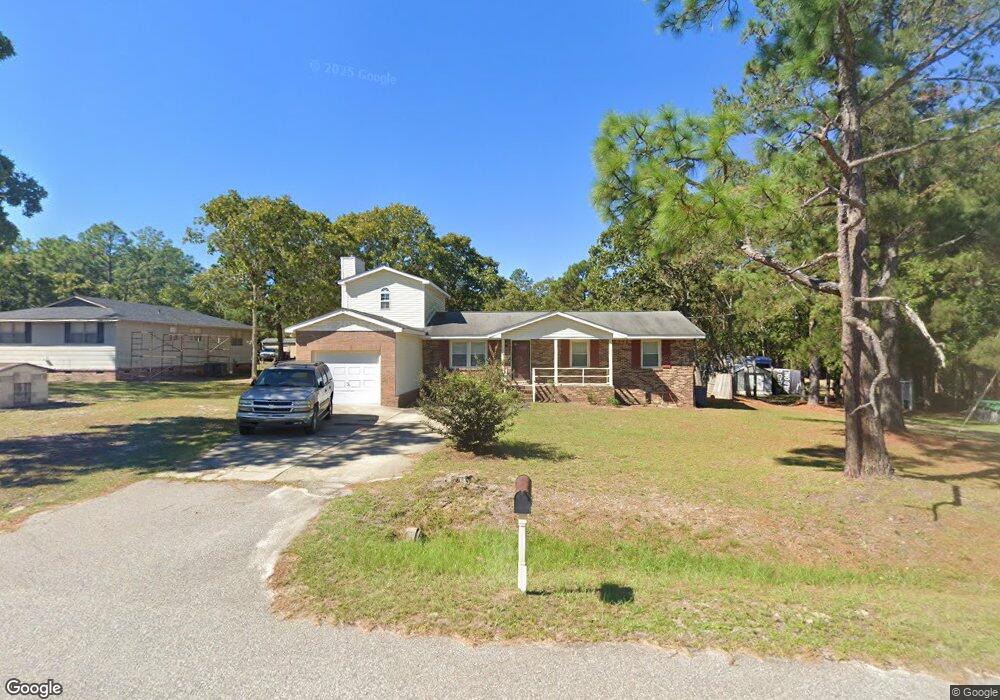
115 Ruff Rd Blythewood, SC 29016
Estimated Value: $202,000 - $273,000
4
Beds
2
Baths
1,718
Sq Ft
$142/Sq Ft
Est. Value
About This Home
This home is located at 115 Ruff Rd, Blythewood, SC 29016 and is currently estimated at $244,267, approximately $142 per square foot. 115 Ruff Rd is a home located in Richland County with nearby schools including Langford Elementary School, Blythewood Middle School, and Blythewood High School.
Ownership History
Date
Name
Owned For
Owner Type
Purchase Details
Closed on
Jul 24, 2017
Sold by
Harrison Randy M
Bought by
Cannon Timothy T
Current Estimated Value
Home Financials for this Owner
Home Financials are based on the most recent Mortgage that was taken out on this home.
Original Mortgage
$128,525
Outstanding Balance
$106,841
Interest Rate
3.91%
Mortgage Type
New Conventional
Estimated Equity
$137,426
Purchase Details
Closed on
Mar 1, 2016
Sold by
Harrison Randy M
Bought by
Cannon Timothy
Create a Home Valuation Report for This Property
The Home Valuation Report is an in-depth analysis detailing your home's value as well as a comparison with similar homes in the area
Home Values in the Area
Average Home Value in this Area
Purchase History
| Date | Buyer | Sale Price | Title Company |
|---|---|---|---|
| Cannon Timothy T | $132,500 | None Available | |
| Cannon Timothy | -- | None Available |
Source: Public Records
Mortgage History
| Date | Status | Borrower | Loan Amount |
|---|---|---|---|
| Open | Cannon Timothy T | $128,525 | |
| Closed | Cannon Timothy | $0 |
Source: Public Records
Tax History
| Year | Tax Paid | Tax Assessment Tax Assessment Total Assessment is a certain percentage of the fair market value that is determined by local assessors to be the total taxable value of land and additions on the property. | Land | Improvement |
|---|---|---|---|---|
| 2024 | $1,695 | $157,600 | $0 | $0 |
| 2023 | $1,637 | $5,480 | $0 | $0 |
| 2022 | $1,471 | $137,000 | $13,800 | $123,200 |
| 2021 | $1,471 | $5,480 | $0 | $0 |
| 2020 | $1,491 | $5,480 | $0 | $0 |
| 2019 | $1,467 | $5,480 | $0 | $0 |
| 2018 | $1,425 | $5,300 | $0 | $0 |
| 2017 | $1,398 | $5,300 | $0 | $0 |
| 2016 | $4,156 | $7,140 | $0 | $0 |
| 2015 | $4,052 | $7,140 | $0 | $0 |
| 2014 | $1,279 | $119,000 | $0 | $0 |
| 2013 | -- | $4,760 | $0 | $0 |
Source: Public Records
Map
Nearby Homes
- 2220 Lofton Rd
- 2228 Lofton Rd
- 2232 Lofton Rd
- 2212 Lofton Rd
- 2236 Lofton Rd
- 2196 Lofton Rd
- 1135 Ashland Dr
- 2188 Lofton Rd
- 2215 Lofton Rd
- 2219 Lofton Rd
- 2211 Lofton Rd
- 2223 Lofton Rd
- 2207 Lofton Rd
- 2227 Lofton Rd
- 2203 Lofton Rd
- 2199 Lofton Rd
- 2189 Lofton Rd
- 2179 Lofton Rd
- 857 Parnell Ct
- 179 Smith Young Rd
- 113 Ruff Rd
- 116 Ruff Rd
- 121 Ruff Rd
- 121 Ruff Rd
- 109 Ruff Rd
- 106 Ruff Rd
- 1266 Kelly Mill Rd
- 5410 Hardscrabble Rd
- 140 Ruff Rd
- 5416 Hardscrabble Rd
- 1271 Kelly Mill Rd
- 5420 Hardscrabble Rd
- 1284 Kelly Mill Rd
- 1265 Kelly Mill Rd
- 720 Oak Moss (Lot 68) Dr
- 5422 Hardscrabble Rd
- 5411 Hardscrabble Rd
- 758 Pennywell Ct
- 754 Pennywell Ct
- 760 Pennywell Ct
Your Personal Tour Guide
Ask me questions while you tour the home.