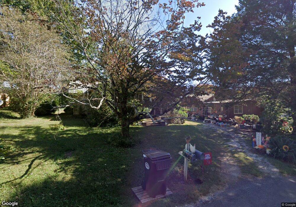
115 S Derrick St Dahlonega, GA 30533
Estimated Value: $275,453 - $512,000
--
Bed
1
Bath
1,272
Sq Ft
$312/Sq Ft
Est. Value
About This Home
This home is located at 115 S Derrick St, Dahlonega, GA 30533 and is currently estimated at $397,363, approximately $312 per square foot. 115 S Derrick St is a home located in Lumpkin County with nearby schools including Clay County Middle School and Lumpkin County High School.
Ownership History
Date
Name
Owned For
Owner Type
Purchase Details
Closed on
Feb 12, 2022
Sold by
Stancil Hayden
Bought by
Stancil Mark
Current Estimated Value
Purchase Details
Closed on
Sep 7, 2016
Sold by
Belle Ola
Bought by
Stancil Imogene
Purchase Details
Closed on
Jan 29, 1992
Sold by
Stancil Imogene
Bought by
Palmer Ola B
Purchase Details
Closed on
Jul 17, 1989
Bought by
Stancil Imogene
Purchase Details
Closed on
Aug 6, 1970
Sold by
Ola Belle
Bought by
Palmer James N
Create a Home Valuation Report for This Property
The Home Valuation Report is an in-depth analysis detailing your home's value as well as a comparison with similar homes in the area
Home Values in the Area
Average Home Value in this Area
Purchase History
| Date | Buyer | Sale Price | Title Company |
|---|---|---|---|
| Stancil Mark | -- | -- | |
| Stancil Imogene | -- | -- | |
| Palmer Ola B | -- | -- | |
| Stancil Imogene | -- | -- | |
| Palmer James N | -- | -- |
Source: Public Records
Tax History Compared to Growth
Tax History
| Year | Tax Paid | Tax Assessment Tax Assessment Total Assessment is a certain percentage of the fair market value that is determined by local assessors to be the total taxable value of land and additions on the property. | Land | Improvement |
|---|---|---|---|---|
| 2024 | $2,389 | $85,014 | $40,000 | $45,014 |
| 2023 | $2,352 | $81,596 | $40,000 | $41,596 |
| 2022 | $2,379 | $77,889 | $40,000 | $37,889 |
| 2021 | $2,310 | $70,811 | $40,000 | $30,811 |
| 2020 | $2,365 | $69,796 | $40,000 | $29,796 |
| 2019 | $2,377 | $69,796 | $40,000 | $29,796 |
| 2018 | $2,401 | $65,955 | $40,000 | $25,955 |
| 2017 | $2,465 | $66,590 | $40,000 | $26,590 |
| 2016 | $26 | $63,792 | $40,000 | $23,792 |
| 2015 | $23 | $63,792 | $40,000 | $23,792 |
| 2014 | $23 | $64,789 | $40,000 | $24,789 |
| 2013 | -- | $0 | $0 | $0 |
Source: Public Records
Map
Nearby Homes
- 0 Highway 60 Unit 7241582
- 0 Highway 9 S Unit 10487179
- 0 Highway 9 S Unit 7548614
- 120 Riley Rd
- 329 Morrison Moore Pkwy E
- 6480A Highway 52
- 1392 S Chestatee St
- 0 Alicia Ln
- 0 Calhoun Rd Unit 7643314
- 0 Calhoun Rd Unit 10598012
- 00 Calhoun Rd
- 0 S Chestatee St Unit 10619536
- 0 Highway 19 N Unit 10594984
- 168 W Main St
- 315 Church St
- 19 Stoneybrook Dr
- 95 Jones St
- 0 Crown Mountain Unit 7682225
- 0 Crown Mountain Unit 10644759
- 0 Deer Run Unit 10437845
- 93 S Derrick St
- 0 Highway 60 Unit 5.77ACRES 8252301
- 0 Highway 60 Unit 3284814
- 0 Highway 60 Unit 5.77ACRES 7327821
- 0 Highway 60 Unit 5.77ACRES 8062121
- 0 Highway 60 Unit 5064839
- 0 Highway 60 Unit 10221613
- 0 Highway 60 Unit 10172631
- 0 Highway 60 Unit 7234280
- 0 Highway 60 Unit 3 8744133
- 38 Tolbert St
- 71 S Derrick St
- 439 S Park St
- 419 S Park St
- 122 Schultz Ave
- 399 S Park St
- 55 S Derrick St
- 142 Schultz Ave
- 375 S Park St
- 29 S Derrick St