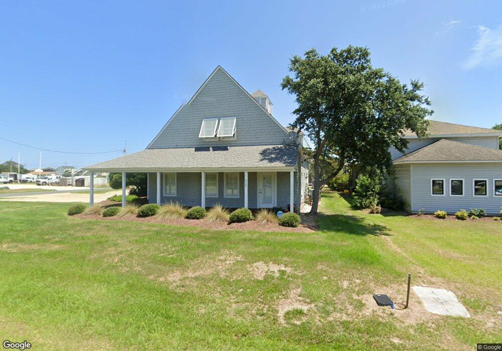
115 S Mustian St Kill Devil Hills, NC 27948
Estimated Value: $903,227
Studio
2
Baths
2,718
Sq Ft
$332/Sq Ft
Est. Value
About This Home
This home is located at 115 S Mustian St, Kill Devil Hills, NC 27948 and is currently estimated at $903,227, approximately $332 per square foot. 115 S Mustian St is a home located in Dare County with nearby schools including First Flight Elementary School, First Flight Middle School, and First Flight High School.
Ownership History
Date
Name
Owned For
Owner Type
Purchase Details
Closed on
Feb 26, 2015
Sold by
Cahoon Benjamin B and Cahoon Melanie S
Bought by
Interfaith Community Outreach Inc
Current Estimated Value
Home Financials for this Owner
Home Financials are based on the most recent Mortgage that was taken out on this home.
Original Mortgage
$365,300
Outstanding Balance
$313,922
Interest Rate
3.75%
Mortgage Type
USDA
Estimated Equity
$589,305
Create a Home Valuation Report for This Property
The Home Valuation Report is an in-depth analysis detailing your home's value as well as a comparison with similar homes in the area
Home Values in the Area
Average Home Value in this Area
Purchase History
| Date | Buyer | Sale Price | Title Company |
|---|---|---|---|
| Interfaith Community Outreach Inc | -- | Attorney |
Source: Public Records
Mortgage History
| Date | Status | Borrower | Loan Amount |
|---|---|---|---|
| Open | Interfaith Community Outreach Inc | $365,300 |
Source: Public Records
Tax History
| Year | Tax Paid | Tax Assessment Tax Assessment Total Assessment is a certain percentage of the fair market value that is determined by local assessors to be the total taxable value of land and additions on the property. | Land | Improvement |
|---|---|---|---|---|
| 2025 | -- | $789,300 | $383,400 | $405,900 |
| 2024 | -- | $441,900 | $198,800 | $243,100 |
| 2023 | $3,339 | $441,900 | $198,800 | $243,100 |
| 2022 | $0 | $441,900 | $198,800 | $243,100 |
| 2021 | $3,323 | $441,900 | $198,800 | $243,100 |
| 2020 | $3,323 | $441,900 | $198,800 | $243,100 |
| 2019 | $3,323 | $409,800 | $178,900 | $230,900 |
| 2018 | $3,323 | $409,800 | $178,900 | $230,900 |
| 2017 | $3,323 | $409,800 | $178,900 | $230,900 |
| 2016 | $3,323 | $409,800 | $178,900 | $230,900 |
| 2014 | $3,200 | $409,800 | $178,900 | $230,900 |
Source: Public Records
Map
Nearby Homes
- 109 E Meadowlark St Unit Lot 17
- 113 E Aviation Ave
- 113 E Aviation Ave Unit Lot 19
- 703 Wrightsville Blvd Unit 13
- 203 A S Virginia Dare Trail Unit Lot B
- 804 S Memorial Blvd Unit 1-E
- 701 S Virginia Dare Trail Unit 1
- 704 Swan St Unit 2
- 900 Fox St
- 902 S Virginia Dare Trail Unit 503
- 902 S Virginia Dare Trail Unit 403
- 902 S Virginia Dare Trail Unit 502
- 815 S Virginia Dare Trail Unit 202
- 110 Baker Ave Unit Lot:7 & PT 6
- 302 W Clark St Unit Lot 6
- 1014 S Virginia Dare Trail Unit 301
- 1014 S Virginia Dare Trail Unit 402
- 907 N Virginia Dare Trail Unit Lot 4
- 1100 Cambridge Rd Unit 301-G
- 1100 Cambridge Rd Unit 301 F
- 114 W Oregon Ave
- 114 E Oregon Ave
- 111 W Carlton Ave
- 111 Colington Rd
- 111 W Oregon Ave
- 302 S Croatan Hwy
- 0 Holly St Unit Lot 1 120061
- 0 Holly St
- 100 W Park Dr
- 108 Colington Rd Unit 202B
- 108 Colington Rd Unit 202A
- 108 Colington Rd
- 106 Colington Rd Unit 22
- 106 Colington Rd Unit 24
- 104 Colington Rd
- 101 E Carlton Ave
- 102 W Park Dr
- 100 E Oregon Ave
- 102 Colington Rd Unit 24
- 400 S Croatan Hwy
Your Personal Tour Guide
Ask me questions while you tour the home.