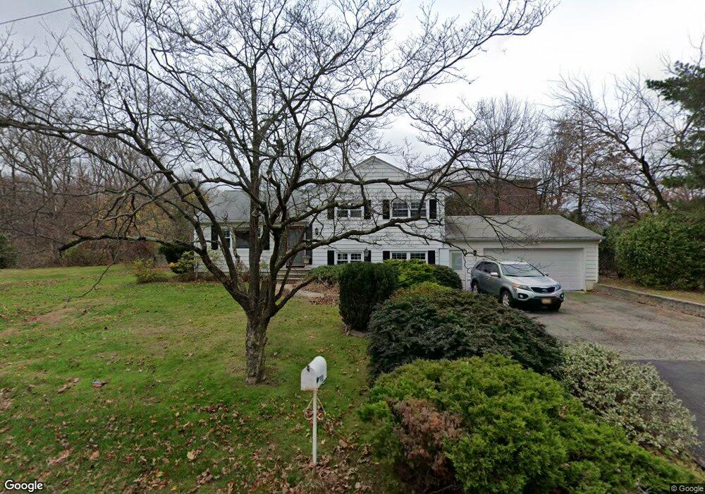
115 Sandra Dr Parsippany, NJ 07054
Estimated Value: $641,000 - $731,000
--
Bed
--
Bath
1,846
Sq Ft
$375/Sq Ft
Est. Value
About This Home
This home is located at 115 Sandra Dr, Parsippany, NJ 07054 and is currently estimated at $691,453, approximately $374 per square foot. 115 Sandra Dr is a home located in Morris County with nearby schools including Northvail Elementary School, Central Middle School, and Parsippany High School.
Ownership History
Date
Name
Owned For
Owner Type
Purchase Details
Closed on
Aug 28, 2009
Sold by
Deluca Deborah A
Bought by
Hui Jack C and Mu Hui Emily
Current Estimated Value
Home Financials for this Owner
Home Financials are based on the most recent Mortgage that was taken out on this home.
Original Mortgage
$308,000
Outstanding Balance
$202,350
Interest Rate
5.28%
Mortgage Type
New Conventional
Estimated Equity
$489,103
Purchase Details
Closed on
Aug 7, 1997
Sold by
Phung Robert V and Phung Kenneth V
Bought by
Deluca Deborah A
Home Financials for this Owner
Home Financials are based on the most recent Mortgage that was taken out on this home.
Original Mortgage
$160,000
Interest Rate
7.5%
Create a Home Valuation Report for This Property
The Home Valuation Report is an in-depth analysis detailing your home's value as well as a comparison with similar homes in the area
Home Values in the Area
Average Home Value in this Area
Purchase History
| Date | Buyer | Sale Price | Title Company |
|---|---|---|---|
| Hui Jack C | $385,000 | Colonial Title & Abstract Se | |
| Deluca Deborah A | $205,000 | -- |
Source: Public Records
Mortgage History
| Date | Status | Borrower | Loan Amount |
|---|---|---|---|
| Open | Hui Jack C | $308,000 | |
| Previous Owner | Deluca Deborah A | $160,000 |
Source: Public Records
Tax History Compared to Growth
Tax History
| Year | Tax Paid | Tax Assessment Tax Assessment Total Assessment is a certain percentage of the fair market value that is determined by local assessors to be the total taxable value of land and additions on the property. | Land | Improvement |
|---|---|---|---|---|
| 2025 | $9,378 | $275,000 | $151,600 | $123,400 |
| 2024 | $9,204 | $275,000 | $151,600 | $123,400 |
| 2023 | $9,204 | $275,000 | $151,600 | $123,400 |
| 2022 | $8,605 | $275,000 | $151,600 | $123,400 |
| 2021 | $8,605 | $275,000 | $151,600 | $123,400 |
| 2020 | $8,421 | $275,000 | $151,600 | $123,400 |
| 2019 | $8,192 | $275,000 | $151,600 | $123,400 |
| 2018 | $8,011 | $275,000 | $151,600 | $123,400 |
| 2017 | $7,827 | $275,000 | $151,600 | $123,400 |
| 2016 | $7,686 | $275,000 | $151,600 | $123,400 |
| 2015 | $7,491 | $275,000 | $151,600 | $123,400 |
| 2014 | $7,389 | $275,000 | $151,600 | $123,400 |
Source: Public Records
Map
Nearby Homes
- 20 Sandra Dr
- 20 Druid Hill Dr
- 209 Raymound Blvd
- 159 Ball Ave
- 3 Woodhaven Rd
- 12 Celtic Way
- 5 Twin Oaks Ct
- 24 Leah Way
- 91 Emily Place
- 2 Buckingham Rd
- 255 Knoll Rd
- 144 Jillian Blvd
- 189 Littleton Rd Unit 41
- 193 Crown Point Rd Unit 193
- 4 New Hampshire Ct
- 123 Cardigan Ct Unit 123
- 91 Rhyan Dr
- 44 Willow Ln
- 49 Willow Ln
- 53 Willow Ln