Estimated Value: $483,000 - $515,000
3
Beds
3
Baths
2,578
Sq Ft
$192/Sq Ft
Est. Value
About This Home
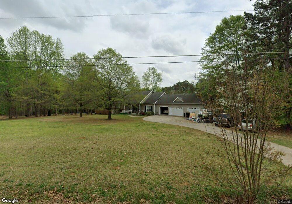
This home is located at 115 Shipp Rd, Hiram, GA 30141 and is currently estimated at $493,696, approximately $191 per square foot. 115 Shipp Rd is a home located in Paulding County with nearby schools including Bessie L. Baggett Elementary School, Irma C. Austin Middle School, and Hiram High School.
Ownership History
Date
Name
Owned For
Owner Type
Purchase Details
Closed on
Jul 6, 2016
Sold by
Richard B
Bought by
Strickland Stephen W and Strickland Deborah H
Current Estimated Value
Home Financials for this Owner
Home Financials are based on the most recent Mortgage that was taken out on this home.
Original Mortgage
$250,063
Outstanding Balance
$199,754
Interest Rate
3.6%
Estimated Equity
$293,942
Purchase Details
Closed on
Jan 29, 2008
Sold by
Milam Christopher C and Milam Sandra D
Bought by
Hollis Richard B and Hollis Juanita R
Home Financials for this Owner
Home Financials are based on the most recent Mortgage that was taken out on this home.
Original Mortgage
$255,000
Interest Rate
6.12%
Mortgage Type
New Conventional
Create a Home Valuation Report for This Property
The Home Valuation Report is an in-depth analysis detailing your home's value as well as a comparison with similar homes in the area
Home Values in the Area
Average Home Value in this Area
Purchase History
| Date | Buyer | Sale Price | Title Company |
|---|---|---|---|
| Strickland Stephen W | -- | -- | |
| Hollis Richard B | $295,000 | -- |
Source: Public Records
Mortgage History
| Date | Status | Borrower | Loan Amount |
|---|---|---|---|
| Open | Strickland Stephen W | $250,063 | |
| Previous Owner | Hollis Richard B | $255,000 |
Source: Public Records
Tax History Compared to Growth
Tax History
| Year | Tax Paid | Tax Assessment Tax Assessment Total Assessment is a certain percentage of the fair market value that is determined by local assessors to be the total taxable value of land and additions on the property. | Land | Improvement |
|---|---|---|---|---|
| 2024 | $4,943 | $198,720 | $26,600 | $172,120 |
| 2023 | $4,968 | $190,560 | $25,920 | $164,640 |
| 2022 | $4,460 | $171,080 | $21,080 | $150,000 |
| 2021 | $3,892 | $133,920 | $16,720 | $117,200 |
| 2020 | $3,634 | $122,360 | $15,800 | $106,560 |
| 2019 | $3,320 | $110,200 | $16,720 | $93,480 |
| 2018 | $3,379 | $112,160 | $16,440 | $95,720 |
| 2017 | $3,100 | $101,480 | $15,760 | $85,720 |
| 2016 | $946 | $87,320 | $15,760 | $71,560 |
| 2015 | $927 | $82,280 | $15,480 | $66,800 |
| 2014 | $893 | $74,920 | $14,200 | $60,720 |
| 2013 | -- | $62,440 | $15,600 | $46,840 |
Source: Public Records
Map
Nearby Homes
- 7131 Ridge Rd
- 2010 Laird Rd
- 232 Bethel Church Rd
- 6652 Ridge Rd
- 6994 Ridge Rd
- 115 Ashley Pointe Dr
- 245 London Ln
- 532 Poole Bridge Rd
- 322 London Ln
- 178 Hunters Mill Dr
- 493 Kyles Cir
- 617 Kyles Cir
- 6488 Nebo Rd
- 1616 Mcclung Rd
- 51 White Path Dr
- 496 Hughes Rd
- 18 Thorntree Pass
- 18 Hawk Dr
- 4970 Nebo Rd
- 81 Lawanda Ln
- 54 Shipp Rd
- 141 Shipp Rd
- 7100 Ridge Rd
- 7254 Ridge Rd
- 159 Shipp Rd
- 7256 Ridge Rd
- 7225 Ridge Rd
- 181 Shipp Rd
- 251 Shenandoah Ct
- 235 Shenandoah Ct
- 209 Shenandoah Ct
- 157 Shipp Rd
- 96 Shenandoah Dr
- 7169 Ridge Rd
- 189 Shenandoah Ct
- 78 Shenandoah Dr
- 120 Shenandoah Dr
- 7318 Ridge Rd
- 169 Shenandoah Ct
- 7197 Ridge Rd