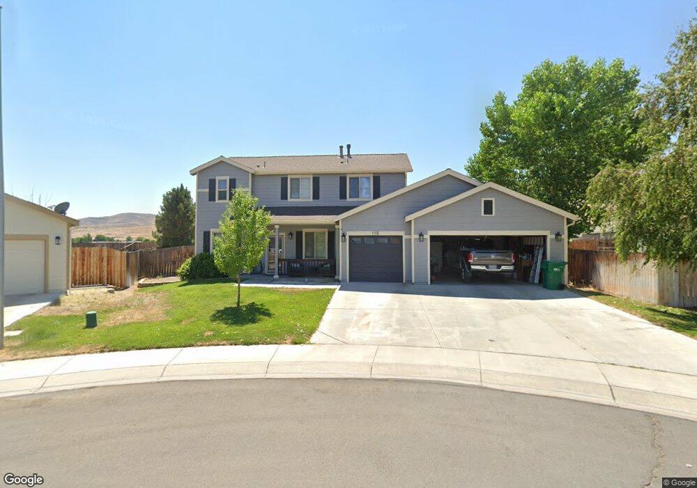
115 Southend Dr Dayton, NV 89403
Estimated Value: $449,000 - $502,017
3
Beds
2
Baths
2,248
Sq Ft
$213/Sq Ft
Est. Value
About This Home
This home is located at 115 Southend Dr, Dayton, NV 89403 and is currently estimated at $478,004, approximately $212 per square foot. 115 Southend Dr is a home located in Lyon County with nearby schools including Sutro Elementary School, Dayton Intermediate School, and Dayton High School.
Ownership History
Date
Name
Owned For
Owner Type
Purchase Details
Closed on
May 3, 2005
Sold by
Sutro Heights Llc
Bought by
Cupp James W and Cupp Donna R
Current Estimated Value
Home Financials for this Owner
Home Financials are based on the most recent Mortgage that was taken out on this home.
Original Mortgage
$223,424
Outstanding Balance
$120,286
Interest Rate
6.35%
Mortgage Type
Adjustable Rate Mortgage/ARM
Estimated Equity
$357,718
Create a Home Valuation Report for This Property
The Home Valuation Report is an in-depth analysis detailing your home's value as well as a comparison with similar homes in the area
Home Values in the Area
Average Home Value in this Area
Purchase History
| Date | Buyer | Sale Price | Title Company |
|---|---|---|---|
| Cupp James W | $279,280 | Stewart Title Company |
Source: Public Records
Mortgage History
| Date | Status | Borrower | Loan Amount |
|---|---|---|---|
| Open | Cupp James W | $223,424 |
Source: Public Records
Tax History Compared to Growth
Tax History
| Year | Tax Paid | Tax Assessment Tax Assessment Total Assessment is a certain percentage of the fair market value that is determined by local assessors to be the total taxable value of land and additions on the property. | Land | Improvement |
|---|---|---|---|---|
| 2025 | $2,497 | $149,127 | $57,750 | $91,377 |
| 2024 | $2,424 | $149,531 | $57,750 | $91,780 |
| 2023 | $2,424 | $143,851 | $57,750 | $86,101 |
| 2022 | $1,964 | $127,689 | $48,090 | $79,599 |
| 2021 | $1,906 | $121,364 | $43,785 | $77,579 |
| 2020 | $1,850 | $117,946 | $43,790 | $74,156 |
| 2019 | $1,796 | $100,669 | $29,190 | $71,479 |
| 2018 | $1,744 | $90,695 | $21,000 | $69,695 |
| 2017 | $1,693 | $83,654 | $14,000 | $69,654 |
| 2016 | $1,650 | $73,033 | $8,660 | $64,373 |
| 2015 | $1,647 | $56,054 | $8,660 | $47,394 |
| 2014 | -- | $50,092 | $8,660 | $41,432 |
Source: Public Records
Map
Nearby Homes
- 463 Sheep Camp Dr
- 462 Sheep Camp Dr
- 467 Sheep Camp Dr Unit Lot 137
- 467 Sheep Camp Dr
- 469 Sheep Camp Dr Unit Amber 138
- 469 Sheep Camp Dr
- 466 Sheep Camp Dr
- 468 Sheep Camp Dr
- 471 Sheep Camp Dr Unit Lot 139
- 470 Sheep Camp Dr
- 470 Sheep Camp Dr Unit Lot 129
- 475 Sheep Camp Dr Unit Lot 141
- 474 Sheep Camp Dr
- 502 Russell Rd Unit Lot 93
- 618 Union Rd Unit Lot 67
- 500 Russell Rd Unit Lot 92
- WASHOE Plan at Amber Ridge
- YOSEMITE Plan at Amber Ridge
- TAHOE Plan at Amber Ridge
- TOPAZ Plan at Amber Ridge
- 113 Southend Dr
- 117 S End Dr
- 117 Southend Dr
- 410 Valley Cir
- 410 Valley Cir Unit D
- 410 Valley Cir
- 111 Southend Dr
- 119 Southend Dr
- 112 Southend Dr
- 305 Zimmerman Rd Unit Lot 159
- 408 Valley Cir
- 109 Southend Dr
- 116 Southend Dr
- 215 Chandler Rd
- 307 Zimmerman Rd Unit Lot 158
- 216 Chandler Rd Unit Lot 151
- 108 Southend Dr
- 406 Valley Cir
- 412 Valley Cir Unit 4
- 412 Valley Cir