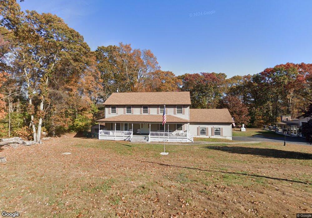
115 Spithead Rd Waterford, CT 06385
Estimated Value: $444,000 - $967,000
Studio
4
Baths
--
Sq Ft
1.16
Acres
About This Home
This home is located at 115 Spithead Rd, Waterford, CT 06385 and is currently estimated at $723,089. 115 Spithead Rd is a home located in New London County with nearby schools including Clark Lane Middle School, Waterford High School, and New London High School Multi-Magnet Campus.
Ownership History
Date
Name
Owned For
Owner Type
Purchase Details
Closed on
Aug 12, 1998
Sold by
Castle Hill Dev
Bought by
Rocheleau Maurice and Rocheleau Lucille
Current Estimated Value
Home Financials for this Owner
Home Financials are based on the most recent Mortgage that was taken out on this home.
Original Mortgage
$204,000
Interest Rate
6.94%
Mortgage Type
Purchase Money Mortgage
Create a Home Valuation Report for This Property
The Home Valuation Report is an in-depth analysis detailing your home's value as well as a comparison with similar homes in the area
Home Values in the Area
Average Home Value in this Area
Purchase History
| Date | Buyer | Sale Price | Title Company |
|---|---|---|---|
| Rocheleau Maurice | $24,500 | -- |
Source: Public Records
Mortgage History
| Date | Status | Borrower | Loan Amount |
|---|---|---|---|
| Closed | Rocheleau Maurice | $70,000 | |
| Closed | Rocheleau Maurice | $100,000 | |
| Closed | Rocheleau Maurice | $100,000 | |
| Closed | Rocheleau Maurice | $204,000 |
Source: Public Records
Tax History
| Year | Tax Paid | Tax Assessment Tax Assessment Total Assessment is a certain percentage of the fair market value that is determined by local assessors to be the total taxable value of land and additions on the property. | Land | Improvement |
|---|---|---|---|---|
| 2025 | $10,810 | $462,740 | $97,280 | $365,460 |
| 2024 | $10,319 | $462,740 | $97,280 | $365,460 |
| 2023 | $9,810 | $462,740 | $97,280 | $365,460 |
| 2022 | $10,430 | $378,450 | $66,350 | $312,100 |
| 2021 | $10,460 | $378,450 | $66,350 | $312,100 |
| 2020 | $10,547 | $378,450 | $66,350 | $312,100 |
| 2019 | $10,589 | $378,450 | $66,350 | $312,100 |
| 2018 | $10,377 | $378,450 | $66,350 | $312,100 |
| 2017 | $10,421 | $385,540 | $68,490 | $317,050 |
| 2016 | $10,325 | $385,540 | $68,490 | $317,050 |
| 2015 | $9,958 | $385,540 | $68,490 | $317,050 |
| 2014 | $9,561 | $385,540 | $68,490 | $317,050 |
Source: Public Records
Map
Nearby Homes
- 164 Stoneheights Dr Unit 164
- 310 Boston Post Rd Unit 76
- 310 Boston Post Rd Unit 152
- 310 Boston Post Rd Unit 90
- 9 Arrowhead Trail
- 398 & 402 Boston Post Rd
- 398 Boston Post Rd
- 6 Fulmore Dr
- 16 Longview Ave
- 276 Niantic River Rd
- 49 Cross Rd
- 270 Boston Post Rd Unit TRLR 6
- 9 3rd Ave
- 139 Oswegatchie Rd
- 32 Bishops Bay Rd
- 20 North Rd
- 26 Beechwood Dr
- 12 Beechwood Dr
- 213 Boston Post Rd
- 163 Oswegatchie Rd
- 109 Spithead Rd
- 96 Mullen Hill Rd
- 114 Spithead Rd
- 100 Mullen Hill Rd
- 116 Spithead Rd
- 118 Spithead Rd
- 108 Spithead Rd
- 1 Doyle Rd
- 120.5 Spithead Rd
- 120 Spithead Rd
- 120 1/2 Spithead Rd
- 105 Spithead Rd
- 121 Spithead Rd
- 106 Spithead Rd
- 106 Spithead Rd
- 8 Paula Ln
- 95 Mullen Hill Rd
- 93 Mullen Hill Rd
- 10 Paula Ln
- 6 Paula Ln
Your Personal Tour Guide
Ask me questions while you tour the home.