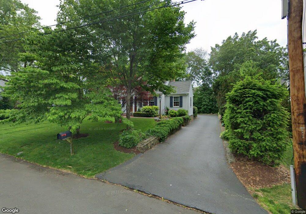
115 Spruce St Southport, CT 06890
Southport NeighborhoodEstimated Value: $1,028,000 - $1,920,000
3
Beds
4
Baths
2,848
Sq Ft
$502/Sq Ft
Est. Value
About This Home
This home is located at 115 Spruce St, Southport, CT 06890 and is currently estimated at $1,429,864, approximately $502 per square foot. 115 Spruce St is a home located in Fairfield County with nearby schools including Mill Hill School, Roger Ludlowe Middle School, and Fairfield Ludlowe High School.
Ownership History
Date
Name
Owned For
Owner Type
Purchase Details
Closed on
Jun 26, 2015
Sold by
Pensiero Frank and Pensiero Vicki
Bought by
Pensiero Vicki
Current Estimated Value
Purchase Details
Closed on
Mar 25, 2013
Sold by
Pensiero Vicki
Bought by
Pesiero Frank
Home Financials for this Owner
Home Financials are based on the most recent Mortgage that was taken out on this home.
Original Mortgage
$417,000
Interest Rate
3.57%
Purchase Details
Closed on
Sep 21, 2011
Sold by
Speer Edward
Bought by
Pensiero Vicki
Purchase Details
Closed on
Oct 29, 1996
Sold by
Speer June L Est
Bought by
Speer Edward S
Home Financials for this Owner
Home Financials are based on the most recent Mortgage that was taken out on this home.
Original Mortgage
$192,000
Interest Rate
8.22%
Mortgage Type
Unknown
Create a Home Valuation Report for This Property
The Home Valuation Report is an in-depth analysis detailing your home's value as well as a comparison with similar homes in the area
Home Values in the Area
Average Home Value in this Area
Purchase History
| Date | Buyer | Sale Price | Title Company |
|---|---|---|---|
| Pensiero Vicki | -- | -- | |
| Pensiero Vicki | -- | -- | |
| Pesiero Frank | -- | -- | |
| Pesiero Frank | -- | -- | |
| Pensiero Vicki | $315,000 | -- | |
| Pensiero Vicki | $315,000 | -- | |
| Speer Edward S | $250,000 | -- | |
| Speer Edward S | $250,000 | -- |
Source: Public Records
Mortgage History
| Date | Status | Borrower | Loan Amount |
|---|---|---|---|
| Previous Owner | Speer Edward S | $417,000 | |
| Previous Owner | Speer Edward S | $192,000 |
Source: Public Records
Tax History Compared to Growth
Tax History
| Year | Tax Paid | Tax Assessment Tax Assessment Total Assessment is a certain percentage of the fair market value that is determined by local assessors to be the total taxable value of land and additions on the property. | Land | Improvement |
|---|---|---|---|---|
| 2025 | $16,161 | $569,240 | $278,600 | $290,640 |
| 2024 | $15,882 | $569,240 | $278,600 | $290,640 |
| 2023 | $15,660 | $569,240 | $278,600 | $290,640 |
| 2022 | $15,506 | $569,240 | $278,600 | $290,640 |
| 2021 | $15,358 | $569,240 | $278,600 | $290,640 |
| 2020 | $15,351 | $573,020 | $275,660 | $297,360 |
| 2019 | $15,351 | $573,020 | $275,660 | $297,360 |
| 2018 | $15,105 | $573,020 | $275,660 | $297,360 |
| 2017 | $14,795 | $573,020 | $275,660 | $297,360 |
| 2016 | $14,583 | $573,020 | $275,660 | $297,360 |
| 2015 | $13,369 | $539,280 | $274,890 | $264,390 |
| 2014 | $13,158 | $539,280 | $274,890 | $264,390 |
Source: Public Records
Map
Nearby Homes
- 2 Elmwood Dr Unit 2
- 74 Westford Dr
- 60 Hulls Hwy Unit 60
- 153 Pease Ave
- 944 Pequot Ave
- 305 S Gate Ln
- 260 Willow St
- 844 Mill Hill Terrace
- 6 Sunny Acres Ln
- 478 Hulls Hwy
- 365 Greens Farms Rd
- 53 Hilltop Dr
- 7 Roshab Ln
- 220 Lansdowne
- 100 Overhill Rd
- 144 Lansdowne Unit 144
- 260 Range Rd
- 342 Greens Farms Rd
- 88 Overhill Rd
- 400 Bronson Rd
- 99 Spruce St Unit 99
- 127 Spruce St
- 57 Rennell Dr
- 101 Spruce St
- 100 Spruce St
- 116 Spruce St
- 114 Spruce St
- 116 Spruce St Unit 116
- 116 Spruce St Unit 1
- 450 Center St Unit 9
- 83 Spruce St
- 95 Rennell Dr
- 97 Rennell Dr
- 450 Center St Unit 9
- 450 Center St Unit 8
- 450 Center St Unit 7
- 450 Center St Unit 6
- 450 Center St Unit 5
- 450 Center St Unit 4
- 450 Center St Unit 3