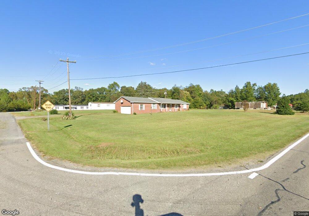
115 Squirrel Trail Reidsville, NC 27320
Estimated Value: $216,000 - $331,000
--
Bed
--
Bath
1,860
Sq Ft
$140/Sq Ft
Est. Value
About This Home
This home is located at 115 Squirrel Trail, Reidsville, NC 27320 and is currently estimated at $259,915, approximately $139 per square foot. 115 Squirrel Trail is a home located in Rockingham County with nearby schools including Williamsburg Elementary School, Reidsville High School, and Reidsville Middle School.
Ownership History
Date
Name
Owned For
Owner Type
Purchase Details
Closed on
Aug 14, 2006
Sold by
Maynard James H and Maynard Pattie W
Bought by
Maynard Alfred
Current Estimated Value
Home Financials for this Owner
Home Financials are based on the most recent Mortgage that was taken out on this home.
Original Mortgage
$89,184
Outstanding Balance
$53,282
Interest Rate
6.67%
Mortgage Type
New Conventional
Estimated Equity
$206,633
Create a Home Valuation Report for This Property
The Home Valuation Report is an in-depth analysis detailing your home's value as well as a comparison with similar homes in the area
Home Values in the Area
Average Home Value in this Area
Purchase History
| Date | Buyer | Sale Price | Title Company |
|---|---|---|---|
| Maynard Alfred | $111,480 | None Available |
Source: Public Records
Mortgage History
| Date | Status | Borrower | Loan Amount |
|---|---|---|---|
| Open | Maynard Alfred | $89,184 |
Source: Public Records
Tax History Compared to Growth
Tax History
| Year | Tax Paid | Tax Assessment Tax Assessment Total Assessment is a certain percentage of the fair market value that is determined by local assessors to be the total taxable value of land and additions on the property. | Land | Improvement |
|---|---|---|---|---|
| 2025 | $1,754 | $257,946 | $17,325 | $240,621 |
| 2024 | $1,709 | $257,946 | $17,325 | $240,621 |
| 2023 | $1,275 | $158,394 | $15,675 | $142,719 |
| 2022 | $1,275 | $158,394 | $15,675 | $142,719 |
| 2021 | $1,275 | $158,394 | $15,675 | $142,719 |
| 2020 | $1,275 | $158,394 | $15,675 | $142,719 |
| 2019 | $1,275 | $158,394 | $15,675 | $142,719 |
| 2018 | $1,209 | $150,030 | $17,776 | $132,254 |
| 2017 | $1,209 | $150,030 | $17,776 | $132,254 |
| 2015 | $1,221 | $150,030 | $17,776 | $132,254 |
| 2014 | $1,209 | $150,030 | $17,776 | $132,254 |
Source: Public Records
Map
Nearby Homes
- 552 Nc Highway 87
- 251 MacY Mae Way
- 319 MacY Mae Way
- 341 Somers Loop
- 0000 Neal Rd
- 000 Neal Rd
- 475 Parkdale Rd
- 723 Gardner Rd
- 590 Gilliam Rd
- 276 Brann Rd
- 11741 N Carolina 150
- 8212 Brann Rd
- 000 Sunset View Ct
- 199 Brann Rd
- 1152 Pagetown Rd
- 450 Simpson Rd
- 7930 E Nc Highway 150
- 6736 High Rock Rd
- 3349 Nc Highway 87
- 1306 Deer Trail
- 534 Nc Highway 87
- 560 Nc Highway 87
- 511 Nc Highway 87
- 512 Nc Highway 87
- 583 Nc Highway 87
- 149 Squirrel Trail
- 491 Nc Highway 87
- 496 Nc Highway 87
- 598 Nc Highway 87
- 528 Nc Highway 87
- 476 Nc Highway 87
- 608 Nc Highway 87
- 463 Nc Highway 87
- 123 Robbie Scott Trail
- 462 Nc Highway 87
- 492 Nc Highway 87
- 626 Nc Highway 87
- 468 Nc Highway 87
- 439 Nc Highway 87
- 462 Nc Highway 87 N