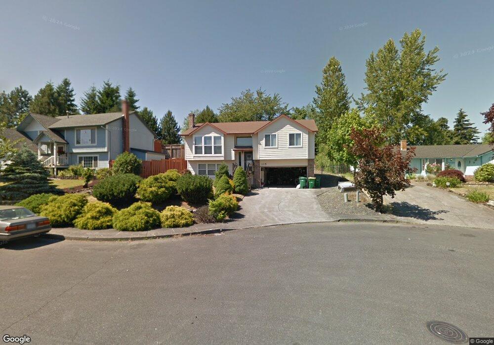
115 SW 22nd St Troutdale, OR 97060
Sunrise NeighborhoodEstimated Value: $486,639 - $536,000
3
Beds
3
Baths
1,253
Sq Ft
$406/Sq Ft
Est. Value
About This Home
This home is located at 115 SW 22nd St, Troutdale, OR 97060 and is currently estimated at $509,160, approximately $406 per square foot. 115 SW 22nd St is a home located in Multnomah County with nearby schools including Sweetbriar Elementary School, Walt Morey Middle School, and Reynolds High School.
Ownership History
Date
Name
Owned For
Owner Type
Purchase Details
Closed on
Mar 11, 2014
Sold by
Spikes Robert E
Bought by
Spikes Robert E and The Robert E Spikes Survivors Trust
Current Estimated Value
Purchase Details
Closed on
Sep 19, 2008
Sold by
Przybylo Susan A
Bought by
Spikes Robert E and Spikes Delores B
Purchase Details
Closed on
Jul 27, 2007
Sold by
Spikes Robert E
Bought by
Przybylo Susan A
Home Financials for this Owner
Home Financials are based on the most recent Mortgage that was taken out on this home.
Original Mortgage
$264,975
Interest Rate
6.73%
Mortgage Type
Purchase Money Mortgage
Create a Home Valuation Report for This Property
The Home Valuation Report is an in-depth analysis detailing your home's value as well as a comparison with similar homes in the area
Home Values in the Area
Average Home Value in this Area
Purchase History
| Date | Buyer | Sale Price | Title Company |
|---|---|---|---|
| Spikes Robert E | -- | None Available | |
| Spikes Robert E | -- | Ticor Title | |
| Przybylo Susan A | $275,000 | Ticor Title Insurance Compan |
Source: Public Records
Mortgage History
| Date | Status | Borrower | Loan Amount |
|---|---|---|---|
| Previous Owner | Przybylo Susan A | $264,975 |
Source: Public Records
Tax History Compared to Growth
Tax History
| Year | Tax Paid | Tax Assessment Tax Assessment Total Assessment is a certain percentage of the fair market value that is determined by local assessors to be the total taxable value of land and additions on the property. | Land | Improvement |
|---|---|---|---|---|
| 2025 | $4,911 | $266,020 | -- | -- |
| 2024 | $4,641 | $258,280 | -- | -- |
| 2023 | $4,519 | $250,760 | $0 | $0 |
| 2022 | $4,411 | $243,460 | $0 | $0 |
| 2021 | $4,308 | $236,370 | $0 | $0 |
| 2020 | $4,029 | $229,490 | $0 | $0 |
| 2019 | $3,867 | $222,810 | $0 | $0 |
| 2018 | $3,841 | $216,330 | $0 | $0 |
| 2017 | $3,833 | $210,030 | $0 | $0 |
| 2016 | $3,705 | $203,920 | $0 | $0 |
| 2015 | $3,612 | $197,990 | $0 | $0 |
| 2014 | $3,512 | $192,230 | $0 | $0 |
Source: Public Records
Map
Nearby Homes
- 2154 SE Sandy Ct
- 2511 S Troutdale Rd
- 665 SW 24th St
- 2020 SW Laura Ct
- 839 SW Grant Way
- 2505 SE Clark Ct
- 1021 SW 24th St
- 2521 SE Clark Ct
- 1019 SE 27th St
- 1226 SW Hensley Rd
- 724 SW 28th St
- 821 SW 14th St
- 1129 SE 26th St
- 2846 SW Faith Ct
- 3205 SE Hampton Loop
- 216 SE 34th Cir
- 809 SW Crestview Way
- 1427 SW 24th St
- 735 SW Sunset Way
- 2326 SW Mcginnis Ave
- 127 SW 22nd St
- 2130 SW Spence Ct
- 139 SW 22nd St
- 2148 SW Spence Ct
- 120 SW 22nd St
- 2051 S Troutdale Rd
- 2202 SW Spence Ct
- 134 SW 22nd St
- 169 SW 22nd St
- 2217 SW Spence Ct
- 2214 SW Spence Ct
- 2039 S Troutdale Rd
- 148 SW 22nd St
- 215 SW 22nd St
- 2002 SW Sunrise Cir
- 202 SW 22nd St
- 2027 S Troutdale Rd
- 67 SW Corbeth Ln
- 130 SE 21st St
- 2014 SW Sunrise Cir