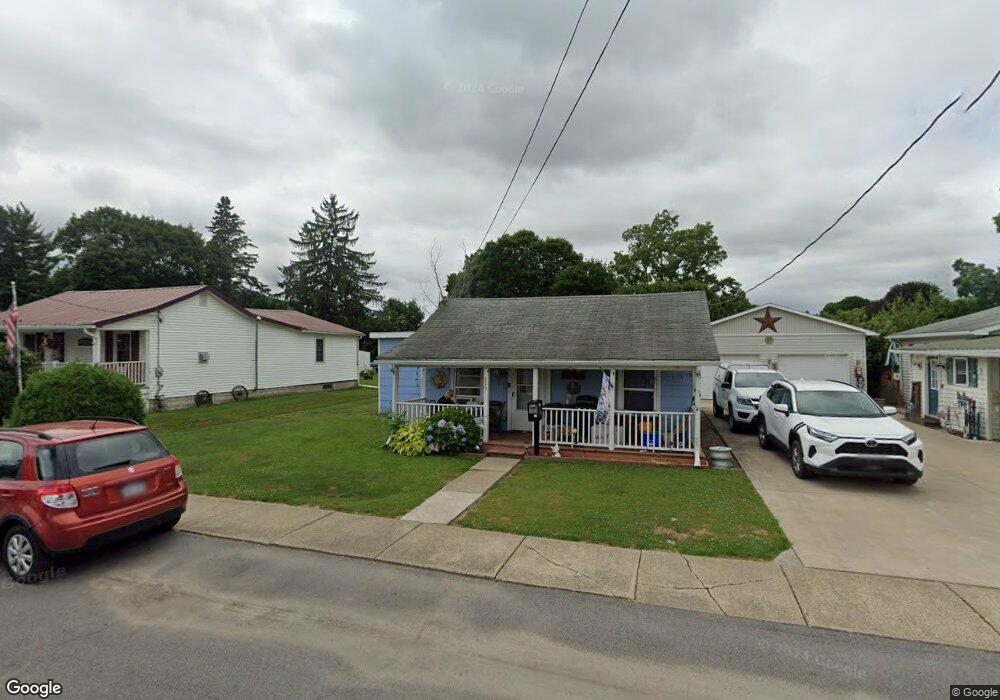
115 Taft Ave Elkland, PA 16920
Estimated Value: $104,000 - $148,000
2
Beds
2
Baths
1,032
Sq Ft
$116/Sq Ft
Est. Value
About This Home
This home is located at 115 Taft Ave, Elkland, PA 16920 and is currently estimated at $119,903, approximately $116 per square foot. 115 Taft Ave is a home located in Tioga County with nearby schools including Clark Wood Elementary School, Williamson Senior High School, and Wesley Academy.
Ownership History
Date
Name
Owned For
Owner Type
Purchase Details
Closed on
Nov 26, 2011
Sold by
Adams Andrew
Bought by
Blend David M and Blend Donna J
Current Estimated Value
Purchase Details
Closed on
Dec 10, 2010
Sold by
Adams Andrew and Hurd Susan
Bought by
Adams Andrew
Purchase Details
Closed on
Apr 29, 2008
Sold by
Wilson Edward and Wilson Gladys
Bought by
Adams Andrew and Hurd Susan
Home Financials for this Owner
Home Financials are based on the most recent Mortgage that was taken out on this home.
Original Mortgage
$47,025
Interest Rate
5.91%
Mortgage Type
Unknown
Create a Home Valuation Report for This Property
The Home Valuation Report is an in-depth analysis detailing your home's value as well as a comparison with similar homes in the area
Home Values in the Area
Average Home Value in this Area
Purchase History
| Date | Buyer | Sale Price | Title Company |
|---|---|---|---|
| Blend David M | $55,000 | None Available | |
| Adams Andrew | $1,000 | None Available | |
| Adams Andrew | $49,500 | None Available |
Source: Public Records
Mortgage History
| Date | Status | Borrower | Loan Amount |
|---|---|---|---|
| Previous Owner | Adams Andrew | $47,025 |
Source: Public Records
Tax History Compared to Growth
Tax History
| Year | Tax Paid | Tax Assessment Tax Assessment Total Assessment is a certain percentage of the fair market value that is determined by local assessors to be the total taxable value of land and additions on the property. | Land | Improvement |
|---|---|---|---|---|
| 2025 | $1,898 | $100,470 | $9,200 | $91,270 |
| 2024 | $2,642 | $100,470 | $9,200 | $91,270 |
| 2023 | $1,729 | $52,490 | $6,000 | $46,490 |
| 2022 | $1,665 | $52,490 | $6,000 | $46,490 |
| 2021 | $1,665 | $52,490 | $6,000 | $46,490 |
| 2020 | $1,665 | $52,490 | $6,000 | $46,490 |
| 2019 | $1,580 | $52,490 | $6,000 | $46,490 |
| 2018 | $1,529 | $52,490 | $6,000 | $46,490 |
| 2017 | -- | $52,490 | $6,000 | $46,490 |
| 2016 | $1,487 | $52,490 | $6,000 | $46,490 |
| 2015 | -- | $52,490 | $6,000 | $46,490 |
| 2014 | -- | $52,490 | $6,000 | $46,490 |
Source: Public Records
Map
Nearby Homes
- 202 Proctor Ave
- 409 E Main St
- 0 Coates Ave
- 106 E Main St
- 108 First St
- 111 S Buffalo St
- 215 Second St
- 222 Second St
- 101 Close Ave
- 103 Oak Ave
- 305 Oak Ave
- 113 W Woodlawn Ave
- 7910 Route 49
- 111 S Tuscarora Rd
- 207 Holden St
- 561 County Road 101
- 561 County Route 101
- 13 Capitol Dr
- VL Lot 10 Brennan Rd
- 0 Vl Mud Run Rd Unit LotWP004