Estimated Value: $322,120
--
Bed
--
Bath
--
Sq Ft
0.97
Acres
About This Home
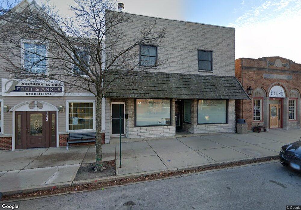
This home is located at 115 W Main St Unit 2A, Cary, IL 60013 and is currently estimated at $322,120. 115 W Main St Unit 2A is a home located in McHenry County with nearby schools including Briargate Elementary School, Cary Jr High School, and Cary Grove High School.
Ownership History
Date
Name
Owned For
Owner Type
Purchase Details
Closed on
Dec 3, 2021
Sold by
Atkins Brian
Bought by
Pswp Properties Llc
Current Estimated Value
Purchase Details
Closed on
Dec 2, 2021
Sold by
117 West Main Inc
Bought by
Synon Daniel E and Atkins Brian
Purchase Details
Closed on
Nov 15, 2021
Sold by
Synon Daniel E and Atkins Brian
Bought by
Atkins Brian
Purchase Details
Closed on
Sep 30, 2011
Sold by
Spaulding Michelle M
Bought by
117 West Main Inc
Purchase Details
Closed on
Feb 5, 2004
Sold by
Harris Trust & Savings Bank
Bought by
Yurgaitis Simone R and The Simone R Yurgaitis Revocable Trust
Home Financials for this Owner
Home Financials are based on the most recent Mortgage that was taken out on this home.
Original Mortgage
$40,000
Interest Rate
5.71%
Mortgage Type
Credit Line Revolving
Create a Home Valuation Report for This Property
The Home Valuation Report is an in-depth analysis detailing your home's value as well as a comparison with similar homes in the area
Home Values in the Area
Average Home Value in this Area
Purchase History
| Date | Buyer | Sale Price | Title Company |
|---|---|---|---|
| Pswp Properties Llc | -- | English Steven | |
| Synon Daniel E | -- | None Available | |
| Atkins Brian | $133,000 | None Available | |
| Synon Daniel E | -- | English Steven | |
| 117 West Main Inc | $140,000 | Republic Title Company | |
| Yurgaitis Simone R | -- | Republic Title Company |
Source: Public Records
Mortgage History
| Date | Status | Borrower | Loan Amount |
|---|---|---|---|
| Previous Owner | Yurgaitis Simone R | $40,000 |
Source: Public Records
Tax History Compared to Growth
Tax History
| Year | Tax Paid | Tax Assessment Tax Assessment Total Assessment is a certain percentage of the fair market value that is determined by local assessors to be the total taxable value of land and additions on the property. | Land | Improvement |
|---|---|---|---|---|
| 2024 | $10,209 | $121,231 | $10,567 | $110,664 |
| 2023 | $10,037 | $108,426 | $48,448 | $59,978 |
| 2022 | $9,163 | $97,858 | $43,726 | $54,132 |
| 2021 | $8,772 | $91,166 | $40,736 | $50,430 |
| 2020 | $8,533 | $87,939 | $39,294 | $48,645 |
| 2019 | $8,390 | $84,168 | $37,609 | $46,559 |
| 2018 | $7,956 | $77,754 | $34,743 | $43,011 |
| 2017 | $7,839 | $73,249 | $32,730 | $40,519 |
| 2016 | $7,822 | $68,701 | $30,698 | $38,003 |
| 2013 | -- | $64,089 | $28,638 | $35,451 |
Source: Public Records
Map
Nearby Homes
- 754 Westbury Dr
- 60 S Seebert St
- 341 Cold Spring St
- 331 Cold Spring St
- 321 Cold Spring St
- Lots 2,3,4 Northwest Hwy
- 124 E Main St Unit 2-3
- 26 Wagner Dr
- 129 Weaver Dr
- 411 Park Ave
- 324 Alma Terrace
- 641 Alida Dr
- 305 Pearl St
- 336 W Margaret Terrace
- 340 W Margaret Terrace
- 438 High Rd
- 305 Bell Dr
- 515 Crest Dr
- 326 Alicia Dr
- 204 Country Commons Rd
- 115 W Main St
- 121 W Main St
- 117 W Main St
- 105 W Main St
- 10 Spring St
- 118 Cary St
- 110 Cary St
- 124 Cary St
- 18 Spring St Unit FR-MID
- 18 Spring St Unit FRONT
- 18 Spring St Unit 2
- 107 W Main St
- 19 High Rd Unit 23
- 13 High Rd
- 2 Spring St
- 22 Spring St
- 77 W Main St
- 0 Spring St
- 0 Spring St Unit 7524620
- 16 High St Unit 2