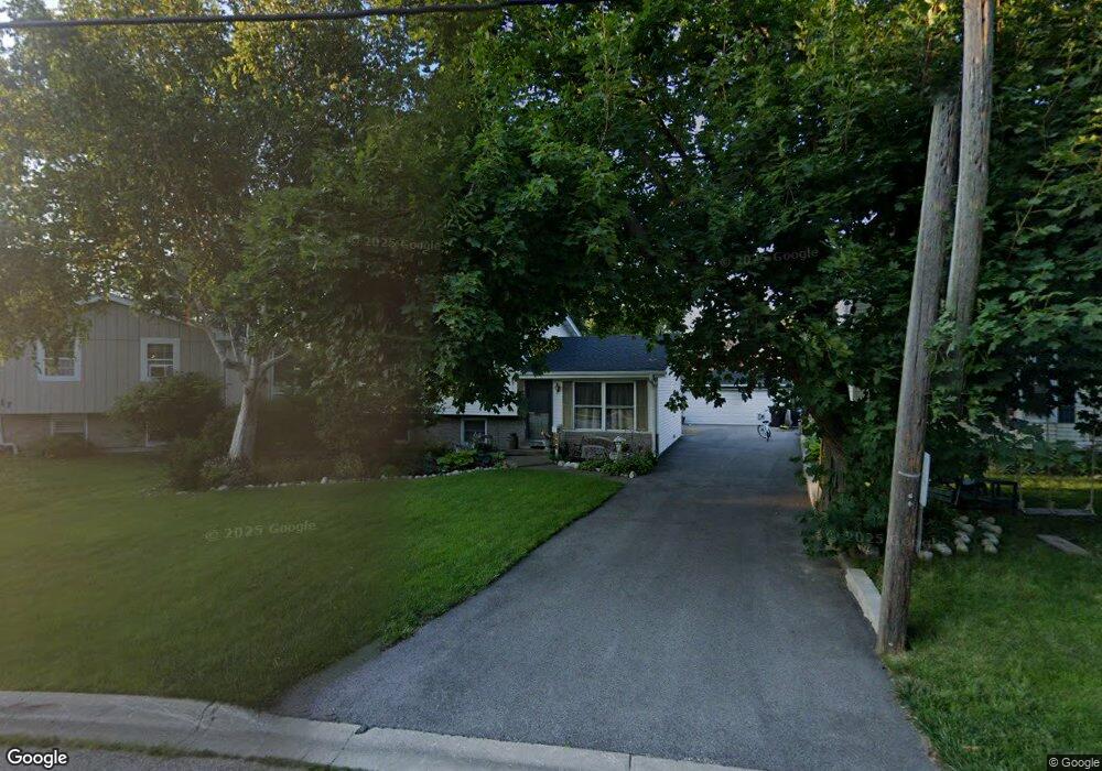
115 W Maple Ave Wauconda, IL 60084
Estimated Value: $216,000 - $269,388
3
Beds
2
Baths
932
Sq Ft
$257/Sq Ft
Est. Value
About This Home
This home is located at 115 W Maple Ave, Wauconda, IL 60084 and is currently estimated at $239,097, approximately $256 per square foot. 115 W Maple Ave is a home located in Lake County with nearby schools including Wauconda Grade School, Wauconda Middle School, and Wauconda High School.
Ownership History
Date
Name
Owned For
Owner Type
Purchase Details
Closed on
Mar 22, 2007
Sold by
Rivers Kenneth
Bought by
Rivers Dawn
Current Estimated Value
Purchase Details
Closed on
Dec 21, 1998
Sold by
Rivers Kenneth
Bought by
Rivers Dawn
Purchase Details
Closed on
Mar 28, 1996
Sold by
Fitzgerald Dawn and Rivers Dawn
Bought by
Rivers Kenneth and Rivers Dawn
Home Financials for this Owner
Home Financials are based on the most recent Mortgage that was taken out on this home.
Original Mortgage
$108,000
Interest Rate
7.36%
Purchase Details
Closed on
Mar 6, 1995
Sold by
Whitney Robert B and Whitney Charlene M
Bought by
Fitzgerald Dawn
Home Financials for this Owner
Home Financials are based on the most recent Mortgage that was taken out on this home.
Original Mortgage
$96,400
Interest Rate
9.13%
Create a Home Valuation Report for This Property
The Home Valuation Report is an in-depth analysis detailing your home's value as well as a comparison with similar homes in the area
Home Values in the Area
Average Home Value in this Area
Purchase History
| Date | Buyer | Sale Price | Title Company |
|---|---|---|---|
| Rivers Dawn | -- | None Available | |
| Rivers Dawn | -- | -- | |
| Rivers Kenneth | -- | Ati Title Company | |
| Fitzgerald Dawn | $120,500 | -- |
Source: Public Records
Mortgage History
| Date | Status | Borrower | Loan Amount |
|---|---|---|---|
| Previous Owner | Rivers Kenneth | $108,000 | |
| Previous Owner | Fitzgerald Dawn | $96,400 |
Source: Public Records
Tax History
| Year | Tax Paid | Tax Assessment Tax Assessment Total Assessment is a certain percentage of the fair market value that is determined by local assessors to be the total taxable value of land and additions on the property. | Land | Improvement |
|---|---|---|---|---|
| 2024 | $5,502 | $70,011 | $15,575 | $54,436 |
| 2023 | $5,247 | $63,996 | $14,237 | $49,759 |
| 2022 | $5,247 | $54,086 | $14,296 | $39,790 |
| 2021 | $4,993 | $51,106 | $13,508 | $37,598 |
| 2020 | $4,819 | $48,710 | $12,875 | $35,835 |
| 2019 | $4,269 | $46,035 | $12,168 | $33,867 |
| 2018 | $5,227 | $51,475 | $14,145 | $37,330 |
| 2017 | $5,221 | $50,879 | $13,981 | $36,898 |
| 2016 | $4,889 | $48,181 | $13,240 | $34,941 |
| 2015 | $4,572 | $44,232 | $12,155 | $32,077 |
| 2014 | $3,966 | $40,456 | $14,234 | $26,222 |
| 2012 | $3,886 | $39,964 | $13,618 | $26,346 |
Source: Public Records
Map
Nearby Homes
- 124 Hubbard Ct
- 155 E Mill St Unit 8
- 227 Kimball Ave
- 450 N Main St Unit S208A
- 214 Minerva Ave
- 330 Indian Ridge Trail
- 27071 N Ridge St
- 25586 W High St
- 25578 W High St
- 25570 W High St
- 555 Meadowview Dr
- 360 Promontory Ln Unit B
- 360 Promontory Ln Unit D
- 25817 W Cook St
- 365 Lake Ave Unit C
- 304 Hill St Unit 1004
- 26630 N Pheasant Trail
- 159 Parkview Dr Unit 159
- 225 Regency Ct Unit A
- 428 Country Lane Ct Unit 301
- 113 W Maple Ave
- 117 W Maple Ave
- 116 W Maple Ave
- 117 Bangs St
- 123 W Maple Ave
- 117 N Main St
- 101 N Main St
- 129 W Maple Ave
- 110 W Maple Ave
- 110 Slocum Lake Rd
- 114 Slocum Lake Rd
- 122 W Maple Ave
- 120 Slocum Lake Rd
- 102 W Maple Ave
- 130 W Maple Ave
- 124 Slocum Lake Rd
- 135 W Maple Ave
- 110 N Main St Unit B
- 110 N Main St Unit C
- 110 N Main St Unit D-E
Your Personal Tour Guide
Ask me questions while you tour the home.