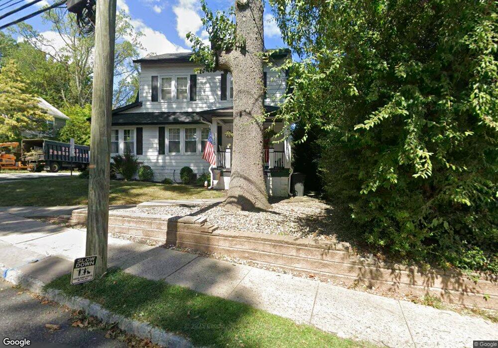
115 Walker Rd West Orange, NJ 07052
Estimated Value: $582,000 - $769,556
Studio
--
Bath
1,724
Sq Ft
$400/Sq Ft
Est. Value
About This Home
This home is located at 115 Walker Rd, West Orange, NJ 07052 and is currently estimated at $689,139, approximately $399 per square foot. 115 Walker Rd is a home located in Essex County with nearby schools including West Orange High School and Golda Och Academy Lower School.
Ownership History
Date
Name
Owned For
Owner Type
Purchase Details
Closed on
Sep 8, 2011
Sold by
Hudson City Savings Bank
Bought by
Cranston James and Cranston Victoria J
Current Estimated Value
Home Financials for this Owner
Home Financials are based on the most recent Mortgage that was taken out on this home.
Original Mortgage
$224,656
Outstanding Balance
$153,401
Interest Rate
4.2%
Mortgage Type
FHA
Estimated Equity
$535,738
Purchase Details
Closed on
Aug 31, 2010
Sold by
Trembley Steven and Trembley Claire
Bought by
Hudson City Savings Bank
Purchase Details
Closed on
Jul 23, 2008
Sold by
Trembley Claire
Bought by
Trembley Stephen
Purchase Details
Closed on
Jun 1, 1995
Sold by
Pugliese Leonard
Bought by
Trembly Stephen and Trembly Claire
Home Financials for this Owner
Home Financials are based on the most recent Mortgage that was taken out on this home.
Original Mortgage
$128,000
Interest Rate
8.21%
Mortgage Type
Purchase Money Mortgage
Create a Home Valuation Report for This Property
The Home Valuation Report is an in-depth analysis detailing your home's value as well as a comparison with similar homes in the area
Home Values in the Area
Average Home Value in this Area
Purchase History
| Date | Buyer | Sale Price | Title Company |
|---|---|---|---|
| Cranston James | $230,500 | Multiple | |
| Hudson City Savings Bank | -- | None Available | |
| Trembley Stephen | -- | None Available | |
| Trembly Stephen | $135,000 | -- |
Source: Public Records
Mortgage History
| Date | Status | Borrower | Loan Amount |
|---|---|---|---|
| Open | Cranston James | $224,656 | |
| Previous Owner | Trembly Stephen | $128,000 |
Source: Public Records
Tax History
| Year | Tax Paid | Tax Assessment Tax Assessment Total Assessment is a certain percentage of the fair market value that is determined by local assessors to be the total taxable value of land and additions on the property. | Land | Improvement |
|---|---|---|---|---|
| 2025 | $14,433 | $608,700 | $287,000 | $321,700 |
| 2024 | $14,433 | $313,900 | $147,800 | $166,100 |
| 2022 | $13,928 | $313,900 | $147,800 | $166,100 |
| 2021 | $13,667 | $313,900 | $147,800 | $166,100 |
| 2020 | $13,447 | $313,900 | $147,800 | $166,100 |
| 2019 | $13,061 | $313,900 | $147,800 | $166,100 |
| 2018 | $12,675 | $313,900 | $147,800 | $166,100 |
| 2017 | $12,512 | $313,900 | $147,800 | $166,100 |
| 2016 | $12,211 | $313,900 | $147,800 | $166,100 |
| 2015 | $11,982 | $313,900 | $147,800 | $166,100 |
| 2014 | $11,746 | $313,900 | $147,800 | $166,100 |
Source: Public Records
Map
Nearby Homes
- 12 Winding Way
- 43 Ridgeview Ave
- 5 Overlook Ave
- 31 Collamore Terrace
- 11 Mountain Way S
- 59 Hillside Ave
- 53 Forest Hill Rd
- 540 Liberty St
- 622 Tremont Ave
- 181 Mitchell St
- 631 Valley St
- 527 Valley St
- 16 Walnut Ct
- 639 Nassau St Unit 8
- 17 Wellington Ave
- 9 S Valley Rd
- 132 Mitchell St
- 745 Valley St
- 19 Bradford Ave
- 585 Mcchesney St
Your Personal Tour Guide
Ask me questions while you tour the home.