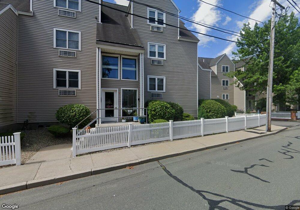
115 Water St Unit 15 Beverly, MA 01915
Downtown Beverly NeighborhoodEstimated Value: $379,242 - $469,000
1
Bed
1
Bath
724
Sq Ft
$582/Sq Ft
Est. Value
About This Home
This home is located at 115 Water St Unit 15, Beverly, MA 01915 and is currently estimated at $421,561, approximately $582 per square foot. 115 Water St Unit 15 is a home located in Essex County with nearby schools including Beverly High School, Salem Academy Charter School, and Mrs Alexander's School.
Ownership History
Date
Name
Owned For
Owner Type
Purchase Details
Closed on
May 16, 2017
Sold by
Est Clune Ruth M and Reed Mary C
Bought by
Crawford Cynthia H
Current Estimated Value
Home Financials for this Owner
Home Financials are based on the most recent Mortgage that was taken out on this home.
Original Mortgage
$209,000
Outstanding Balance
$174,000
Interest Rate
4.14%
Mortgage Type
New Conventional
Estimated Equity
$247,561
Purchase Details
Closed on
Dec 20, 1993
Sold by
Sheeran Robert L
Bought by
Muise Cindy J
Home Financials for this Owner
Home Financials are based on the most recent Mortgage that was taken out on this home.
Original Mortgage
$64,000
Interest Rate
7.03%
Mortgage Type
Purchase Money Mortgage
Create a Home Valuation Report for This Property
The Home Valuation Report is an in-depth analysis detailing your home's value as well as a comparison with similar homes in the area
Home Values in the Area
Average Home Value in this Area
Purchase History
| Date | Buyer | Sale Price | Title Company |
|---|---|---|---|
| Crawford Cynthia H | $220,000 | -- | |
| Muise Cindy J | $80,000 | -- |
Source: Public Records
Mortgage History
| Date | Status | Borrower | Loan Amount |
|---|---|---|---|
| Open | Crawford Cynthia H | $209,000 | |
| Previous Owner | Muise Cindy J | $64,000 |
Source: Public Records
Tax History Compared to Growth
Tax History
| Year | Tax Paid | Tax Assessment Tax Assessment Total Assessment is a certain percentage of the fair market value that is determined by local assessors to be the total taxable value of land and additions on the property. | Land | Improvement |
|---|---|---|---|---|
| 2025 | $3,600 | $327,600 | $0 | $327,600 |
| 2024 | $3,495 | $311,200 | $0 | $311,200 |
| 2023 | $3,343 | $296,900 | $0 | $296,900 |
| 2022 | $3,454 | $283,800 | $0 | $283,800 |
| 2021 | $3,377 | $265,900 | $0 | $265,900 |
| 2020 | $3,361 | $262,000 | $0 | $262,000 |
| 2019 | $3,256 | $246,500 | $0 | $246,500 |
| 2018 | $2,936 | $215,900 | $0 | $215,900 |
| 2017 | $2,827 | $198,000 | $0 | $198,000 |
| 2016 | $2,622 | $182,200 | $0 | $182,200 |
| 2015 | $2,458 | $174,200 | $0 | $174,200 |
Source: Public Records
Map
Nearby Homes
- 7 Lothrop St
- 40 & 40R Stone St
- 43 Front St
- 10 Quincy Park
- 12 Fayette St Unit 4
- 21 Summit Ave Unit 2
- 60 Rantoul St Unit 711N
- 12 Thorndike St
- 261 Rantoul St
- 19 Pond St
- The Cabot Collection
- 14 Lathrop St
- 23 Beach Ave Unit 1
- 348 Rantoul St Unit 202
- 16 Crescent Ave
- 112 Bay View Ave
- 39 & 41 Woodbury St
- 70 Chase St
- 123 Livingstone Ave
- 17 Orchard St
- 115 Water St Unit 20
- 115 Water St Unit 19
- 115 Water St Unit 18
- 115 Water St Unit 17
- 115 Water St Unit 16
- 115 Water St Unit 14
- 115 Water St Unit 13
- 115 Water St Unit 13,115
- 115 Water St Unit 2
- 115 Water St Unit 14/115
- 115 Water St Unit 17 115
- 115 Water St Unit 115 14
- 113 Water St Unit 79
- 113 Water St Unit 78
- 113 Water St Unit 77
- 113 Water St Unit 76
- 113 Water St Unit 75
- 113 Water St Unit 74
- 113 Water St Unit 73
- 113 Water St Unit 72