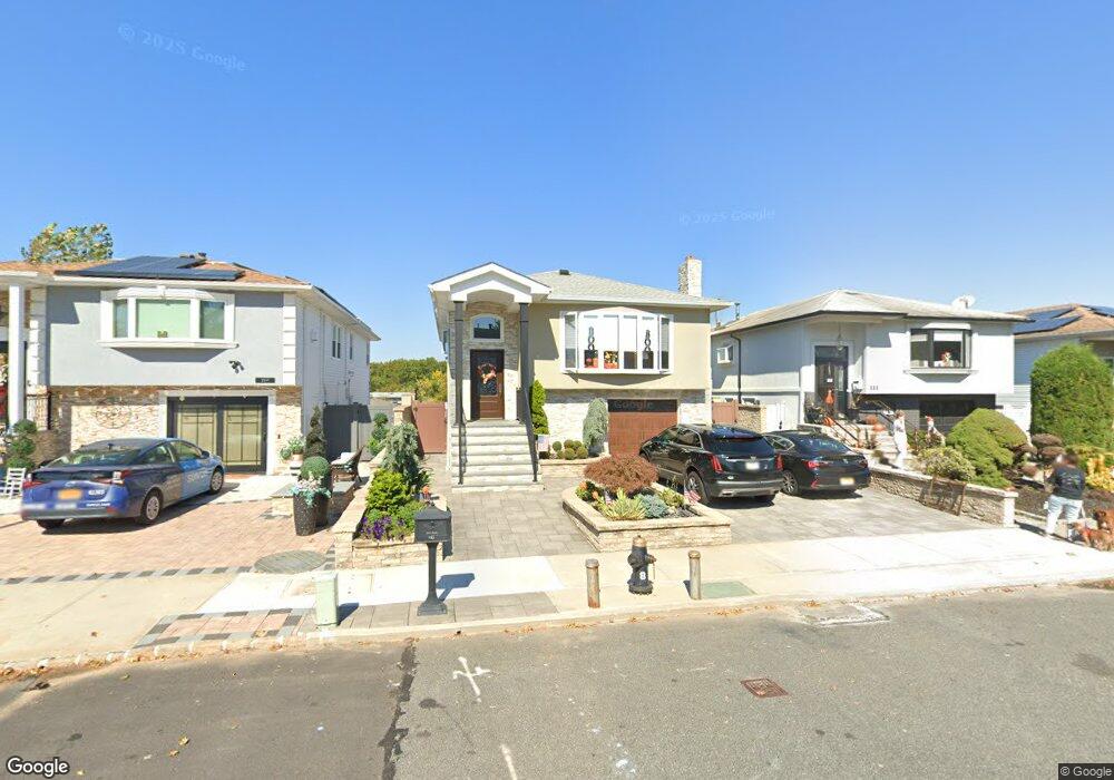
115 Wieland Ave Staten Island, NY 10309
Woodrow NeighborhoodEstimated Value: $809,704 - $1,066,000
4
Beds
1
Bath
2,311
Sq Ft
$401/Sq Ft
Est. Value
About This Home
This home is located at 115 Wieland Ave, Staten Island, NY 10309 and is currently estimated at $927,676, approximately $401 per square foot. 115 Wieland Ave is a home located in Richmond County with nearby schools including P.S. 56 - The Louis Desario School, Is 34 Tottenville, and Tottenville High School.
Ownership History
Date
Name
Owned For
Owner Type
Purchase Details
Closed on
Jan 30, 2019
Sold by
Schau Danielle
Bought by
Schau Kathleen
Current Estimated Value
Purchase Details
Closed on
May 15, 2018
Sold by
Schau Kathleen
Bought by
Schau Danielle
Purchase Details
Closed on
Dec 14, 2007
Sold by
Karseboom Albert and Karseboom Mary
Bought by
Schau Kathleen
Home Financials for this Owner
Home Financials are based on the most recent Mortgage that was taken out on this home.
Original Mortgage
$417,000
Outstanding Balance
$262,164
Interest Rate
6.17%
Mortgage Type
Purchase Money Mortgage
Estimated Equity
$665,512
Purchase Details
Closed on
May 3, 2006
Sold by
Trachta Thomas M and Trachta Jane A
Bought by
Schau Kathleen
Create a Home Valuation Report for This Property
The Home Valuation Report is an in-depth analysis detailing your home's value as well as a comparison with similar homes in the area
Home Values in the Area
Average Home Value in this Area
Purchase History
| Date | Buyer | Sale Price | Title Company |
|---|---|---|---|
| Schau Kathleen | -- | Judicial Title | |
| Schau Danielle | -- | Judicial Title | |
| Schau Kathleen | -- | None Available | |
| Schau Kathleen | $585,000 | None Available |
Source: Public Records
Mortgage History
| Date | Status | Borrower | Loan Amount |
|---|---|---|---|
| Open | Schau Kathleen | $417,000 |
Source: Public Records
Tax History Compared to Growth
Tax History
| Year | Tax Paid | Tax Assessment Tax Assessment Total Assessment is a certain percentage of the fair market value that is determined by local assessors to be the total taxable value of land and additions on the property. | Land | Improvement |
|---|---|---|---|---|
| 2025 | $7,913 | $46,800 | $8,789 | $38,011 |
| 2024 | $7,913 | $46,800 | $8,789 | $38,011 |
| 2023 | $7,941 | $39,102 | $9,282 | $29,820 |
| 2022 | $7,364 | $43,680 | $10,440 | $33,240 |
| 2021 | $7,324 | $43,680 | $10,440 | $33,240 |
| 2020 | $6,950 | $44,940 | $10,440 | $34,500 |
| 2019 | $6,868 | $46,260 | $10,440 | $35,820 |
| 2018 | $6,642 | $32,585 | $10,346 | $22,239 |
| 2017 | $6,267 | $30,741 | $9,206 | $21,535 |
| 2016 | $5,798 | $29,001 | $9,973 | $19,028 |
| 2015 | $5,251 | $27,360 | $8,700 | $18,660 |
| 2014 | $5,251 | $27,360 | $8,700 | $18,660 |
Source: Public Records
Map
Nearby Homes
- 0 Woodrow Rd
- 1272 Woodrow Rd
- 104 Wieland Ave
- 106 Wieland Ave
- 108 Wieland Ave
- 142 Wieland Ave
- 559 Alverson Ave
- 265 Ramapo Ave
- 880 Sinclair Ave
- 30 Alverson Loop
- 973 Sheldon Ave
- 839 Sinclair Ave
- 9 Mallow St
- 47 Hemlock St
- 727 Stafford Ave
- 960 Rensselaer Ave
- 816 Sinclair Ave
- 980 Rensselaer Ave
- 234 Gervil St
- 735 Maguire Ave
- 111 Wieland Ave
- 119 Wieland Ave
- 107 Wieland Ave
- 123 Wieland Ave
- 1304 Woodrow Rd
- 1308 Woodrow Rd
- 1298 Woodrow Rd
- 127 Wieland Ave
- 1292 Woodrow Rd
- 1312 Woodrow Rd
- 116 Wieland Ave
- 1288 Woodrow Rd
- 1318 Woodrow Rd
- 141 Wieland Ave
- 126 Wieland Ave
- 1284 Woodrow Rd
- 138 Wieland Ave
- 1280 Woodrow Rd
- 1326 Woodrow Rd
- 94 Wieland Ave