Estimated Value: $182,000 - $283,535
2
Beds
2
Baths
1,036
Sq Ft
$225/Sq Ft
Est. Value
About This Home
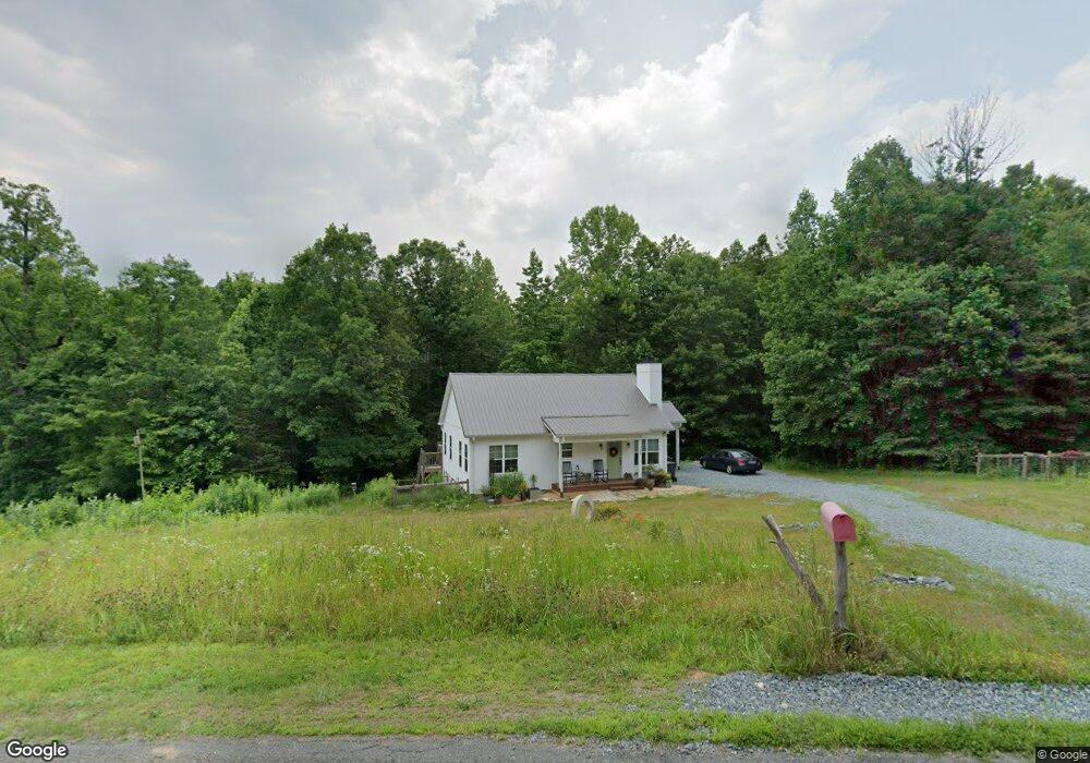
This home is located at 1150 Birthel Bennett Rd, King, NC 27021 and is currently estimated at $233,384, approximately $225 per square foot. 1150 Birthel Bennett Rd is a home with nearby schools including Mount Olive Elementary School, Chestnut Grove Middle, and West Stokes High.
Ownership History
Date
Name
Owned For
Owner Type
Purchase Details
Closed on
Feb 20, 2020
Sold by
Covin Roger Dean
Bought by
Patterson Rachael Christine
Current Estimated Value
Home Financials for this Owner
Home Financials are based on the most recent Mortgage that was taken out on this home.
Original Mortgage
$37,425
Outstanding Balance
$8,352
Interest Rate
3.6%
Mortgage Type
Future Advance Clause Open End Mortgage
Estimated Equity
$225,032
Create a Home Valuation Report for This Property
The Home Valuation Report is an in-depth analysis detailing your home's value as well as a comparison with similar homes in the area
Home Values in the Area
Average Home Value in this Area
Purchase History
| Date | Buyer | Sale Price | Title Company |
|---|---|---|---|
| Patterson Rachael Christine | $46,500 | Chicago Title Insurance Co |
Source: Public Records
Mortgage History
| Date | Status | Borrower | Loan Amount |
|---|---|---|---|
| Open | Patterson Rachael Christine | $37,425 |
Source: Public Records
Tax History Compared to Growth
Tax History
| Year | Tax Paid | Tax Assessment Tax Assessment Total Assessment is a certain percentage of the fair market value that is determined by local assessors to be the total taxable value of land and additions on the property. | Land | Improvement |
|---|---|---|---|---|
| 2025 | $1,781 | $249,100 | $71,500 | $177,600 |
| 2024 | $1,781 | $179,200 | $54,500 | $124,700 |
| 2023 | $1,452 | $179,200 | $54,500 | $124,700 |
| 2022 | $1,326 | $179,200 | $54,500 | $124,700 |
| 2021 | $1,095 | $148,000 | $54,500 | $93,500 |
| 2020 | $391 | $52,900 | $52,900 | $0 |
| 2019 | $391 | $52,900 | $52,900 | $0 |
| 2018 | $391 | $52,900 | $52,900 | $0 |
| 2017 | $389 | $52,900 | $52,900 | $0 |
| 2016 | $388 | $52,800 | $52,800 | $0 |
| 2015 | $385 | $52,800 | $52,800 | $0 |
| 2014 | $372 | $52,800 | $52,800 | $0 |
Source: Public Records
Map
Nearby Homes
- +/- 17.06 Johnson Rd
- 0 Nance Rd
- .64 Ac Kentland Dr Unit .64 Ac
- 5.25 Ac Capella Ridge Rd Unit 5.25 Ac
- 1208 Kentland Dr
- 1739 Denny Rd
- 108 Nova Ln
- 100 Ridgecrest Dr
- 1255 Mountain View Rd
- 6064 S Nc Highway 66
- 4.45acres Gib Ferguson Rd
- 3125 YMcA Camp Rd
- 1065 Reid Rd
- 0 Reid Rd
- 103 Jasper Ct
- 1085 Mystic Ln
- 1105 Flippin Ln
- Lot 9 Brown Rd
- 1060 Brown Rd
- 112 Rocky Maple Dr
- 1020 Old Wagon Rd
- XX Birthel Bennett
- 1111 Birthel Bennett Rd
- 1181 Birthel Bennett Rd
- 1034 Old Wagon Rd
- 1109 Birthel Bennett Rd
- 1040 Old Wagon Rd
- 1068 Birthel Bennett Rd
- 1068 Birthel Bennett Rd
- 1203 Geeps Trail Rd
- 1075 Old Wagon Rd
- xxxx Birthel Bennett Rd
- 1080 Old Wagon Rd
- 1195 Geeps Trail Rd
- 1200 Geeps Trail Rd
- 1022 Birthel Bennett Rd
- 1185 Geeps Trail Rd
- 1190 Geeps Trail Rd
- 1097 Nance Ln
- 1426 Ralph Boyles Rd