Estimated Value: $373,000 - $537,000
6
Beds
3
Baths
3,645
Sq Ft
$125/Sq Ft
Est. Value
About This Home
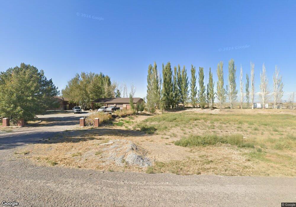
This home is located at 1150 E 2000 S, Delta, UT 84624 and is currently estimated at $455,000, approximately $124 per square foot. 1150 E 2000 S is a home located in Millard County.
Ownership History
Date
Name
Owned For
Owner Type
Purchase Details
Closed on
Dec 28, 2018
Sold by
Sabey Judy W and Peck Gregory D
Bought by
Johnson Carl D
Current Estimated Value
Purchase Details
Closed on
Dec 21, 2018
Sold by
Sabey Judy W and Peck Gregory D
Bought by
Anderson Dennis and Marital & Family Trust
Create a Home Valuation Report for This Property
The Home Valuation Report is an in-depth analysis detailing your home's value as well as a comparison with similar homes in the area
Purchase History
| Date | Buyer | Sale Price | Title Company |
|---|---|---|---|
| Johnson Carl D | -- | -- | |
| Anderson Dennis | -- | None Available |
Source: Public Records
Tax History
| Year | Tax Paid | Tax Assessment Tax Assessment Total Assessment is a certain percentage of the fair market value that is determined by local assessors to be the total taxable value of land and additions on the property. | Land | Improvement |
|---|---|---|---|---|
| 2025 | $2,291 | $282,011 | $18,948 | $263,063 |
| 2024 | $2,291 | $287,418 | $15,341 | $272,077 |
| 2023 | $2,607 | $287,418 | $15,341 | $272,077 |
| 2022 | $2,236 | $198,102 | $13,630 | $184,472 |
| 2021 | $1,754 | $149,928 | $13,630 | $136,298 |
| 2020 | $1,680 | $144,641 | $13,630 | $131,011 |
| 2019 | $1,617 | $140,528 | $13,630 | $126,898 |
| 2018 | $1,030 | $91,791 | $13,700 | $78,091 |
| 2017 | $1,037 | $88,491 | $10,400 | $78,091 |
| 2016 | $988 | $88,491 | $10,400 | $78,091 |
| 2015 | $987 | $88,491 | $10,400 | $78,091 |
| 2014 | -- | $88,491 | $10,400 | $78,091 |
| 2013 | -- | $81,208 | $10,400 | $70,808 |
Source: Public Records
Map
Nearby Homes
- 2595 E 500 Rd S Unit 3
- 648 Tamarix St
- 321 E 200 S
- 38 E 300 S
- 32 E 300 S
- Locust Ave Unit LotWP001
- 87 S 300 East Rd
- 44 E 300 S
- 0 E Highway 6 Unit LotWP001 16586023
- 294 S 300 W
- 163 W 100 S
- 445 Topaz Blvd Unit 10
- 7900 E 250 Rd N
- 341 W 100 S
- 628 Sunset St
- 520 E 450 North Rd
- 325 N 100 W
- 901 E 750 Rd N
- 700 N Highway 6
- 451 W 300 N
Your Personal Tour Guide
Ask me questions while you tour the home.