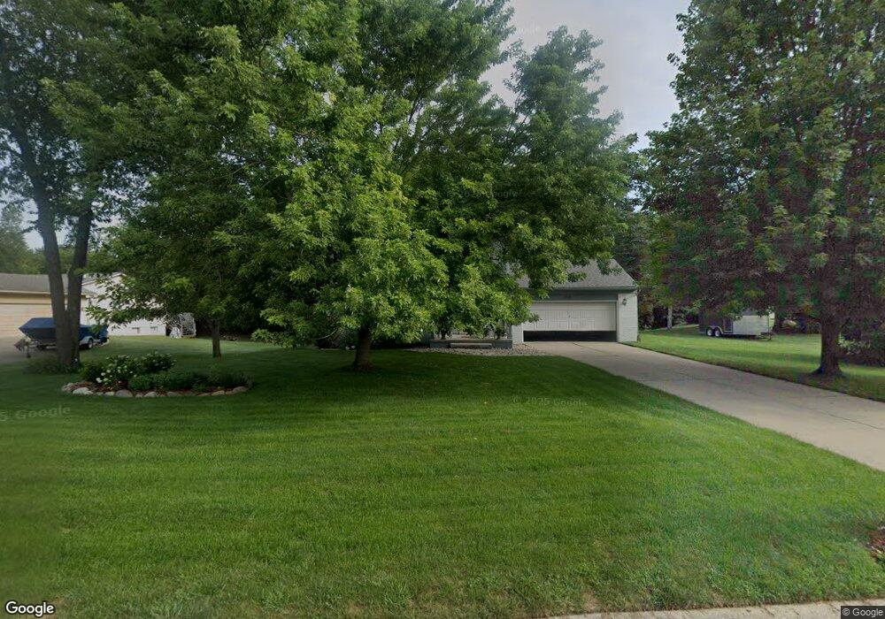
1150 Eagle Nest Dr Rochester, MI 48306
Estimated Value: $463,758 - $502,000
3
Beds
3
Baths
2,037
Sq Ft
$235/Sq Ft
Est. Value
About This Home
This home is located at 1150 Eagle Nest Dr, Rochester, MI 48306 and is currently estimated at $479,440, approximately $235 per square foot. 1150 Eagle Nest Dr is a home located in Oakland County with nearby schools including Baldwin Elementary School, Hart Middle School, and Stoney Creek High School.
Ownership History
Date
Name
Owned For
Owner Type
Purchase Details
Closed on
Nov 21, 2007
Sold by
Grimes Keith D and Grimes Deborah J
Bought by
Mcdonald Michael and Mcdonald Jennifer
Current Estimated Value
Purchase Details
Closed on
Nov 21, 1997
Sold by
Desai Hitesh R
Bought by
Grimes Keith D
Home Financials for this Owner
Home Financials are based on the most recent Mortgage that was taken out on this home.
Original Mortgage
$166,500
Interest Rate
7.46%
Create a Home Valuation Report for This Property
The Home Valuation Report is an in-depth analysis detailing your home's value as well as a comparison with similar homes in the area
Home Values in the Area
Average Home Value in this Area
Purchase History
We collect this data history from publicly available records. To have your information removed, we recommend requesting removal directly through your county’s website.
| Date | Buyer | Sale Price | Title Company |
|---|---|---|---|
| Mcdonald Michael | $240,000 | Metropolitan Title Company | |
| Grimes Keith D | $185,000 | -- |
Source: Public Records
Mortgage History
We collect this data history from publicly available records. To have your information removed, we recommend requesting removal directly through your county’s website.
| Date | Status | Borrower | Loan Amount |
|---|---|---|---|
| Previous Owner | Grimes Keith D | $166,500 |
Source: Public Records
Tax History
| Year | Tax Paid | Tax Assessment Tax Assessment Total Assessment is a certain percentage of the fair market value that is determined by local assessors to be the total taxable value of land and additions on the property. | Land | Improvement |
|---|---|---|---|---|
| 2025 | $2,487 | $204,330 | $0 | $0 |
| 2024 | $1,621 | $203,580 | $0 | $0 |
| 2023 | $1,559 | $177,370 | $0 | $0 |
| 2022 | $2,309 | $152,960 | $0 | $0 |
| 2021 | $2,152 | $145,540 | $0 | $0 |
| 2020 | $1,506 | $140,320 | $0 | $0 |
| 2019 | $2,272 | $132,370 | $0 | $0 |
| 2018 | $2,281 | $127,760 | $0 | $0 |
| 2017 | $2,247 | $127,340 | $0 | $0 |
| 2016 | $2,236 | $124,300 | $0 | $0 |
| 2015 | -- | $109,840 | $0 | $0 |
| 2014 | -- | $85,980 | $0 | $0 |
| 2011 | -- | $88,930 | $0 | $0 |
Source: Public Records
Map
Nearby Homes
- 1081 Eagle Nest Dr
- 2654 Quail Run St
- 2747 Pebble Beach Dr
- 2738 Pebble Beach Dr Unit 127
- 2862 Bay Hill Ct
- 3215 Pompilio Dr
- 3082 Pompilio Dr
- 2648 Pebble Beach Dr
- 3146 Pompilio Dr
- 3214 Pompilio Dr
- 2616 Pebble Beach Dr
- 2612 Invitational Dr
- 2483 Spyglass Dr
- 3269 Willis Dr
- 3268 Willis Dr
- 2453 Pebble Beach Dr
- 000 Parks
- 63888 Dequindre Rd
- 63770 Dequindre Rd
- 65565 Dequindre Rd
- 1156 Eagle Nest Dr
- 1140 Eagle Nest Dr
- 1127 Eagle Nest Dr
- 1138 Eagle Nest Dr
- 1162 Eagle Nest Dr
- 1155 Eagle Nest Dr
- 2610 Quail Run St
- 1132 Eagle Nest Dr
- 2611 Quail Run St
- 1126 Eagle Nest Dr
- 2733 Pheasant Ct
- 1121 Eagle Nest Dr
- 2720 Pheasant Ct
- 2606 Quail Run St
- 1190 Eagle Nest Dr
- 2615 Quail Run St
- 1120 Eagle Nest Dr
- 2744 Pheasant Ct
- 2732 Pheasant Ct
- 2623 Quail Run St
Your Personal Tour Guide
Ask me questions while you tour the home.