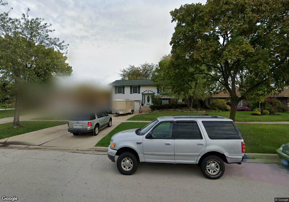
1150 Hassell Rd Hoffman Estates, IL 60169
High Point Park NeighborhoodEstimated Value: $333,000 - $405,000
3
Beds
2
Baths
1,176
Sq Ft
$325/Sq Ft
Est. Value
About This Home
This home is located at 1150 Hassell Rd, Hoffman Estates, IL 60169 and is currently estimated at $382,769, approximately $325 per square foot. 1150 Hassell Rd is a home located in Cook County with nearby schools including MacArthur International Spanish Academy, Dwight D Eisenhower Junior High School, and Hoffman Estates High School.
Ownership History
Date
Name
Owned For
Owner Type
Purchase Details
Closed on
Oct 24, 2007
Sold by
Jones Rachelle L
Bought by
Baize Debra I
Current Estimated Value
Home Financials for this Owner
Home Financials are based on the most recent Mortgage that was taken out on this home.
Original Mortgage
$196,000
Outstanding Balance
$123,447
Interest Rate
6.38%
Mortgage Type
Negative Amortization
Estimated Equity
$259,322
Purchase Details
Closed on
Oct 27, 1997
Sold by
Solvie Scott E and Solvie Sharon L
Bought by
Baize Debra I and Jones Rachelle L
Home Financials for this Owner
Home Financials are based on the most recent Mortgage that was taken out on this home.
Original Mortgage
$100,205
Interest Rate
7.42%
Mortgage Type
FHA
Create a Home Valuation Report for This Property
The Home Valuation Report is an in-depth analysis detailing your home's value as well as a comparison with similar homes in the area
Home Values in the Area
Average Home Value in this Area
Purchase History
| Date | Buyer | Sale Price | Title Company |
|---|---|---|---|
| Baize Debra I | $62,500 | Marine Title Corp | |
| Baize Debra I | $156,000 | -- |
Source: Public Records
Mortgage History
| Date | Status | Borrower | Loan Amount |
|---|---|---|---|
| Open | Baize Debra I | $196,000 | |
| Previous Owner | Baize Debra I | $100,205 |
Source: Public Records
Tax History Compared to Growth
Tax History
| Year | Tax Paid | Tax Assessment Tax Assessment Total Assessment is a certain percentage of the fair market value that is determined by local assessors to be the total taxable value of land and additions on the property. | Land | Improvement |
|---|---|---|---|---|
| 2024 | $8,189 | $30,001 | $6,668 | $23,333 |
| 2023 | $7,894 | $30,001 | $6,668 | $23,333 |
| 2022 | $7,894 | $30,001 | $6,668 | $23,333 |
| 2021 | $6,967 | $24,125 | $4,445 | $19,680 |
| 2020 | $6,879 | $24,125 | $4,445 | $19,680 |
| 2019 | $6,844 | $26,806 | $4,445 | $22,361 |
| 2018 | $5,595 | $20,594 | $3,778 | $16,816 |
| 2017 | $5,515 | $20,594 | $3,778 | $16,816 |
| 2016 | $5,731 | $21,735 | $3,778 | $17,957 |
| 2015 | $5,339 | $19,246 | $3,333 | $15,913 |
| 2014 | $5,262 | $19,246 | $3,333 | $15,913 |
| 2013 | $5,109 | $19,246 | $3,333 | $15,913 |
Source: Public Records
Map
Nearby Homes
- 1180 Cobble Hill Ct
- 1360 Mayfield Ln
- 1420 Hassell Rd
- 1410 Nottingham Ln
- 1445 Nottingham Ln
- 1860 Ashley Rd
- 920 Eden Dr
- 2079 E Parkview Cir
- 2004 E Parkview Cir
- 1940 Kenilworth Cir Unit H
- 1360 Devonshire Ln
- 1975 Kenilworth Cir Unit B
- 1977 Kenilworth Cir Unit D
- 1738 Ardwick Dr
- 540 Jamison Ln
- 1735 Highland Blvd
- 1704 Fayette Walk Unit B
- 1712 Fayette Walk Unit D
- 1800 Huntington Blvd Unit AE615
- 1800 Huntington Blvd Unit AE212
- 1140 Hassell Rd
- 1160 Hassell Rd
- 1155 Mayfield Ln
- 1130 Hassell Rd
- 1145 Mayfield Ln
- 1135 Mayfield Ln
- 1990 Chippendale Rd
- 1120 Hassell Rd
- 1155 Hassell Rd
- 1125 Mayfield Ln
- 2000 Hilltop Rd
- 2010 Hilltop Rd
- 1165 Hassell Rd
- 1110 Hassell Rd
- 2020 Hilltop Rd
- 1980 Chippendale Rd
- 1105 Hassell Rd
- 1175 Hassell Rd
- 2030 Hilltop Rd
- 1150 Mayfield Ln
