
Seller's Agent in 2022
Kim Shupe
Coldwell Banker Upchurch Realty
(706) 207-0823
226 Total Sales
Estimated Value: $618,000 - $712,372
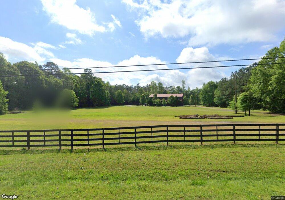
Dreaming of quiet country living yet accessibility to fantastic restaurants, shopping and Award Winning Schools? This incredible Barndominium offers gorgeous upgraded living spaces inside and out on over 6 acres! As you enter the code-secured gates of this nearly 6.3 acre property, you'll find that the exterior attributes and technical specs are quite rare and ideal for a multitude of lifestyles for any homebuyer, including a fire pit area and a full recreational size (12ft ceiling) lean-to sheltered back patio that is already pre-wired for hot tub hook up or can be enjoyed as a covered RV storage area with electrical hookup. Also included in this beautiful property is a separate storage building with an attached pavilion perfect for cookouts and large gatherings. This upgraded luxury home sits upstairs with an extra wide stairway from the garage and offers bamboo finished floors throughout, custom light fixtures, custom barn doors, and breathtaking finishes around every corner of the house. The large kitchen is equipped with custom butcher block countertops, custom cabinetry with pull outs, stainless steel appliances, gas stove, and a walk in pantry. All 3 bedrooms have their own attached full-sized bathroom which have recently been remodeled and renovated, including the owner's suite bathroom with a jetted soaker tub, huge 63 sq ft separate shower with 2 shower heads and corner bench, and custom wood finishings on cabinets. Downstairs you'll find a 4320 sq ft, 12ft ceiling garage with access via code-secured front/back doors or through two 12'W x 9'H garage doors. The garage is complete with hot & cold faucets at both ends, copper airlines throughout, trade fixed (negotiable with current price) shelving/storage, motorcycle lift, two post car lift, tire machine, tire balancer, air compressor, hose reels plus more! Call today for a private tour!
Last Agent to Sell the Property
Coldwell Banker Upchurch Realty License #239084 Listed on: 07/11/2022
Last Buyer's Agent
Phillip Wilson
United Country Real Estate Sou License #391225
| Date | Buyer | Sale Price | Title Company |
|---|---|---|---|
| Deist Jason Michael | $610,000 | -- | |
| Shuart Kenneth R | $285,000 | -- | |
| Waters Edge Properties Llc | -- | -- | |
| Bone Joseph | $38,000 | -- |
| Date | Status | Borrower | Loan Amount |
|---|---|---|---|
| Open | Deist Jason Michael | $575,000 | |
| Previous Owner | Shuart Kenneth R | $220,000 |
| Date | Event | Price | List to Sale | Price per Sq Ft |
|---|---|---|---|---|
| 09/06/2022 09/06/22 | Sold | $610,000 | -2.4% | $191 / Sq Ft |
| 08/07/2022 08/07/22 | Pending | -- | -- | -- |
| 07/11/2022 07/11/22 | For Sale | $625,000 | -- | $195 / Sq Ft |
| Year | Tax Paid | Tax Assessment Tax Assessment Total Assessment is a certain percentage of the fair market value that is determined by local assessors to be the total taxable value of land and additions on the property. | Land | Improvement |
|---|---|---|---|---|
| 2024 | $6,517 | $252,377 | $32,947 | $219,430 |
| 2023 | $7,161 | $234,573 | $27,456 | $207,117 |
| 2022 | $4,080 | $149,932 | $18,876 | $131,056 |
| 2021 | $3,718 | $123,781 | $18,876 | $104,905 |
| 2020 | $3,659 | $121,035 | $16,130 | $104,905 |
| 2019 | $3,647 | $119,288 | $16,130 | $103,158 |
| 2018 | $3,556 | $115,878 | $14,758 | $101,120 |
| 2017 | $2,914 | $101,214 | $13,728 | $87,486 |
| 2016 | $2,905 | $101,214 | $13,728 | $87,486 |
| 2015 | $2,906 | $101,214 | $13,728 | $87,486 |
| 2014 | -- | $14,690 | $13,716 | $974 |
| 2013 | -- | $14,690 | $13,716 | $974 |
Seller's Agent in 2022
Kim Shupe
Coldwell Banker Upchurch Realty
(706) 207-0823
226 Total Sales
P
Buyer's Agent in 2022
Phillip Wilson
United Country Real Estate Sou
Source: Savannah Multi-List Corporation
MLS Number: CM1000446
APN: 0053-094
Disclaimer: Certain information contained herein is derived from information provided by parties other than Homes.com. All information provided is deemed reliable, but is not guaranteed to be accurate and should be independently verified.
![]() IDX information is provided exclusively for personal, non-commercial use, and may not be used for any purpose other than to identify prospective properties consumers may be interested in purchasing.
IDX information is provided exclusively for personal, non-commercial use, and may not be used for any purpose other than to identify prospective properties consumers may be interested in purchasing.
Information is deemed reliable but not guaranteed.