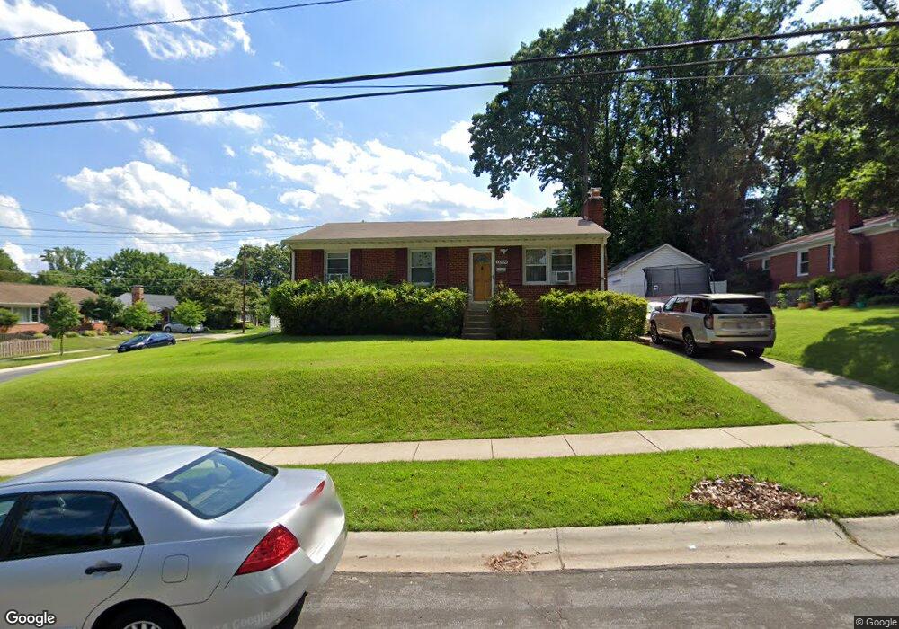
11500 Soward Dr Silver Spring, MD 20902
North Kensington NeighborhoodEstimated Value: $798,000 - $906,000
Studio
2
Baths
2,200
Sq Ft
$377/Sq Ft
Est. Value
About This Home
This home is located at 11500 Soward Dr, Silver Spring, MD 20902 and is currently estimated at $828,427, approximately $376 per square foot. 11500 Soward Dr is a home located in Montgomery County with nearby schools including Rock View Elementary School, Newport Mill Middle School, and Albert Einstein High School.
Ownership History
Date
Name
Owned For
Owner Type
Purchase Details
Closed on
May 20, 2016
Sold by
Dejesus Amabelle E and Dejesus Amelia E
Bought by
Dejesus Amabelle E
Current Estimated Value
Purchase Details
Closed on
Aug 28, 2003
Sold by
Dejesus Amabelle E
Bought by
Dejesus Amabelle E and Dejesus Amelia E
Purchase Details
Closed on
Jul 19, 2001
Sold by
Shaffer Thomas J and Shaffer M C
Bought by
Dejesus Amabelle E
Create a Home Valuation Report for This Property
The Home Valuation Report is an in-depth analysis detailing your home's value as well as a comparison with similar homes in the area
Home Values in the Area
Average Home Value in this Area
Purchase History
| Date | Buyer | Sale Price | Title Company |
|---|---|---|---|
| Dejesus Amabelle E | -- | Attorney | |
| Dejesus Amabelle E | -- | -- | |
| Dejesus Amabelle E | $225,000 | -- |
Source: Public Records
Tax History
| Year | Tax Paid | Tax Assessment Tax Assessment Total Assessment is a certain percentage of the fair market value that is determined by local assessors to be the total taxable value of land and additions on the property. | Land | Improvement |
|---|---|---|---|---|
| 2025 | $8,461 | $726,933 | -- | -- |
| 2024 | $8,461 | $671,500 | $184,000 | $487,500 |
| 2023 | $8,858 | $647,733 | $0 | $0 |
| 2022 | $4,192 | $383,400 | $0 | $0 |
| 2021 | $2,353 | $375,400 | $169,000 | $206,400 |
| 2020 | $3,738 | $351,367 | $0 | $0 |
| 2019 | $4,466 | $327,333 | $0 | $0 |
| 2018 | $4,237 | $303,300 | $154,100 | $149,200 |
| 2017 | $4,143 | $290,567 | $0 | $0 |
| 2016 | -- | $277,833 | $0 | $0 |
| 2015 | $2,713 | $265,100 | $0 | $0 |
| 2014 | $2,713 | $265,100 | $0 | $0 |
Source: Public Records
Map
Nearby Homes
- 11319 Woodson Ave
- 11852 Huggins Dr
- 3921 Lantern Dr
- 4008 Adams Dr
- 3509 Astoria Rd
- 11814 College View Dr
- 3726 Ferrara Dr
- 3720 Ferrara Dr
- 11006 Madison St
- 11315 Palisades Ct
- 3103 Dawson Ave
- 4305 Garrett Park Rd
- 4111 Denfeld Ave
- 2890 Schoolhouse Cir
- 4104 Tulare Dr
- 4106 Mitscher Ct
- 4119 Denfeld Ave
- 3355 University Blvd W
- 3355 University Blvd W Unit 206
- 3355 University Blvd W
- 3803 Woodridge Ave
- 11504 Soward Dr
- 3805 Woodridge Ave
- 3707 Woodridge Ave
- 11422 Soward Dr
- 11508 Soward Dr
- 11505 Soward Dr
- 3802 Woodridge Ave
- 3807 Woodridge Ave
- 3804 Woodridge Ave
- 11512 Soward Dr
- 11419 Soward Dr
- 3809 Woodridge Ave
- 11507 Soward Dr
- 3705 Woodridge Ave
- 3806 Woodridge Ave
- 11516 Soward Dr
- 11420 Soward Dr
- 11318 Woodson Ave
- 11509 Soward Dr
Your Personal Tour Guide
Ask me questions while you tour the home.