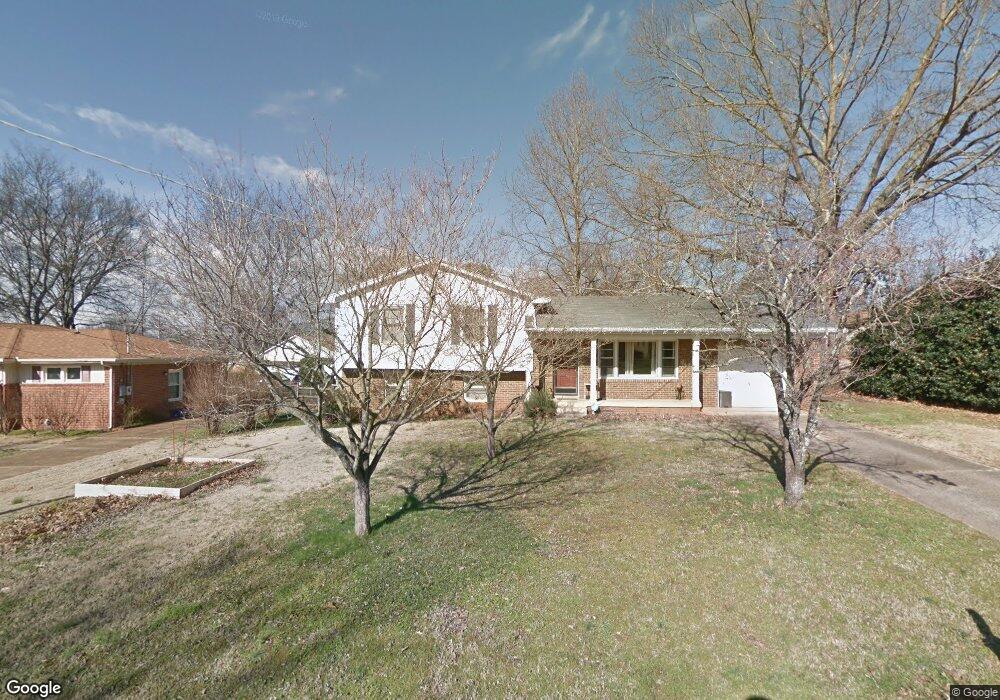
11502 Maplecrest Dr SE Huntsville, AL 35803
Weatherly Heights NeighborhoodEstimated Value: $206,000 - $286,000
--
Bed
--
Bath
1,528
Sq Ft
$159/Sq Ft
Est. Value
About This Home
This home is located at 11502 Maplecrest Dr SE, Huntsville, AL 35803 and is currently estimated at $243,248, approximately $159 per square foot. 11502 Maplecrest Dr SE is a home with nearby schools including Mountain Gap Elementary School, Mt. Gap Middle School, and Virgil Grissom High School.
Ownership History
Date
Name
Owned For
Owner Type
Purchase Details
Closed on
Sep 10, 2020
Sold by
Ables Sandra S
Bought by
Denis Philip Timothy and Denis Jennifer Ashley
Current Estimated Value
Purchase Details
Closed on
Oct 12, 2015
Sold by
Ables Sandra S
Bought by
Ables Sandra S
Home Financials for this Owner
Home Financials are based on the most recent Mortgage that was taken out on this home.
Original Mortgage
$85,000
Interest Rate
3.87%
Mortgage Type
New Conventional
Purchase Details
Closed on
Mar 2, 2007
Sold by
Bosley Jennifer
Bought by
Ables Sandra S
Purchase Details
Closed on
Jun 1, 2006
Sold by
Whitten Joseph and Whitten Jamie A
Bought by
Bosley Jennifer
Home Financials for this Owner
Home Financials are based on the most recent Mortgage that was taken out on this home.
Original Mortgage
$93,500
Interest Rate
6.44%
Mortgage Type
New Conventional
Create a Home Valuation Report for This Property
The Home Valuation Report is an in-depth analysis detailing your home's value as well as a comparison with similar homes in the area
Home Values in the Area
Average Home Value in this Area
Purchase History
| Date | Buyer | Sale Price | Title Company |
|---|---|---|---|
| Denis Philip Timothy | $130,000 | None Available | |
| Ables Sandra S | $35,000 | None Available | |
| Ables Sandra S | -- | -- | |
| Bosley Jennifer | -- | -- |
Source: Public Records
Mortgage History
| Date | Status | Borrower | Loan Amount |
|---|---|---|---|
| Previous Owner | Ables Sandra S | $85,000 | |
| Previous Owner | Bosley Jennifer | $93,500 |
Source: Public Records
Tax History Compared to Growth
Tax History
| Year | Tax Paid | Tax Assessment Tax Assessment Total Assessment is a certain percentage of the fair market value that is determined by local assessors to be the total taxable value of land and additions on the property. | Land | Improvement |
|---|---|---|---|---|
| 2024 | $1,230 | $22,040 | $4,500 | $17,540 |
| 2023 | $1,230 | $21,460 | $4,500 | $16,960 |
| 2022 | $967 | $17,500 | $3,260 | $14,240 |
| 2021 | $896 | $16,280 | $3,260 | $13,020 |
| 2020 | $1,638 | $28,240 | $5,500 | $22,740 |
| 2019 | $1,508 | $26,000 | $3,260 | $22,740 |
| 2018 | $1,415 | $24,400 | $0 | $0 |
| 2017 | $1,393 | $24,020 | $0 | $0 |
| 2016 | $649 | $12,020 | $0 | $0 |
| 2015 | $649 | $12,020 | $0 | $0 |
| 2014 | $640 | $11,860 | $0 | $0 |
Source: Public Records
Map
Nearby Homes
- 11402 Hillwood Dr SE
- 301 Belvidere Rd SE
- 12003 Greenleaf Dr SE
- 11211 Dellcrest Dr SE
- 2000 English Dr SW Unit 1
- 2016 English Dr SW
- 11026 Crestfield Dr SE
- 701 Mountain Gap Rd SE
- 1927 Edenton Dr SW
- 10132 Skylark Dr SE
- 2106 Mythewood Dr SW
- 409 Cumberland Dr SE
- 10136 Skylark Dr SE
- 907 Sommerset Rd SE
- 11 Hidden Grove Cir SW
- 2117 Mythewood Dr SW
- 11112 S Memorial Pkwy Unit N3
- 11112 S Memorial Pkwy Unit 5L
- 329 Pawnee Trail SE
- 1903 Rosebury Ln SW
- 11504 Maplecrest Dr SE
- 11500 Maplecrest Dr SE
- 315 Mockingbird Rd SE
- 11506 Maplecrest Dr SE
- 317 Mockingbird Rd SE
- 11505 Maplecrest Dr SE
- 11507 Maplecrest Dr SE
- 11503 Maplecrest Dr SE
- 313 Mockingbird Rd SE
- 11509 Maplecrest Dr SE
- 11501 Maplecrest Dr SE
- 311 Mockingbird Rd SE
- 11508 Maplecrest Dr SE
- 11511 Maplecrest Dr SE
- 11337 Chicamauga Trail SE
- 11335 Chicamauga Trail SE
- 11333 Chicamauga Trail SE
- 10019 Pikes Peak Dr SE
- 314 Mountain Gap Rd SE
- 314 Mockingbird Rd SE