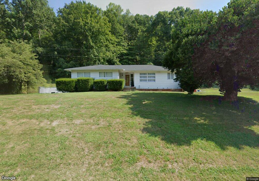
11509 State Route 217 Scottown, OH 45678
Estimated Value: $210,000 - $277,000
3
Beds
2
Baths
1,600
Sq Ft
$148/Sq Ft
Est. Value
About This Home
This home is located at 11509 State Route 217, Scottown, OH 45678 and is currently estimated at $236,136, approximately $147 per square foot. 11509 State Route 217 is a home located in Lawrence County with nearby schools including Symmes Valley Elementary School and Symmes Valley High School.
Ownership History
Date
Name
Owned For
Owner Type
Purchase Details
Closed on
Jul 19, 2022
Sold by
Spurlock Jeremiah S
Bought by
Spurlock Travis D
Current Estimated Value
Purchase Details
Closed on
Aug 31, 2017
Sold by
Holschuh Glen Dale and Holschuh Dale G
Bought by
Spurlock Richard D
Home Financials for this Owner
Home Financials are based on the most recent Mortgage that was taken out on this home.
Original Mortgage
$149,150
Interest Rate
3.83%
Mortgage Type
New Conventional
Purchase Details
Closed on
Sep 19, 2002
Sold by
Holschuh Dale and Holschuh Betty
Bought by
Holschuh Dale
Create a Home Valuation Report for This Property
The Home Valuation Report is an in-depth analysis detailing your home's value as well as a comparison with similar homes in the area
Home Values in the Area
Average Home Value in this Area
Purchase History
| Date | Buyer | Sale Price | Title Company |
|---|---|---|---|
| Spurlock Travis D | -- | -- | |
| Spurlock Richard D | $157,000 | None Available | |
| Holschuh Dale | -- | -- |
Source: Public Records
Mortgage History
| Date | Status | Borrower | Loan Amount |
|---|---|---|---|
| Previous Owner | Spurlock Richard D | $149,150 |
Source: Public Records
Tax History Compared to Growth
Tax History
| Year | Tax Paid | Tax Assessment Tax Assessment Total Assessment is a certain percentage of the fair market value that is determined by local assessors to be the total taxable value of land and additions on the property. | Land | Improvement |
|---|---|---|---|---|
| 2024 | -- | $44,000 | $10,280 | $33,720 |
| 2023 | $1,124 | $44,000 | $10,280 | $33,720 |
| 2022 | $1,122 | $44,000 | $10,280 | $33,720 |
| 2021 | $1,078 | $40,350 | $8,290 | $32,060 |
| 2020 | $1,093 | $40,350 | $8,290 | $32,060 |
| 2019 | $621 | $40,350 | $8,290 | $32,060 |
| 2018 | $1,070 | $37,400 | $8,130 | $29,270 |
| 2017 | $805 | $37,400 | $8,130 | $29,270 |
| 2016 | $751 | $35,610 | $6,340 | $29,270 |
| 2015 | $672 | $32,550 | $6,300 | $26,250 |
| 2014 | $672 | $32,550 | $6,300 | $26,250 |
| 2013 | $671 | $32,550 | $6,300 | $26,250 |
Source: Public Records
Map
Nearby Homes
- 0 Ohio 217
- 00 Ohio 217
- 0 County Road 12
- State Route 790
- 1805 Long Creek Rd E
- State Route 790
- 0 Dillon Ridge Unit 23651508
- 0 Dillon Ridge Unit 181305
- 2255 County Road 66
- 4754 County Road 36
- 2202 County Road 66
- 120 County Road 408
- 810 Township Road 141
- 479 Township Road 122
- 1334 Township Road 214th N
- 1263 County Road 73
- 1334 McKinney Creek-Hesson Hollow Rd N
- 190 Township Rd
- 168 Township Road 122 W
- 181 Private Road 3954
- 11528 State Route 217
- 11486 State Route 217
- 11447 State Route 217
- 11236 State Route 217
- 11188 State Route 217
- 11637 State Route 217
- 11366 State Route 217
- 11528 Ohio 217
- 11132 State Route 217
- 11300 State Route 217 Unit ComO-1
- 11300 State Route 217
- 9662 Ohio 217
- 11278 State Route 217
- 11839 Ohio 217
- 11767 State Route 217
- 11198 State Route 217
- 9198 State Route 775
- 316 County Road 37
- 11839 State Route 217
- 11887 State Route 217