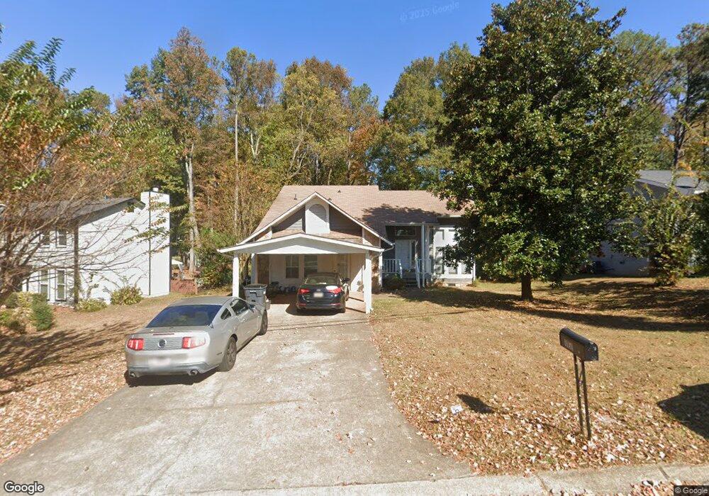
1151 Bailing Dr Lawrenceville, GA 30043
Estimated Value: $356,000 - $394,991
4
Beds
3
Baths
2,211
Sq Ft
$171/Sq Ft
Est. Value
About This Home
This home is located at 1151 Bailing Dr, Lawrenceville, GA 30043 and is currently estimated at $376,998, approximately $170 per square foot. 1151 Bailing Dr is a home located in Gwinnett County with nearby schools including McKendree Elementary School, Creekland Middle School, and Collins Hill High School.
Ownership History
Date
Name
Owned For
Owner Type
Purchase Details
Closed on
Jun 16, 2003
Sold by
Mehal Iram H
Bought by
Mehal Saleem A and Mehal Iram
Current Estimated Value
Home Financials for this Owner
Home Financials are based on the most recent Mortgage that was taken out on this home.
Original Mortgage
$110,950
Outstanding Balance
$46,551
Interest Rate
5.2%
Mortgage Type
New Conventional
Estimated Equity
$330,447
Purchase Details
Closed on
Mar 6, 2001
Sold by
Broome Sandra W
Bought by
Bankers Trust Co
Create a Home Valuation Report for This Property
The Home Valuation Report is an in-depth analysis detailing your home's value as well as a comparison with similar homes in the area
Home Values in the Area
Average Home Value in this Area
Purchase History
| Date | Buyer | Sale Price | Title Company |
|---|---|---|---|
| Mehal Saleem A | -- | -- | |
| Bankers Trust Co | $109,650 | -- |
Source: Public Records
Mortgage History
| Date | Status | Borrower | Loan Amount |
|---|---|---|---|
| Open | Mehal Saleem A | $110,950 |
Source: Public Records
Tax History Compared to Growth
Tax History
| Year | Tax Paid | Tax Assessment Tax Assessment Total Assessment is a certain percentage of the fair market value that is determined by local assessors to be the total taxable value of land and additions on the property. | Land | Improvement |
|---|---|---|---|---|
| 2024 | $5,878 | $155,680 | $28,000 | $127,680 |
| 2023 | $5,878 | $155,680 | $28,000 | $127,680 |
| 2022 | $3,641 | $133,160 | $22,000 | $111,160 |
| 2021 | $3,021 | $100,800 | $19,200 | $81,600 |
| 2020 | $2,861 | $92,360 | $16,080 | $76,280 |
| 2019 | $2,796 | $92,360 | $16,080 | $76,280 |
| 2018 | $2,421 | $75,040 | $12,880 | $62,160 |
| 2016 | $2,066 | $57,680 | $10,800 | $46,880 |
| 2015 | $2,085 | $57,680 | $10,800 | $46,880 |
| 2014 | -- | $47,440 | $7,200 | $40,240 |
Source: Public Records
Map
Nearby Homes
- 1131 Bailing Dr
- 1182 Bailing Dr
- 1006 Bass Ct
- 1181 Colony Bend Dr
- 1460 Walnut Hill Cir
- 1346 Lucan Ln Unit WC2.27
- 1356 Lucan Ln Unit WC2.26
- 1312 Yorktown Cir Unit 3
- 1416 Lucan Ln Unit WC2.20
- 1216 Lucan Ln Unit WC2.32
- 1226 Lucan Ln Unit WC2.31
- 1236 Lucan Ln Unit WC2.30
- 1165 Luther Way
- 1246 Lucan Ln Unit WC2.29
- 585 Station View Run
- 1425 Wheatfield Dr
- 830 Meadowsong Cir
- 1368 Christiana Dr
- 1292 Cherokee Trail
- 1044 Haley Woods Ln
- 1141 Bailing Dr Unit 1
- 1161 Bailing Dr Unit 1
- 1025 Bass Ct
- 1015 Bass Ct
- 1025 Bass Court North W
- 1131 Bailing Dr Unit 1
- 1036 Brown Duck Trail
- 1026 Bass Court North W
- 1181 Bailing Dr
- 1026 Bass Ct
- 1045 Brown Duck Trail
- 1162 Bailing Dr
- 1005 Bass Ct
- 1201 Bailing Dr
- 1046 Brown Duck Trail
- 1016 Bass Ct
- 1172 Bailing Dr
- 1066 Brown Duck Trail
- 1055 Brown Duck Trail
- 1211 Plunkett Way