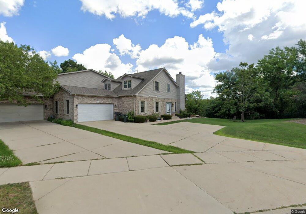
1151 Harmon Blvd Hoffman Estates, IL 60169
South Hoffman Estates NeighborhoodEstimated Value: $428,201 - $551,000
3
Beds
4
Baths
2,224
Sq Ft
$224/Sq Ft
Est. Value
About This Home
This home is located at 1151 Harmon Blvd, Hoffman Estates, IL 60169 and is currently estimated at $497,800, approximately $223 per square foot. 1151 Harmon Blvd is a home located in Cook County with nearby schools including Hoover Math And Science Academy, Helen Keller Junior High School, and Hoffman Estates High School.
Ownership History
Date
Name
Owned For
Owner Type
Purchase Details
Closed on
Nov 24, 2009
Sold by
Perry Daniel Joseph and Perry Kathleen A
Bought by
Mudassiruddin Mohammed and Tabasum Yasmeen
Current Estimated Value
Home Financials for this Owner
Home Financials are based on the most recent Mortgage that was taken out on this home.
Original Mortgage
$268,111
Outstanding Balance
$171,481
Interest Rate
4.84%
Mortgage Type
FHA
Estimated Equity
$326,319
Purchase Details
Closed on
Mar 23, 2006
Sold by
Nierman Lynn A
Bought by
Perry Daniel Joseph and Perry Kathleen A
Home Financials for this Owner
Home Financials are based on the most recent Mortgage that was taken out on this home.
Original Mortgage
$330,000
Interest Rate
6.34%
Mortgage Type
Fannie Mae Freddie Mac
Create a Home Valuation Report for This Property
The Home Valuation Report is an in-depth analysis detailing your home's value as well as a comparison with similar homes in the area
Home Values in the Area
Average Home Value in this Area
Purchase History
| Date | Buyer | Sale Price | Title Company |
|---|---|---|---|
| Mudassiruddin Mohammed | $310,000 | None Available | |
| Perry Daniel Joseph | $370,000 | Atgf Inc |
Source: Public Records
Mortgage History
| Date | Status | Borrower | Loan Amount |
|---|---|---|---|
| Open | Mudassiruddin Mohammed | $268,111 | |
| Previous Owner | Perry Daniel Joseph | $330,000 |
Source: Public Records
Tax History
| Year | Tax Paid | Tax Assessment Tax Assessment Total Assessment is a certain percentage of the fair market value that is determined by local assessors to be the total taxable value of land and additions on the property. | Land | Improvement |
|---|---|---|---|---|
| 2025 | $9,263 | $46,000 | $24,493 | $21,507 |
| 2024 | $9,263 | $33,500 | $6,500 | $27,000 |
| 2023 | $8,933 | $33,500 | $6,500 | $27,000 |
| 2022 | $8,933 | $33,500 | $6,500 | $27,000 |
| 2021 | $10,684 | $35,219 | $34,821 | $398 |
| 2020 | $10,509 | $35,219 | $34,821 | $398 |
| 2019 | $9,307 | $35,219 | $34,821 | $398 |
| 2018 | $8,931 | $30,826 | $29,565 | $1,261 |
| 2017 | $8,792 | $30,826 | $29,565 | $1,261 |
| 2016 | $8,440 | $30,826 | $29,565 | $1,261 |
| 2015 | $8,666 | $29,604 | $25,623 | $3,981 |
| 2014 | $8,530 | $29,604 | $25,623 | $3,981 |
| 2013 | $8,293 | $29,604 | $25,623 | $3,981 |
Source: Public Records
Map
Nearby Homes
- 1975 Leiter Way Unit 12002
- 1982 Leiter Way Unit 13004
- 1985 Leiter Way Unit 1102
- 1988 Leiter Way Unit 13001
- 1979 Leiter Way Unit 12004
- 1981 Leiter Way Unit 12005
- 1994 Leiter Way Unit 14003
- 1977 Leiter Way Unit 12003
- 1986 Leiter Way Unit 13002
- 1989 Leiter Way Unit 11004
- 1103 Southbridge Ln
- 1708 Southbridge Ct
- 1365 Newcastle Ln
- 845 Harmon Blvd
- 1335 Blair Ln
- 1300 Chatsworth Ln
- 1880 Bonnie Ln Unit 416
- 1880 Bonnie Ln Unit 112
- 1360 Devonshire Ln
- 1975 Windsong Dr Unit 333E1
- 1155 Harmon Blvd
- 1985 Leiter Way
- 0 E Unit MRD10958968
- 1180 Harmon Blvd
- 1180 Harmon Blvd Unit 1180
- 1184 Harmon Blvd
- 1589 W Oakmont Rd
- 1555 Creekside Dr
- 1591 W Oakmont Rd
- 1061 Sweetflower Dr
- 1065 Sweetflower Dr
- 1075 Sweetflower Dr
- 1545 Creekside Dr Unit 3
- 1725 Pebble Beach Ct
- 1071 Sweetflower Dr
- 1587 W Oakmont Rd
- 1723 Pebble Beach Ct
- 1723 Pebble Beach Dr
- 1721 Pebble Beach Ct
- 1721 Pebble Beach Dr
Your Personal Tour Guide
Ask me questions while you tour the home.