Estimated Value: $406,000 - $464,000
3
Beds
1
Bath
1,360
Sq Ft
$319/Sq Ft
Est. Value
About This Home
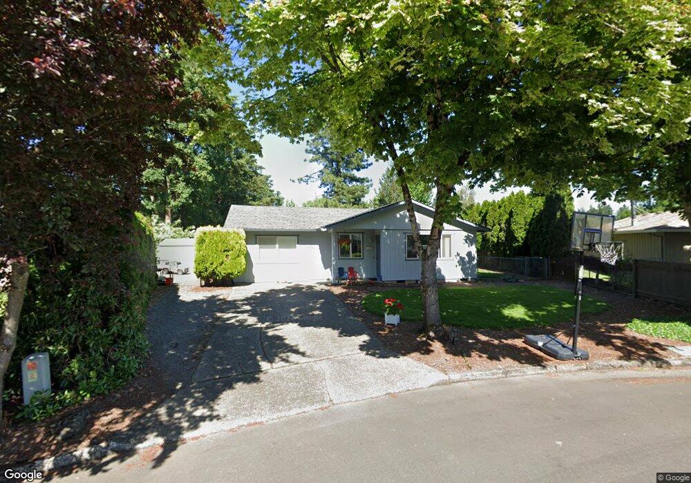
This home is located at 1151 NE 13th Cir, Canby, OR 97013 and is currently estimated at $433,928, approximately $319 per square foot. 1151 NE 13th Cir is a home located in Clackamas County with nearby schools including Josefa L. Sambrano Elementary School, William Knight Elementary School, and Baker Prairie Middle School.
Ownership History
Date
Name
Owned For
Owner Type
Purchase Details
Closed on
Jul 7, 2005
Sold by
Miller Theodore C and Miller Melissa L
Bought by
Hazapis Debra J and Hazapis Nicholas P
Current Estimated Value
Home Financials for this Owner
Home Financials are based on the most recent Mortgage that was taken out on this home.
Original Mortgage
$232,000
Outstanding Balance
$119,712
Interest Rate
5.58%
Mortgage Type
Fannie Mae Freddie Mac
Estimated Equity
$314,216
Purchase Details
Closed on
Dec 12, 2002
Sold by
Duke Lee
Bought by
Labedz Ted and Labedz Cary Ann
Create a Home Valuation Report for This Property
The Home Valuation Report is an in-depth analysis detailing your home's value as well as a comparison with similar homes in the area
Home Values in the Area
Average Home Value in this Area
Purchase History
| Date | Buyer | Sale Price | Title Company |
|---|---|---|---|
| Hazapis Debra J | $290,000 | Ticor Title Insurance Compan | |
| Labedz Ted | $118,000 | First Amer Title Ins Co Of O |
Source: Public Records
Mortgage History
| Date | Status | Borrower | Loan Amount |
|---|---|---|---|
| Open | Hazapis Debra J | $232,000 |
Source: Public Records
Tax History Compared to Growth
Tax History
| Year | Tax Paid | Tax Assessment Tax Assessment Total Assessment is a certain percentage of the fair market value that is determined by local assessors to be the total taxable value of land and additions on the property. | Land | Improvement |
|---|---|---|---|---|
| 2025 | $3,235 | $182,596 | -- | -- |
| 2024 | $3,144 | $177,278 | -- | -- |
| 2023 | $3,144 | $172,115 | $0 | $0 |
| 2022 | $2,892 | $167,102 | $0 | $0 |
| 2021 | $2,785 | $162,235 | $0 | $0 |
| 2020 | $2,735 | $157,510 | $0 | $0 |
| 2019 | $2,605 | $152,923 | $0 | $0 |
| 2018 | $2,547 | $148,469 | $0 | $0 |
| 2017 | $2,482 | $144,145 | $0 | $0 |
| 2016 | $2,399 | $139,947 | $0 | $0 |
| 2015 | $2,317 | $135,871 | $0 | $0 |
| 2014 | $2,250 | $131,914 | $0 | $0 |
Source: Public Records
Map
Nearby Homes
- 1558 NE 10th Place
- 1009 NE 17th Ave
- 947 NE 17th Ave
- 860 NE 14th Ave
- 1620 N Sweetgum St
- 1422 NE 18th Place
- 878 NE 17th Ave
- 952 NE 17th Ave
- 1750 N Oak St
- 853 NE 17th Ave
- 844 NE 17th Ave
- 838 NE 17th Ave
- 1552 NE 19th Loop
- 832 NE 17th Ave
- 1200 NE Territorial Rd Unit 93
- 660 NE 20th Ave
- 312 NE 14th Ave
- 1947 NE 21st Ave
- 1751 N Laurelwood Loop
- 835 SE 1st Ave Unit 64
- 1155 NE 13th Cir
- 1284 NE 14th Place
- 1159 NE 13th Cir
- 1351 N Ponderosa St
- 1355 N Ponderosa St
- 1139 NE 13th Cir
- 1361 N Ponderosa St
- 1345 N Ponderosa St
- 1144 NE 13th Cir
- 1272 NE 14th Place
- 1333 N Ponderosa St
- 1165 NE 13th Cir
- 1258 NE 14th Place
- 1131 NE 13th Cir
- 1170 NE 13th Cir
- 1136 NE 13th Cir
- 1315 N Ponderosa St
- 1367 N Ponderosa St
- 1222 NE 14th Place
- 1362 NE 13th Place