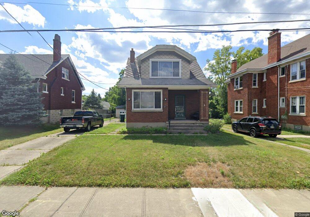
1151 Rulison Ave Cincinnati, OH 45238
West Price Hill NeighborhoodEstimated Value: $110,000 - $210,000
3
Beds
2
Baths
1,443
Sq Ft
$119/Sq Ft
Est. Value
About This Home
This home is located at 1151 Rulison Ave, Cincinnati, OH 45238 and is currently estimated at $171,430, approximately $118 per square foot. 1151 Rulison Ave is a home located in Hamilton County with nearby schools including Carson School, Gilbert A. Dater High School, and Western Hills High School.
Ownership History
Date
Name
Owned For
Owner Type
Purchase Details
Closed on
Jan 10, 2025
Sold by
Haussler Daniel and Haussler Bailey K
Bought by
Pasqualetti Joseph Anthony
Current Estimated Value
Purchase Details
Closed on
Nov 24, 2004
Sold by
Lohaus Edward B and Lohaus Rosemary C
Bought by
Haussler Daniel and Haussler Daniel A
Home Financials for this Owner
Home Financials are based on the most recent Mortgage that was taken out on this home.
Original Mortgage
$88,000
Interest Rate
5.71%
Mortgage Type
Fannie Mae Freddie Mac
Create a Home Valuation Report for This Property
The Home Valuation Report is an in-depth analysis detailing your home's value as well as a comparison with similar homes in the area
Home Values in the Area
Average Home Value in this Area
Purchase History
| Date | Buyer | Sale Price | Title Company |
|---|---|---|---|
| Pasqualetti Joseph Anthony | $115,000 | None Listed On Document | |
| Pasqualetti Joseph Anthony | $115,000 | None Listed On Document | |
| Haussler Daniel | $116,500 | -- |
Source: Public Records
Mortgage History
| Date | Status | Borrower | Loan Amount |
|---|---|---|---|
| Previous Owner | Haussler Daniel | $88,000 |
Source: Public Records
Tax History
| Year | Tax Paid | Tax Assessment Tax Assessment Total Assessment is a certain percentage of the fair market value that is determined by local assessors to be the total taxable value of land and additions on the property. | Land | Improvement |
|---|---|---|---|---|
| 2025 | $2,544 | $41,097 | $5,425 | $35,672 |
| 2024 | $2,469 | $41,097 | $5,425 | $35,672 |
| 2023 | $2,523 | $41,097 | $5,425 | $35,672 |
| 2022 | $1,440 | $20,934 | $5,390 | $15,544 |
| 2021 | $1,384 | $20,934 | $5,390 | $15,544 |
| 2020 | $1,422 | $20,934 | $5,390 | $15,544 |
| 2019 | $1,414 | $19,030 | $4,900 | $14,130 |
| 2018 | $1,416 | $19,030 | $4,900 | $14,130 |
| 2017 | $1,346 | $19,030 | $4,900 | $14,130 |
| 2016 | $1,652 | $23,072 | $5,236 | $17,836 |
| 2015 | $1,489 | $23,072 | $5,236 | $17,836 |
| 2014 | $1,500 | $23,072 | $5,236 | $17,836 |
| 2013 | $1,732 | $26,219 | $5,950 | $20,269 |
Source: Public Records
Map
Nearby Homes
- 1075 Coronado Ave
- 1086 Benz Ave
- 4764 Dale Ave
- 1059 Lockman Ave
- 4965 Glenway Ave
- 1092 Morado Dr
- 815 Pedretti Ave
- 1137 Covedale Ave
- 1702 Ashbrook Dr
- 4458 W 8th St
- 4419 Ridgeview Ave
- 4526 Clearview Ave
- 4915 Heuwerth Ave
- 4614 Midland Ave
- 4849 Prosperity Place
- 5114 Cleves Warsaw Pike
- 1023 Woodbriar Ln
- 1762 Ashbrook Dr
- 1758 Tuxworth Ave
- 4730 Prosperity Place
- 1145 Rulison Ave
- 1155 Rulison Ave
- 1155 Rulison Ave Unit 2
- 1155 Rulison Ave Unit 1
- 1159 Rulison Ave
- 1141 Rulison Ave
- 1161 Rulison Ave
- 1148 Coronado Ave
- 1154 Coronado Ave
- 1142 Coronado Ave
- 1139 Rulison Ave
- 1158 Coronado Ave
- 1138 Coronado Ave
- 1150 Rulison Ave
- 1144 Rulison Ave
- 1154 Rulison Ave
- 1135 Rulison Ave
- 1162 Coronado Ave
- 1165 Rulison Ave
- 1142 Rulison Ave
Your Personal Tour Guide
Ask me questions while you tour the home.