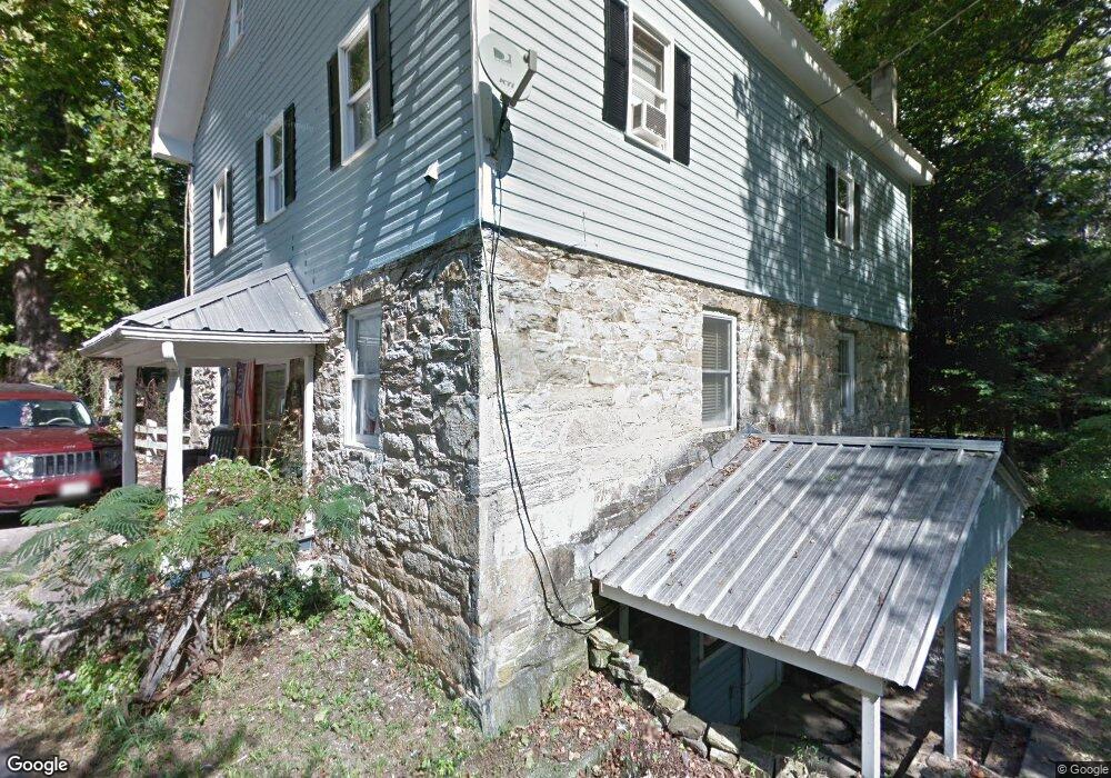
11511 Charles Mill Rd Clear Spring, MD 21722
Estimated Value: $255,000 - $444,000
4
Beds
2
Baths
3,560
Sq Ft
$98/Sq Ft
Est. Value
About This Home
This home is located at 11511 Charles Mill Rd, Clear Spring, MD 21722 and is currently estimated at $349,807, approximately $98 per square foot. 11511 Charles Mill Rd is a home located in Washington County with nearby schools including Clear Spring Elementary School, Clear Spring Middle School, and Clear Spring High School.
Ownership History
Date
Name
Owned For
Owner Type
Purchase Details
Closed on
Feb 2, 1996
Sold by
Blair Richard C
Bought by
John Gill Kenneth and Morales Adele
Current Estimated Value
Purchase Details
Closed on
Mar 16, 1989
Sold by
Blair Richard C and Blair Robin R
Bought by
Blair Richard C
Home Financials for this Owner
Home Financials are based on the most recent Mortgage that was taken out on this home.
Original Mortgage
$52,500
Interest Rate
10.86%
Purchase Details
Closed on
Nov 2, 1984
Sold by
Metger Emory C
Bought by
Blair Richard C and Blair Robin R
Home Financials for this Owner
Home Financials are based on the most recent Mortgage that was taken out on this home.
Original Mortgage
$20,000
Interest Rate
13.85%
Create a Home Valuation Report for This Property
The Home Valuation Report is an in-depth analysis detailing your home's value as well as a comparison with similar homes in the area
Home Values in the Area
Average Home Value in this Area
Purchase History
| Date | Buyer | Sale Price | Title Company |
|---|---|---|---|
| John Gill Kenneth | $123,000 | -- | |
| Blair Richard C | $30,800 | -- | |
| Blair Richard C | $20,000 | -- |
Source: Public Records
Mortgage History
| Date | Status | Borrower | Loan Amount |
|---|---|---|---|
| Previous Owner | Blair Richard C | $52,500 | |
| Previous Owner | Blair Richard C | $20,000 |
Source: Public Records
Tax History Compared to Growth
Tax History
| Year | Tax Paid | Tax Assessment Tax Assessment Total Assessment is a certain percentage of the fair market value that is determined by local assessors to be the total taxable value of land and additions on the property. | Land | Improvement |
|---|---|---|---|---|
| 2025 | $2,108 | $218,767 | $0 | $0 |
| 2024 | $2,108 | $197,833 | $0 | $0 |
| 2023 | $1,892 | $176,900 | $86,500 | $90,400 |
| 2022 | $1,892 | $176,900 | $86,500 | $90,400 |
| 2021 | $1,935 | $176,900 | $86,500 | $90,400 |
| 2020 | $2,201 | $202,000 | $86,500 | $115,500 |
| 2019 | $2,201 | $202,000 | $86,500 | $115,500 |
| 2018 | $2,448 | $202,000 | $86,500 | $115,500 |
| 2017 | $2,093 | $202,000 | $0 | $0 |
| 2016 | -- | $191,833 | $0 | $0 |
| 2015 | -- | $181,667 | $0 | $0 |
| 2014 | $2,375 | $171,500 | $0 | $0 |
Source: Public Records
Map
Nearby Homes
- 12429 Angle Dr
- Block 139 Lot 56 Boo Blvd
- 12136 Big Pool Rd
- Block 92 Lot 12 Bear Bottom Rd
- Block 90 Lot 8 Ranger Rd
- Block 11 Lot 11 Hot Springs Ave
- LOT 37 Hot Springs Ave
- Block 12 Lot 41 Ranger Rd
- 0 Block 10 Lot 2 Deadwood Dr Unit WVBE2040636
- Block 8 Lot 32 & 33 Ice Cream St
- Block 7 Lot 30 & 31 Campfire Blvd
- Block 78 Lot 71 & 72 Boo Blvd
- Block 21 Lot 4 Old Faceful St
- 1-27 Boo Blvd
- 25-20 Rocky Rd
- Block 14 Lot 10 Old Faceful Rd
- Block 5 lots 6 and 7 Poison Oak
- Block 1 Lot 35 Boo Blvd
- Block 1 Lot 36 Boo Blvd
- 139-118 Boo Blvd
- 11444 Charles Mill Rd
- 11520 Charles Mill Rd
- 11451 Charles Mill Rd
- 12423 Big Pool Rd
- 12413 Big Pool Rd
- 12415 Angle Dr
- 12409 Big Pool Rd
- 12427 Big Pool Rd
- 0 Saint Paul Rd Unit WA7414420
- 0 Saint Paul Rd Unit WA7414412
- 0 Saint Paul Unit WA7414407
- LOT # 12 Saint Paul Rd
- LOT #13 Saint Paul Rd
- LOT #14 Saint Paul Rd
- 12507 Big Pool Rd
- TRACT 10 12077 Big Pool Rd
- TRACT 11 12083 Big Pool Rd
- TRACT 7 12059 Big Pool Rd
- 12403 Big Pool Rd
- 12414 Big Pool Rd