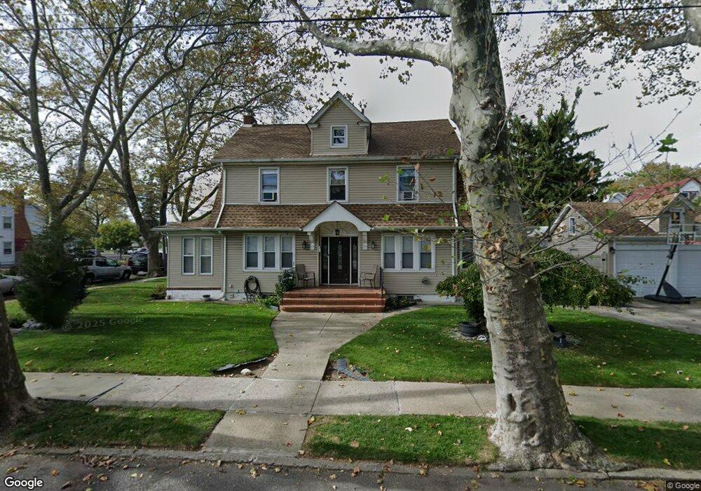
11520 Newburgh St Saint Albans, NY 11412
Saint Albans NeighborhoodEstimated Value: $810,000 - $1,099,000
--
Bed
--
Bath
2,425
Sq Ft
$398/Sq Ft
Est. Value
About This Home
This home is located at 11520 Newburgh St, Saint Albans, NY 11412 and is currently estimated at $964,736, approximately $397 per square foot. 11520 Newburgh St is a home located in Queens County with nearby schools including Ps 36 St Albans School, Is 59 Springfield Gardens, and Riverton Street Charter School.
Ownership History
Date
Name
Owned For
Owner Type
Purchase Details
Closed on
Apr 21, 2021
Sold by
Clough Ryan H and Simpson Tahnee N
Bought by
Simpson Tahnee N
Current Estimated Value
Purchase Details
Closed on
Sep 16, 2015
Sold by
Vine Michael
Bought by
Clough Ryan H and Simpson Tahnee N
Home Financials for this Owner
Home Financials are based on the most recent Mortgage that was taken out on this home.
Original Mortgage
$482,600
Outstanding Balance
$378,527
Interest Rate
3.95%
Mortgage Type
New Conventional
Estimated Equity
$586,209
Purchase Details
Closed on
Aug 24, 2007
Sold by
Est Of Angelina John and John Administrator David A
Bought by
Vine Michael
Home Financials for this Owner
Home Financials are based on the most recent Mortgage that was taken out on this home.
Original Mortgage
$43,000
Interest Rate
6.74%
Create a Home Valuation Report for This Property
The Home Valuation Report is an in-depth analysis detailing your home's value as well as a comparison with similar homes in the area
Home Values in the Area
Average Home Value in this Area
Purchase History
| Date | Buyer | Sale Price | Title Company |
|---|---|---|---|
| Simpson Tahnee N | $220,169 | -- | |
| Clough Ryan H | $510,000 | -- | |
| Vine Michael | $430,000 | -- | |
| Vine Michael | $430,000 | -- |
Source: Public Records
Mortgage History
| Date | Status | Borrower | Loan Amount |
|---|---|---|---|
| Open | Clough Ryan H | $482,600 | |
| Previous Owner | Vine Michael | $43,000 | |
| Previous Owner | Vine Michael | $344,000 |
Source: Public Records
Tax History Compared to Growth
Tax History
| Year | Tax Paid | Tax Assessment Tax Assessment Total Assessment is a certain percentage of the fair market value that is determined by local assessors to be the total taxable value of land and additions on the property. | Land | Improvement |
|---|---|---|---|---|
| 2025 | $7,097 | $36,070 | $8,742 | $27,328 |
| 2024 | $7,097 | $35,334 | $8,834 | $26,500 |
| 2023 | $6,696 | $33,336 | $8,061 | $25,275 |
| 2022 | $6,279 | $44,220 | $12,840 | $31,380 |
| 2021 | $6,619 | $36,660 | $12,840 | $23,820 |
| 2020 | $6,362 | $37,740 | $12,840 | $24,900 |
| 2019 | $6,160 | $41,580 | $12,840 | $28,740 |
| 2018 | $5,811 | $27,780 | $10,321 | $17,459 |
| 2016 | $4,930 | $26,209 | $9,874 | $16,335 |
| 2015 | $2,762 | $25,048 | $11,143 | $13,905 |
| 2014 | $2,762 | $24,538 | $13,094 | $11,444 |
Source: Public Records
Map
Nearby Homes
- 188-45 Quencer Rd
- 189-18 114th Dr
- 18908 114th Rd
- 187-15 Tioga Dr
- 18918 Tioga Dr
- 191-16 114th Rd
- 115-72 Farmers Blvd
- 115-11 180th St
- 116-39 Newburg St
- 18833 Keeseville Ave
- 188-07 Mangin Ave
- 191-34 114th Rd
- 18823 Mangin Ave
- 188-25 Mangin Ave
- 191-47 114th Dr
- 179-07 Murdock Ave
- 187-44 Jordan Ave
- 191-68 115th Rd
- 191-40 112th Rd
- 11480 178th Place
- 11520 Newburgh St
- 18853 Quencer Rd
- 188,49 Quencer Rd
- 11502 Newburgh St
- 11519 Newburgh St
- 18848 Dormans Rd
- 11519 Newburgh St
- 18845 Quencer Rd
- 188-48 Dormans Rd
- 18854 Quencer Rd
- 18844 Dormans Rd
- 188-48 Quencer Rd
- 18907 Quencer Rd
- 18907 Quencer Rd
- 18902 Dormans Rd
- 18841 Quencer Rd
- 18842 Dormans Rd
- 18764 Sullivan Rd
- 18906 Dormans Rd
- 11529 Newburgh St