Estimated Value: $250,483 - $270,000
3
Beds
2
Baths
1,864
Sq Ft
$139/Sq Ft
Est. Value
About This Home
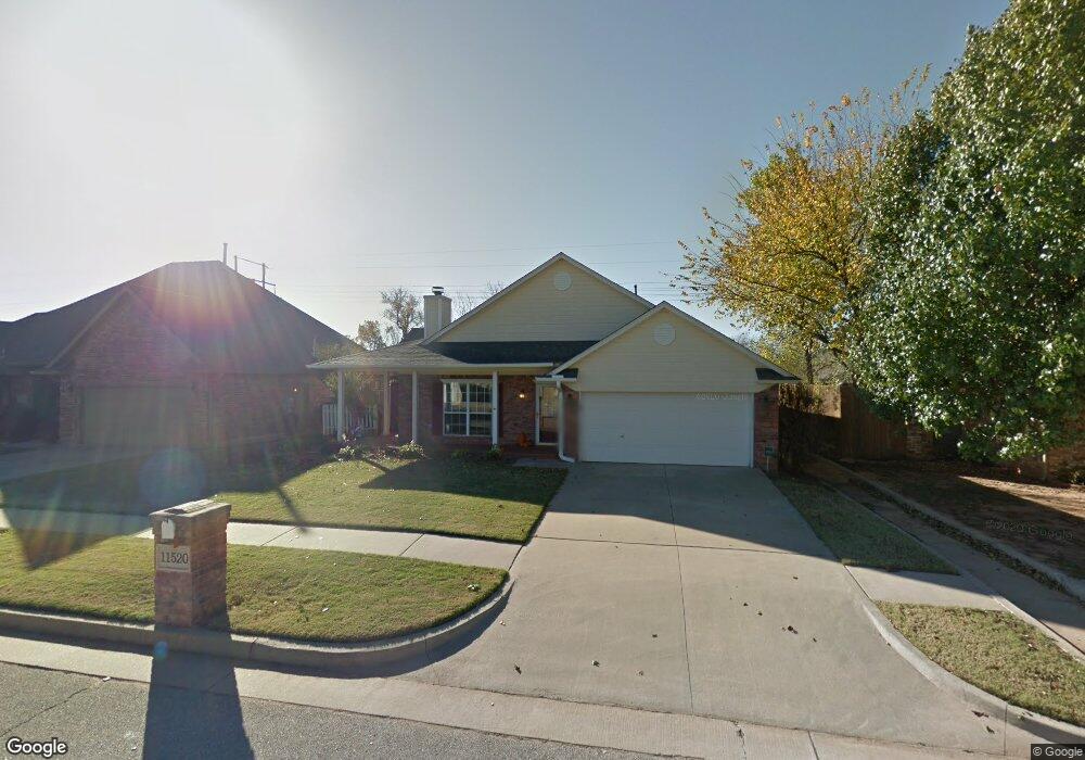
This home is located at 11520 NW 5th St, Yukon, OK 73099 and is currently estimated at $259,121, approximately $139 per square foot. 11520 NW 5th St is a home located in Canadian County with nearby schools including Parkland Elementary School, Independence Elementary School, and Yukon Middle School.
Ownership History
Date
Name
Owned For
Owner Type
Purchase Details
Closed on
Sep 9, 2013
Sold by
Fisher Larry F and Fisher Virgie L
Bought by
Wiles Lance J and Wiles Brandee N
Current Estimated Value
Home Financials for this Owner
Home Financials are based on the most recent Mortgage that was taken out on this home.
Original Mortgage
$158,003
Outstanding Balance
$117,720
Interest Rate
4.36%
Estimated Equity
$141,401
Purchase Details
Closed on
Oct 25, 2001
Sold by
Fisher Larry F and Fisher Virgie L
Purchase Details
Closed on
Aug 31, 1998
Sold by
Todd Ron and Todd Carolyn
Purchase Details
Closed on
Jan 14, 1997
Sold by
Drakestone Corp
Create a Home Valuation Report for This Property
The Home Valuation Report is an in-depth analysis detailing your home's value as well as a comparison with similar homes in the area
Home Values in the Area
Average Home Value in this Area
Purchase History
| Date | Buyer | Sale Price | Title Company |
|---|---|---|---|
| Wiles Lance J | $163,000 | Ort | |
| -- | -- | -- | |
| -- | $115,000 | -- | |
| -- | $15,000 | -- |
Source: Public Records
Mortgage History
| Date | Status | Borrower | Loan Amount |
|---|---|---|---|
| Open | Wiles Lance J | $158,003 |
Source: Public Records
Tax History Compared to Growth
Tax History
| Year | Tax Paid | Tax Assessment Tax Assessment Total Assessment is a certain percentage of the fair market value that is determined by local assessors to be the total taxable value of land and additions on the property. | Land | Improvement |
|---|---|---|---|---|
| 2024 | $2,242 | $20,208 | $2,160 | $18,048 |
| 2023 | $2,242 | $19,619 | $2,160 | $17,459 |
| 2022 | $2,187 | $19,048 | $2,160 | $16,888 |
| 2021 | $2,108 | $18,493 | $2,160 | $16,333 |
| 2020 | $2,027 | $17,954 | $2,160 | $15,794 |
| 2019 | $1,965 | $17,431 | $2,160 | $15,271 |
| 2018 | $1,906 | $16,924 | $2,160 | $14,764 |
| 2017 | $1,920 | $17,109 | $2,160 | $14,949 |
| 2016 | $1,940 | $17,310 | $2,160 | $15,150 |
| 2015 | $1,998 | $17,413 | $2,160 | $15,253 |
| 2014 | $1,998 | $17,741 | $2,160 | $15,581 |
Source: Public Records
Map
Nearby Homes
- 612 Ellsworth Ave
- 11608 NW 6th St
- 713 Vickery Ave
- 310 Glen Dr
- 11713 NW 6th St
- 309 Glen Dr
- 11817 Hollyrock Dr
- 12177 Hollyrock Dr
- 11741 Oakdale St
- 712 Bobcat Trail
- 624 Caladium Dr
- 12113 NW 7th St
- 2229 Rockbridge Ct
- 629 Dodge Ct
- 2216 Stone Mill Ct
- 612 S Willowood Dr
- 10832 NW 5th St
- 509 Bluegrass Ln
- 701 Bison Crossing Dr
- 320 E Meade Dr
- 11524 NW 5th St
- 11516 NW 5th St
- 11512 NW 5th St
- 11528 NW 5th St
- 11523 NW 5th St
- 11527 NW 5th St
- 11515 NW 5th St
- 11532 NW 5th St
- 11531 NW 5th St
- 11536 NW 5th St
- 604 Dickens Ave
- 11508 NW 6th Cir
- 600 Dickens Ave
- 11512 NW 6th Cir
- 11535 NW 5th St
- 11504 NW 6th Cir
- 11544 NW 5th St
- 11539 NW 5th St
- 605 Dickens Ave
- 11500 NW 6th Cir