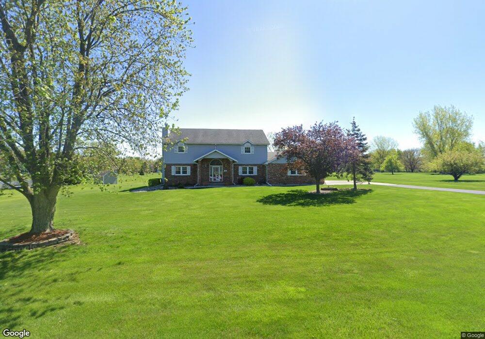
11529 Baker St Crown Point, IN 46307
Estimated Value: $525,000 - $610,685
4
Beds
4
Baths
3,260
Sq Ft
$178/Sq Ft
Est. Value
About This Home
This home is located at 11529 Baker St, Crown Point, IN 46307 and is currently estimated at $580,171, approximately $177 per square foot. 11529 Baker St is a home located in Lake County with nearby schools including Lake Street Elementary School, Robert Taft Middle School, and Crown Point High School.
Ownership History
Date
Name
Owned For
Owner Type
Purchase Details
Closed on
Dec 6, 2021
Sold by
Andersen Donald K and Andersen Debra K
Bought by
Donald K Andersen Living Trust and Debra K Andersen Living Trust
Current Estimated Value
Create a Home Valuation Report for This Property
The Home Valuation Report is an in-depth analysis detailing your home's value as well as a comparison with similar homes in the area
Home Values in the Area
Average Home Value in this Area
Purchase History
| Date | Buyer | Sale Price | Title Company |
|---|---|---|---|
| Donald K Andersen Living Trust | -- | Rice & Rice |
Source: Public Records
Tax History Compared to Growth
Tax History
| Year | Tax Paid | Tax Assessment Tax Assessment Total Assessment is a certain percentage of the fair market value that is determined by local assessors to be the total taxable value of land and additions on the property. | Land | Improvement |
|---|---|---|---|---|
| 2024 | $9,013 | $441,100 | $74,800 | $366,300 |
| 2023 | $4,653 | $424,100 | $74,800 | $349,300 |
| 2022 | $4,653 | $414,000 | $74,800 | $339,200 |
| 2021 | $4,264 | $399,400 | $69,800 | $329,600 |
| 2020 | $4,342 | $386,400 | $69,800 | $316,600 |
| 2019 | $4,294 | $373,800 | $69,800 | $304,000 |
| 2018 | $4,409 | $363,700 | $69,800 | $293,900 |
| 2017 | $4,513 | $368,100 | $69,800 | $298,300 |
| 2016 | $4,463 | $362,500 | $68,600 | $293,900 |
| 2014 | $4,163 | $360,100 | $68,600 | $291,500 |
| 2013 | $4,134 | $358,400 | $68,600 | $289,800 |
Source: Public Records
Map
Nearby Homes
- 11341 Lakewood St
- 11531 Westvalley Dr
- 11606 Westvalley Dr
- 1140 Hyde Park
- 775 Quinlan Ct
- 5121 W 113th Ave
- 1156 Donegal Ln
- 908 Mary Ellen Dr
- 804 Shannon Dr
- 1144 Mary Ellen Dr
- 11224 Durbin Place
- 1089 George Ade Ct
- 4714 W 121st Ave
- 11217 Burr Parcel 2 St
- 10813 Lane St
- 3709 W 121st Ave
- 629 W South St
- 312 Fairfield Dr
- 802 Hayfield Dr
- 10710 Porter St
- 11501 Baker St
- 11563 Baker St
- 11516 Baker St
- 11490 Baker St
- 11580 Lakewood St
- 11484 Baker St
- 4694 Hillcrest Ct
- 11516 Lakewood St
- 11486 Lakewood St
- 11483 Baker St
- 11487 Baker St
- 4581 Hillcrest Ct
- 4762 Hillcrest Ct
- 11460 Lakewood St
- 4655 Hillcrest Ct
- 11589 Lakewood St
- 11436 Lakewood St
- 11571 Lakewood St
- 11541 Lakewood St
- 11559 Westwood Place