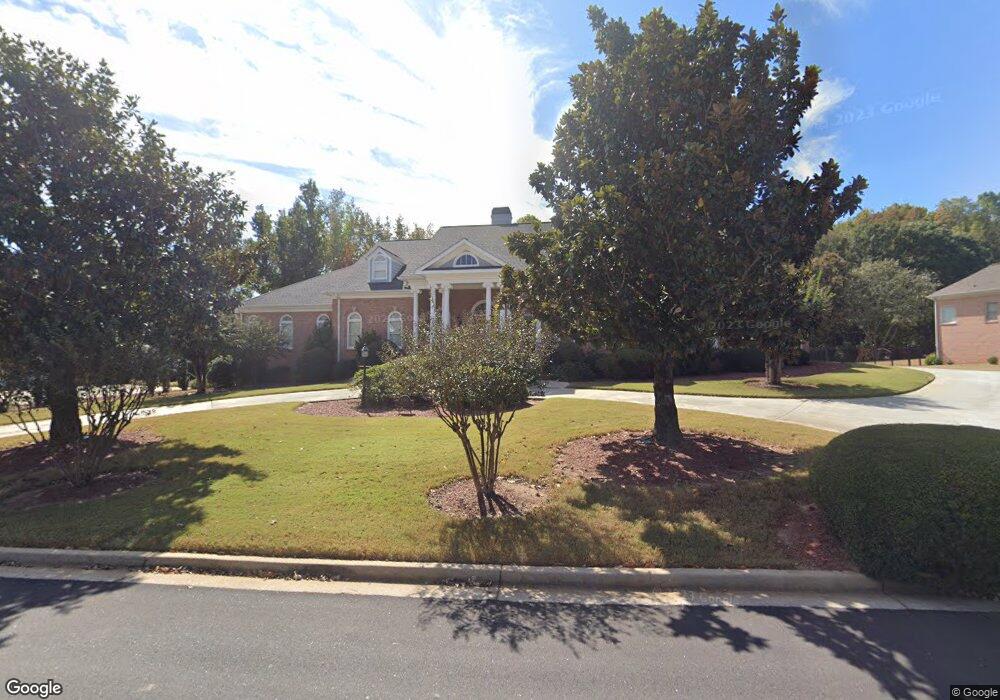
1153 Jimson Cir SE Conyers, GA 30013
Estimated Value: $545,000 - $650,000
5
Beds
5
Baths
8,556
Sq Ft
$68/Sq Ft
Est. Value
About This Home
This home is located at 1153 Jimson Cir SE, Conyers, GA 30013 and is currently estimated at $584,578, approximately $68 per square foot. 1153 Jimson Cir SE is a home located in Rockdale County with nearby schools including Flat Shoals Elementary School, Memorial Middle School, and Rockdale County High School.
Ownership History
Date
Name
Owned For
Owner Type
Purchase Details
Closed on
Oct 12, 2022
Sold by
Outlaw Odaniel
Bought by
Outlaw Rose
Current Estimated Value
Purchase Details
Closed on
Feb 18, 2010
Sold by
Us Bank Na Trust 2006-5
Bought by
Outlaw Odaniel and Outlaw Rose
Home Financials for this Owner
Home Financials are based on the most recent Mortgage that was taken out on this home.
Original Mortgage
$352,309
Interest Rate
4.97%
Mortgage Type
FHA
Purchase Details
Closed on
Oct 7, 2008
Sold by
Dunson Sedrick and Dunson Danielle
Bought by
Us Bank Na Series 2006-5
Purchase Details
Closed on
Feb 15, 2006
Sold by
Hicks Mary A
Bought by
Dunson Sedrick and Dunson Danielle
Home Financials for this Owner
Home Financials are based on the most recent Mortgage that was taken out on this home.
Original Mortgage
$443,200
Interest Rate
6.8%
Mortgage Type
New Conventional
Create a Home Valuation Report for This Property
The Home Valuation Report is an in-depth analysis detailing your home's value as well as a comparison with similar homes in the area
Home Values in the Area
Average Home Value in this Area
Purchase History
| Date | Buyer | Sale Price | Title Company |
|---|---|---|---|
| Outlaw Rose | -- | -- | |
| Outlaw Odaniel | $360,000 | -- | |
| Us Bank Na Series 2006-5 | $391,175 | -- | |
| Dunson Sedrick | $554,000 | -- |
Source: Public Records
Mortgage History
| Date | Status | Borrower | Loan Amount |
|---|---|---|---|
| Previous Owner | Outlaw Odaniel | $352,309 | |
| Previous Owner | Dunson Sedrick | $443,200 |
Source: Public Records
Tax History Compared to Growth
Tax History
| Year | Tax Paid | Tax Assessment Tax Assessment Total Assessment is a certain percentage of the fair market value that is determined by local assessors to be the total taxable value of land and additions on the property. | Land | Improvement |
|---|---|---|---|---|
| 2024 | $5,981 | $260,680 | $39,400 | $221,280 |
| 2023 | $5,478 | $251,120 | $35,240 | $215,880 |
| 2022 | $5,432 | $237,080 | $35,240 | $201,840 |
| 2021 | $4,562 | $190,920 | $25,200 | $165,720 |
| 2020 | $4,263 | $172,240 | $24,560 | $147,680 |
| 2019 | $3,871 | $155,720 | $15,000 | $140,720 |
| 2018 | $3,788 | $152,240 | $15,000 | $137,240 |
| 2017 | $3,272 | $134,240 | $15,000 | $119,240 |
| 2016 | $2,498 | $117,480 | $15,880 | $101,600 |
| 2015 | $2,498 | $117,480 | $15,880 | $101,600 |
| 2014 | $2,136 | $116,240 | $13,400 | $102,840 |
| 2013 | -- | $145,080 | $21,600 | $123,480 |
Source: Public Records
Map
Nearby Homes
- 1180 Azalea Cir SE
- 2259 Old Salem Rd SE
- 2405 Old Salem Rd SE Unit 1
- 2165 Old Salem Rd SE
- 1135 Vineyard Dr SE
- 2474 Harvest Dr SE
- 2235 Kings Forest Dr SE
- 2561 Old Salem Cir SE
- 2225 Kings Forest Dr SE
- 2215 Kings Forest Dr SE
- 1613 Brentwood Crossing SE Unit 3
- 2193 Kings Forest Dr SE
- 1260 Sweet Shrub Ln SE
- 1242 Saxony Dr SE
- 1408 Aramore Dr SE
- 2239 Mission Ridge Dr SE
- 2303 Deerfield Chase SE Unit 5
- 2684 Harvest Dr SE
- 1143 Jimson Cir SE Unit 8
- 1163 Jimson Cir SE Unit 6
- 1143 Rose Bay Ct SE
- 1143 Rose Bay Ct SE Unit 10
- 1133 Jimson Cir SE
- 1132 Jimson Cir SE
- 1142 Jimson Cir SE
- 1122 Jimson Cir SE
- 1144 Rose Bay Ct SE Unit 11
- 1144 Rose Bay Ct SE
- 1162 Jimson Cir SE Unit 31
- 1162 Jimson Cir SE
- 1145 Rose Bay Ct SE
- 1123 Jimson Cir SE Unit 8
- 1112 Jimson Cir SE
- 1146 Rose Bay Ct SE
- 1182 Jimson Cir SE
- 1183 Jimson Cir SE Unit 6
- 1283 Jimson Cir SE
- 0 Rose Bay Ct SE Unit 3115800