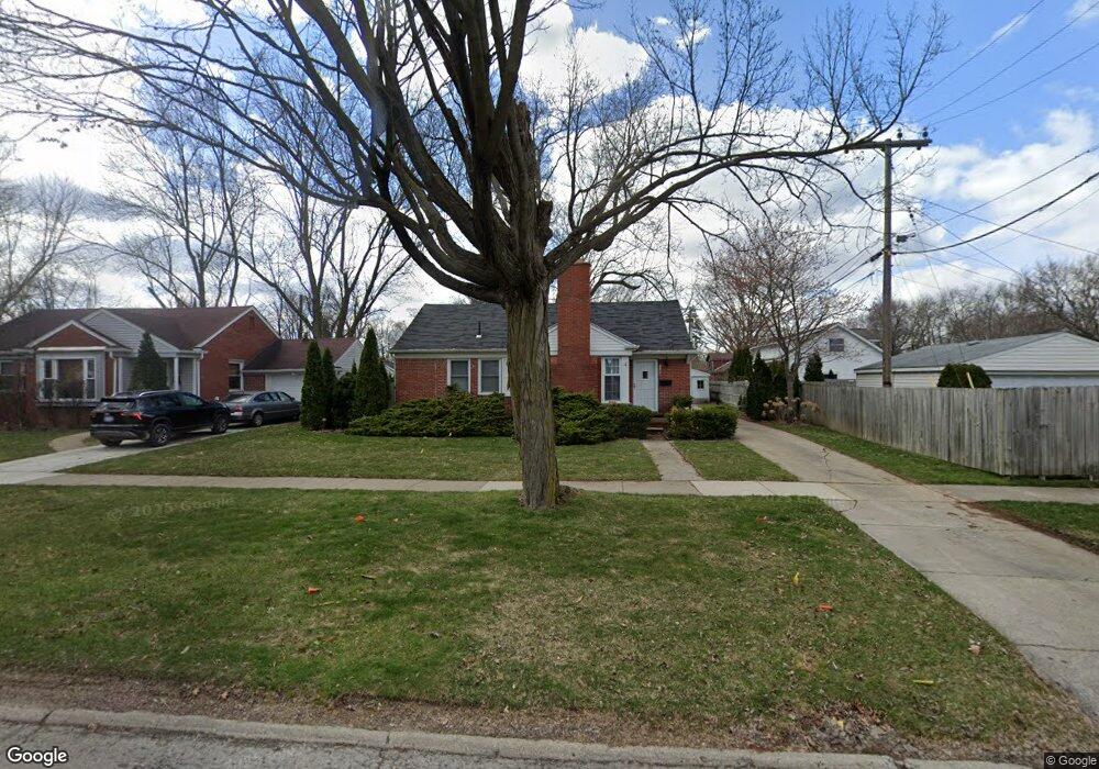
1154 S Eton St Birmingham, MI 48009
Estimated Value: $389,757 - $464,000
2
Beds
1
Bath
1,262
Sq Ft
$334/Sq Ft
Est. Value
About This Home
This home is located at 1154 S Eton St, Birmingham, MI 48009 and is currently estimated at $421,439, approximately $333 per square foot. 1154 S Eton St is a home located in Oakland County with nearby schools including Pembroke Elementary School, Derby Middle School, and Ernest W. Seaholm High School.
Ownership History
Date
Name
Owned For
Owner Type
Purchase Details
Closed on
Dec 3, 2003
Sold by
Sharov Viktor and Grandal Karmen
Bought by
Chikhalenko Anatoliy and Daukste Iveta
Current Estimated Value
Home Financials for this Owner
Home Financials are based on the most recent Mortgage that was taken out on this home.
Original Mortgage
$35,550
Outstanding Balance
$16,163
Interest Rate
5.5%
Mortgage Type
Credit Line Revolving
Estimated Equity
$405,276
Purchase Details
Closed on
Nov 3, 1998
Sold by
Smith Mary Lou
Bought by
Sharov Viktor
Create a Home Valuation Report for This Property
The Home Valuation Report is an in-depth analysis detailing your home's value as well as a comparison with similar homes in the area
Home Values in the Area
Average Home Value in this Area
Purchase History
| Date | Buyer | Sale Price | Title Company |
|---|---|---|---|
| Chikhalenko Anatoliy | $237,000 | -- | |
| Sharov Viktor | $164,500 | -- |
Source: Public Records
Mortgage History
| Date | Status | Borrower | Loan Amount |
|---|---|---|---|
| Open | Chikhalenko Anatoliy | $35,550 | |
| Previous Owner | Chikhalenko Anatoliy | $189,600 | |
| Closed | Sharov Viktor | -- |
Source: Public Records
Tax History Compared to Growth
Tax History
| Year | Tax Paid | Tax Assessment Tax Assessment Total Assessment is a certain percentage of the fair market value that is determined by local assessors to be the total taxable value of land and additions on the property. | Land | Improvement |
|---|---|---|---|---|
| 2024 | $3,188 | $165,820 | $0 | $0 |
| 2023 | $3,056 | $154,070 | $0 | $0 |
| 2022 | $3,276 | $144,480 | $0 | $0 |
| 2021 | $3,305 | $137,540 | $0 | $0 |
| 2020 | $2,945 | $129,830 | $0 | $0 |
| 2019 | $3,333 | $120,980 | $0 | $0 |
| 2018 | $3,307 | $114,380 | $0 | $0 |
| 2017 | $3,302 | $111,950 | $0 | $0 |
| 2016 | $3,309 | $110,120 | $0 | $0 |
| 2015 | -- | $102,400 | $0 | $0 |
| 2014 | -- | $85,660 | $0 | $0 |
| 2011 | -- | $73,020 | $0 | $0 |
Source: Public Records
Map
Nearby Homes
- 1982 E Lincoln St
- 1963 Cole St
- 1760 Cole St
- 000 Taunton Rd
- 1532 Cheltenham Rd
- 2070 Sheffield Rd
- 1840 Holland St
- 1745 Webster St
- 1982 Haynes St
- 1590 Cheltenham Rd
- 1552 Bennaville Ave
- 1717 Penistone St
- 1427 Humphrey Ave
- 1458 Chapin Ave
- 1368 Bennaville Ave
- 1971 Bowers St
- 1489 Holland St
- 1324 Holland St
- 425 Lewis Ct Unit 47
- 1696 Hazel St
- 1990 E Lincoln St
- 1960 E Lincoln St
- 1909 W Melton Rd
- 1891 W Melton Rd
- 1942 E Lincoln St
- 1924 E Lincoln St
- 1947 W Melton Rd
- 1875 W Melton Rd
- 1910 E Lincoln St
- 1983 W Melton Rd
- 1159 S Eton St
- 1165 S Eton St
- 1145 S Eton St
- 1177 S Eton St
- 1193 S Eton St
- 1898 E Lincoln St
- 1101 S Eton St
- 1209 S Eton St
- 1857 W Melton Rd
- 1876 E Lincoln St