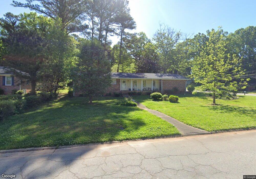
1154 Sherrington Dr Unit C1 Stone Mountain, GA 30083
Estimated Value: $247,014 - $295,000
3
Beds
2
Baths
1,964
Sq Ft
$139/Sq Ft
Est. Value
About This Home
This home is located at 1154 Sherrington Dr Unit C1, Stone Mountain, GA 30083 and is currently estimated at $272,754, approximately $138 per square foot. 1154 Sherrington Dr Unit C1 is a home located in DeKalb County with nearby schools including Allgood Elementary School, Freedom Middle School, and Clarkston High School.
Ownership History
Date
Name
Owned For
Owner Type
Purchase Details
Closed on
Oct 3, 2001
Sold by
Robinson Thomasenia P
Bought by
L & S Properties 1998 Llc
Current Estimated Value
Home Financials for this Owner
Home Financials are based on the most recent Mortgage that was taken out on this home.
Original Mortgage
$111,000
Outstanding Balance
$51,073
Interest Rate
9.5%
Mortgage Type
New Conventional
Estimated Equity
$221,681
Create a Home Valuation Report for This Property
The Home Valuation Report is an in-depth analysis detailing your home's value as well as a comparison with similar homes in the area
Home Values in the Area
Average Home Value in this Area
Purchase History
| Date | Buyer | Sale Price | Title Company |
|---|---|---|---|
| L & S Properties 1998 Llc | $30,300 | -- |
Source: Public Records
Mortgage History
| Date | Status | Borrower | Loan Amount |
|---|---|---|---|
| Open | L & S Properties 1998 Llc | $111,000 |
Source: Public Records
Tax History Compared to Growth
Tax History
| Year | Tax Paid | Tax Assessment Tax Assessment Total Assessment is a certain percentage of the fair market value that is determined by local assessors to be the total taxable value of land and additions on the property. | Land | Improvement |
|---|---|---|---|---|
| 2025 | $613 | $101,600 | $12,000 | $89,600 |
| 2024 | $675 | $107,640 | $12,000 | $95,640 |
| 2023 | $675 | $101,800 | $12,000 | $89,800 |
| 2022 | $639 | $77,640 | $7,200 | $70,440 |
| 2021 | $639 | $59,480 | $7,200 | $52,280 |
| 2020 | $523 | $48,920 | $7,200 | $41,720 |
| 2019 | $496 | $47,800 | $7,200 | $40,600 |
| 2018 | $421 | $48,400 | $7,200 | $41,200 |
| 2017 | $426 | $38,600 | $7,200 | $31,400 |
| 2016 | $377 | $36,520 | $7,200 | $29,320 |
| 2014 | $205 | $21,840 | $7,200 | $14,640 |
Source: Public Records
Map
Nearby Homes
- 1091 To Lani Dr
- 1219 To Lani Dr
- 1104 To Lani Farm Rd
- 4594 Bexley Dr
- 1276 To Lani Farm Rd
- 4467 Thornwood Crescent
- 1083 To Lani Farm Rd
- 1188 To Lani Path
- 1074 Cherokee Heights
- 1009 Autumn Crest Ct
- 1248 To Lani Ct
- 1323 S Hairston Rd
- 1363 To Lani Farm Rd
- 1337 S Hairston Rd
- 968 Oak Springs Ct
- 1374 To Lani Farm Rd
- 1373 To Lani Farm Rd
- 1146 Sherrington Dr
- 0 Sherrington Dr Unit 7430470
- 0 Sherrington Dr Unit 7410113
- 0 Sherrington Dr Unit 7032924
- 0 Sherrington Dr Unit 3226253
- 0 Sherrington Dr Unit 3190408
- 0 Sherrington Dr Unit 3139181
- 0 Sherrington Dr Unit 8757072
- 0 Sherrington Dr Unit 8445376
- 0 Sherrington Dr Unit 8437229
- 0 Sherrington Dr Unit 8265719
- 0 Sherrington Dr Unit 7146611
- 0 Sherrington Dr
- 4579 Chaderton Ct
- 1164 Sherrington Dr
- 1153 Sherrington Dr
- 1136 Sherrington Dr
- 4582 Chaderton Ct
- 1161 Sherrington Dr
- 1145 Sherrington Dr