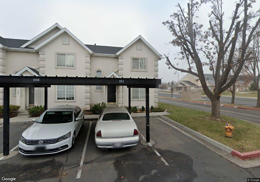
1154 W 950 N Pleasant Grove, UT 84062
Estimated Value: $355,833 - $369,000
3
Beds
2
Baths
1,344
Sq Ft
$269/Sq Ft
Est. Value
About This Home
This home is located at 1154 W 950 N, Pleasant Grove, UT 84062 and is currently estimated at $361,208, approximately $268 per square foot. 1154 W 950 N is a home located in Utah County with nearby schools including Mount Mahogany School, Pleasant Grove Junior High School, and Pleasant Grove High School.
Ownership History
Date
Name
Owned For
Owner Type
Purchase Details
Closed on
Jul 31, 2009
Sold by
Thomas Diane C
Bought by
Naumann Spencer
Current Estimated Value
Home Financials for this Owner
Home Financials are based on the most recent Mortgage that was taken out on this home.
Original Mortgage
$7,918
Outstanding Balance
$5,186
Interest Rate
5.3%
Mortgage Type
Stand Alone Second
Estimated Equity
$356,022
Purchase Details
Closed on
Feb 21, 2002
Sold by
Thomas Diane C
Bought by
Thomas Diane C
Home Financials for this Owner
Home Financials are based on the most recent Mortgage that was taken out on this home.
Original Mortgage
$77,000
Interest Rate
7.04%
Purchase Details
Closed on
May 22, 1996
Sold by
Davencourt Pud L L C
Bought by
Thomas Diane C
Home Financials for this Owner
Home Financials are based on the most recent Mortgage that was taken out on this home.
Original Mortgage
$86,400
Interest Rate
7.97%
Create a Home Valuation Report for This Property
The Home Valuation Report is an in-depth analysis detailing your home's value as well as a comparison with similar homes in the area
Home Values in the Area
Average Home Value in this Area
Purchase History
| Date | Buyer | Sale Price | Title Company |
|---|---|---|---|
| Naumann Spencer | -- | Vintage Title Insurance Age | |
| Thomas Diane C | -- | United Title Services | |
| Thomas Diane C | -- | Fidelity Title |
Source: Public Records
Mortgage History
| Date | Status | Borrower | Loan Amount |
|---|---|---|---|
| Open | Naumann Spencer | $7,918 | |
| Open | Naumann Spencer | $157,102 | |
| Previous Owner | Thomas Diane C | $77,000 | |
| Previous Owner | Thomas Diane C | $86,400 |
Source: Public Records
Tax History Compared to Growth
Tax History
| Year | Tax Paid | Tax Assessment Tax Assessment Total Assessment is a certain percentage of the fair market value that is determined by local assessors to be the total taxable value of land and additions on the property. | Land | Improvement |
|---|---|---|---|---|
| 2025 | $1,588 | $187,440 | $50,100 | $290,700 |
| 2024 | $1,588 | $189,310 | $0 | $0 |
| 2023 | $1,456 | $177,925 | $0 | $0 |
| 2022 | $1,513 | $183,975 | $0 | $0 |
| 2021 | $1,304 | $241,300 | $36,200 | $205,100 |
| 2020 | $1,154 | $209,400 | $31,400 | $178,000 |
| 2019 | $1,114 | $209,100 | $31,400 | $177,700 |
| 2018 | $1,071 | $190,000 | $28,500 | $161,500 |
| 2017 | $926 | $87,505 | $0 | $0 |
| 2016 | $880 | $80,300 | $0 | $0 |
| 2015 | $930 | $80,300 | $0 | $0 |
| 2014 | $900 | $77,000 | $0 | $0 |
Source: Public Records
Map
Nearby Homes
- 909 W 1180 N
- 1096 N 1420 St W Unit 27
- 1065 N 1420 W
- 1443 W 1010 N
- 1491 W 1010 N
- 1515 W 1010 St N
- 1171 N 1430 W
- 1498 W 1060 N Unit 5
- Lytham Plan at Grove Acres
- 1320 W 1340 N
- 1541 W 1060 N
- 685 W 1000 N
- 1130 W State Rd
- Konlee Plan at Makin Dreams
- Alexa Plan at Makin Dreams
- Callahan Plan at Makin Dreams
- Hailey Plan at Makin Dreams
- Alydia Plan at Makin Dreams
- Addison Plan at Makin Dreams
- Julia Plan at Makin Dreams
- 1168 W 950 N
- 1172 W 950 N
- 1001 N 1140 W
- 1001 N 1140 W Unit 12
- 1180 W 950 N
- 1150 W 930 N Unit 51
- 1150 W 930 N Unit 50
- 1150 W 930 N Unit 49
- 1150 W 930 N Unit 48
- 1150 W 930 N Unit 46
- 1150 W 930 N Unit 45
- 1150 W 930 N Unit 43
- 1150 W 930 N Unit 42
- 1150 W 930 N Unit 40
- 1150 W 930 N Unit 25
- 1150 W 930 N Unit 23
- 1150 W 930 N Unit 3
- 1150 W 930 N Unit 24
- 1150 W 930 N Unit 21
- 1150 W 930 N Unit 20