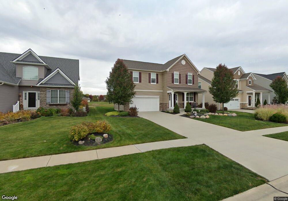
11541 Reserve Way Columbia Station, OH 44028
Estimated Value: $436,993 - $510,000
3
Beds
3
Baths
2,160
Sq Ft
$214/Sq Ft
Est. Value
About This Home
This home is located at 11541 Reserve Way, Columbia Station, OH 44028 and is currently estimated at $461,748, approximately $213 per square foot. 11541 Reserve Way is a home with nearby schools including Strongsville High School and Sts Joseph & John Interparochial School.
Ownership History
Date
Name
Owned For
Owner Type
Purchase Details
Closed on
Jun 2, 2015
Sold by
Thr Drees Co
Bought by
Dennison Michael Patrick and Dennison Thomasina Patton
Current Estimated Value
Home Financials for this Owner
Home Financials are based on the most recent Mortgage that was taken out on this home.
Original Mortgage
$236,880
Interest Rate
4.05%
Mortgage Type
New Conventional
Purchase Details
Closed on
Mar 23, 2015
Sold by
Columbia Reserve Ltd
Bought by
The Drees Co
Create a Home Valuation Report for This Property
The Home Valuation Report is an in-depth analysis detailing your home's value as well as a comparison with similar homes in the area
Home Values in the Area
Average Home Value in this Area
Purchase History
| Date | Buyer | Sale Price | Title Company |
|---|---|---|---|
| Dennison Michael Patrick | $263,300 | First American Title | |
| The Drees Co | $50,000 | None Available |
Source: Public Records
Mortgage History
| Date | Status | Borrower | Loan Amount |
|---|---|---|---|
| Previous Owner | Dennison Michael Patrick | $236,880 |
Source: Public Records
Tax History Compared to Growth
Tax History
| Year | Tax Paid | Tax Assessment Tax Assessment Total Assessment is a certain percentage of the fair market value that is determined by local assessors to be the total taxable value of land and additions on the property. | Land | Improvement |
|---|---|---|---|---|
| 2024 | $6,036 | $136,920 | $35,000 | $101,920 |
| 2023 | $5,089 | $100,373 | $21,518 | $78,855 |
| 2022 | $4,968 | $100,373 | $21,518 | $78,855 |
| 2021 | $5,018 | $100,373 | $21,518 | $78,855 |
| 2020 | $5,113 | $91,840 | $19,690 | $72,150 |
| 2019 | $5,085 | $91,840 | $19,690 | $72,150 |
| 2018 | $5,128 | $91,840 | $19,690 | $72,150 |
| 2017 | $5,295 | $88,060 | $14,760 | $73,300 |
| 2016 | $5,334 | $88,060 | $14,760 | $73,300 |
| 2015 | $821 | $11,200 | $11,200 | $0 |
| 2014 | -- | $0 | $0 | $0 |
Source: Public Records
Map
Nearby Homes
- 11030 Southwind Ct
- 11055 David's Ct
- 23686 Wally's Way
- 10800 Meadow Trail
- 23567 Victory Ln
- 23688 Rebecca Ln
- 10001 N Marks Rd
- 23755 Rebecca Ln
- 23409 Kim's Trail
- 23465 Kim's Trail
- 23789 Snell Rd
- 23446 Kim's Trail
- 23769 Wally's Way
- 21648 Oak Bark Trail
- 9989 Plum Brook Ln
- 21359 Briar Bush Ln
- 23863 Heatherstone Trail
- 9829 Plum Brook Ln
- 12150 N Boone Rd
- 9384 N Marks Rd
- 11549 Reserve Way
- 11533 Reserve Way
- 11525 Reserve Way
- 11557 Reserve Way
- 11544 Reserve Way
- 11536 Reserve Way
- 11565 Reserve Way
- 11517 Reserve Way
- 11552 Reserve Way
- 11528 Reserve Way
- 11560 Reserve Way
- 11520 Reserve Way
- 11573 Reserve Way
- 11509 Reserve Way
- 11743 Clarke Rd
- 11568 Reserve Way
- 11500 Reserve Way
- 11406 Reserve Way
- 11400 Reserve Way
- 11392 Reserve Way