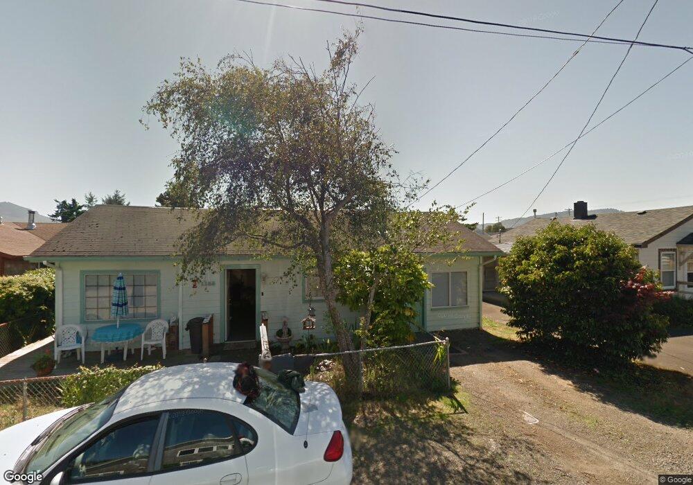
1155 Avenue A Seaside, OR 97138
Estimated Value: $315,000 - $482,000
6
Beds
2
Baths
2,069
Sq Ft
$209/Sq Ft
Est. Value
About This Home
This home is located at 1155 Avenue A, Seaside, OR 97138 and is currently estimated at $431,440, approximately $208 per square foot. 1155 Avenue A is a home located in Clatsop County with nearby schools including Seaside High School.
Ownership History
Date
Name
Owned For
Owner Type
Purchase Details
Closed on
Feb 19, 2020
Sold by
Lupine Propertie Llc
Bought by
Anarchy Investments Llc
Current Estimated Value
Purchase Details
Closed on
Mar 14, 2017
Sold by
Bauske Deborah A
Bought by
Lupine Properties Llc
Purchase Details
Closed on
Feb 24, 2009
Sold by
Martzolf Walter L
Bought by
Bauske Donn C
Purchase Details
Closed on
Feb 15, 2005
Sold by
Hoge Nancy Susan
Bought by
Martzolf Walter L
Home Financials for this Owner
Home Financials are based on the most recent Mortgage that was taken out on this home.
Original Mortgage
$50,100
Interest Rate
5.73%
Mortgage Type
Fannie Mae Freddie Mac
Create a Home Valuation Report for This Property
The Home Valuation Report is an in-depth analysis detailing your home's value as well as a comparison with similar homes in the area
Home Values in the Area
Average Home Value in this Area
Purchase History
| Date | Buyer | Sale Price | Title Company |
|---|---|---|---|
| Anarchy Investments Llc | -- | None Available | |
| Lupine Properties Llc | -- | None Available | |
| Bauske Donn C | $99,000 | None Available | |
| Bauske Donn C | $99,000 | Pacific Title Company | |
| Martzolf Walter L | $115,000 | Ticor Title Ins Co |
Source: Public Records
Mortgage History
| Date | Status | Borrower | Loan Amount |
|---|---|---|---|
| Previous Owner | Martzolf Walter L | $50,100 | |
| Closed | Bauske Donn C | $0 |
Source: Public Records
Tax History Compared to Growth
Tax History
| Year | Tax Paid | Tax Assessment Tax Assessment Total Assessment is a certain percentage of the fair market value that is determined by local assessors to be the total taxable value of land and additions on the property. | Land | Improvement |
|---|---|---|---|---|
| 2024 | $2,880 | $200,447 | -- | -- |
| 2023 | $2,794 | $194,609 | $0 | $0 |
| 2022 | $2,718 | $188,942 | $0 | $0 |
| 2021 | $2,661 | $183,440 | $0 | $0 |
| 2020 | $2,598 | $178,098 | $0 | $0 |
| 2019 | $2,528 | $172,912 | $0 | $0 |
| 2018 | $2,413 | $167,877 | $0 | $0 |
| 2017 | $2,207 | $162,988 | $0 | $0 |
| 2016 | $1,925 | $158,242 | $36,026 | $122,216 |
| 2015 | $1,781 | $147,759 | $63,123 | $84,636 |
| 2014 | $1,202 | $94,174 | $0 | $0 |
| 2013 | -- | $94,488 | $0 | $0 |
Source: Public Records
Map
Nearby Homes
- 1265 Avenue D
- 1269 Avenue D
- 830 Oceanway St
- 720 Avenue G
- 405 S Wahanna Rd
- 720 740 Avenue G
- 1653 Lea Way
- 1000 S King St
- 1659 Whispering Pines Dr
- 1805 Broadway St
- 870 S Holladay Dr Unit 3
- 870 S Holladay Dr
- 218 Necanicum Dr
- 301 C Ave Unit 301
- 301 C Ave
- 1108 S Holladay Dr Unit 24
- VL Spruce Dr
- 1299 6th Ave
- 0 Spruce Dr Unit 682748764
- 500 Farrell Ct