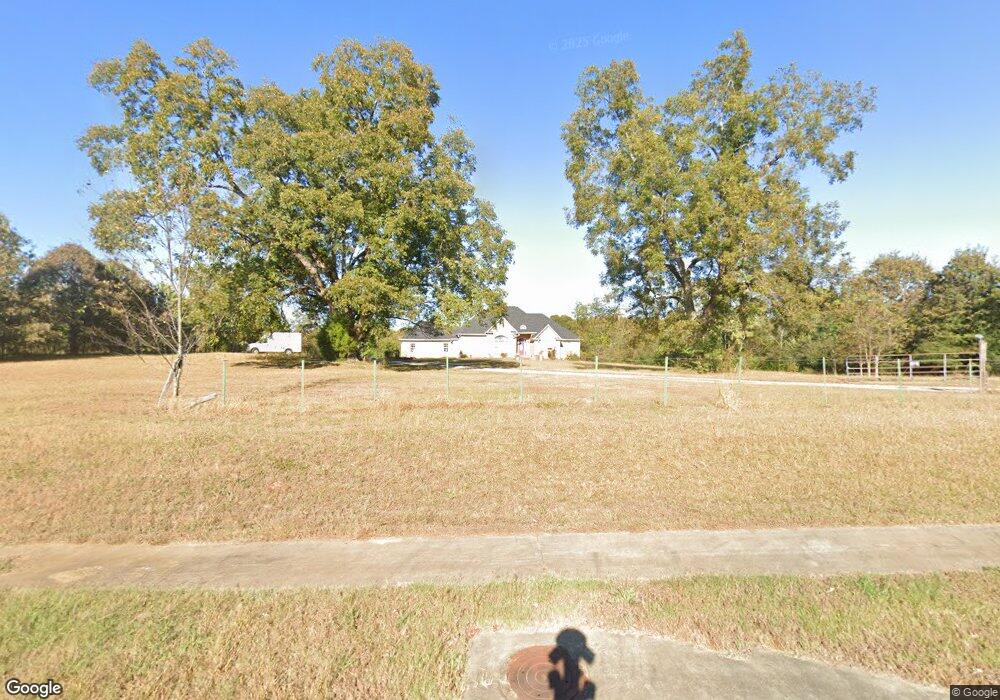
1155 Highway 81 E McDonough, GA 30252
Estimated Value: $381,000 - $1,054,000
3
Beds
3
Baths
2,837
Sq Ft
$213/Sq Ft
Est. Value
About This Home
This home is located at 1155 Highway 81 E, McDonough, GA 30252 and is currently estimated at $604,023, approximately $212 per square foot. 1155 Highway 81 E is a home located in Henry County with nearby schools including Tussahaw Elementary School, McDonough Middle School, and New Creation Christian Academy.
Ownership History
Date
Name
Owned For
Owner Type
Purchase Details
Closed on
Jan 9, 2008
Sold by
Myers Mary E
Bought by
East Village Investors Llc
Current Estimated Value
Home Financials for this Owner
Home Financials are based on the most recent Mortgage that was taken out on this home.
Original Mortgage
$1,042,500
Interest Rate
6.05%
Mortgage Type
New Conventional
Create a Home Valuation Report for This Property
The Home Valuation Report is an in-depth analysis detailing your home's value as well as a comparison with similar homes in the area
Home Values in the Area
Average Home Value in this Area
Purchase History
| Date | Buyer | Sale Price | Title Company |
|---|---|---|---|
| East Village Investors Llc | $1,230,000 | -- |
Source: Public Records
Mortgage History
| Date | Status | Borrower | Loan Amount |
|---|---|---|---|
| Closed | East Village Investors Llc | $1,042,500 |
Source: Public Records
Tax History Compared to Growth
Tax History
| Year | Tax Paid | Tax Assessment Tax Assessment Total Assessment is a certain percentage of the fair market value that is determined by local assessors to be the total taxable value of land and additions on the property. | Land | Improvement |
|---|---|---|---|---|
| 2025 | $10,681 | $283,000 | $90,120 | $192,880 |
| 2024 | $10,681 | $188,000 | $70,400 | $117,600 |
| 2023 | $7,023 | $188,000 | $70,400 | $117,600 |
| 2022 | $6,573 | $202,480 | $70,400 | $132,080 |
| 2021 | $5,996 | $153,840 | $50,680 | $103,160 |
| 2020 | $6,025 | $153,840 | $50,680 | $103,160 |
| 2019 | $5,336 | $155,640 | $50,680 | $104,960 |
| 2018 | $5,720 | $141,960 | $45,760 | $96,200 |
| 2016 | $6,214 | $152,640 | $49,720 | $102,920 |
| 2015 | $6,621 | $156,320 | $59,680 | $96,640 |
| 2014 | $6,359 | $152,920 | $59,680 | $93,240 |
Source: Public Records
Map
Nearby Homes
- 125 Steeplechase Dr
- 466 Best Friends Turn Alley
- 150 Sterling Ave
- 1449 Highway 81 E
- 325 Rosser Rd
- 5 Wellington Dr
- 312 Amble Side
- 500 Tulip Ln
- 191 Daisy Cir
- The Ramsey II 3-M Plan at Symphony Park
- The Harvey 3-M Plan at Symphony Park
- The Sedona 3-M Plan at Symphony Park
- The Austin 3-M Plan at Symphony Park
- The Laurel 3-M Plan at Symphony Park
- The Austin with Bonus 3-M Plan at Symphony Park
- The Winston 3-M Plan at Symphony Park
- The Redland 3-M Plan at Symphony Park
- The Logan 3-M Plan at Symphony Park
- The Bridgestone 3-M Plan at Symphony Park
- The Avenir 3-M Plan at Symphony Park
- 1193 Highway 81 E
- 205 Churchill Way
- 1125 Highway 81 E
- 100 Steeplechase Dr
- 0 Churchill Way Unit 7207485
- 0 Churchill Way Unit 8113283
- 0 Churchill Way Unit 8295383
- 0 Churchill Way Unit 8403785
- 0 Churchill Way
- 215 Churchill Way
- 102 Steeplechase Dr
- 200 Churchill Way
- 101 Steeplechase Dr
- 225 Churchill Way
- 210 Churchill Way
- 275 Churchill Way
- 105 Steeplechase Dr
- 265 Churchill Way
- 1100 Highway 81 E
- 220 Churchill Way