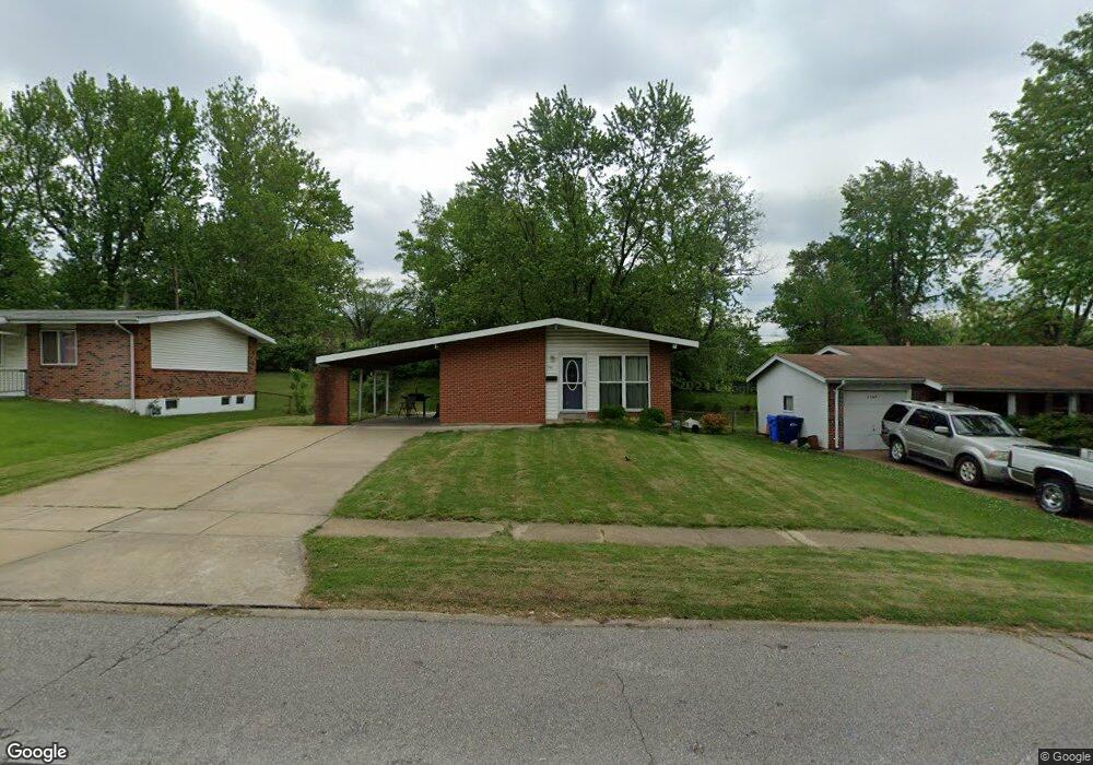
1155 Saint Anthony Ln Florissant, MO 63033
Estimated Value: $154,049 - $178,000
3
Beds
2
Baths
1,040
Sq Ft
$160/Sq Ft
Est. Value
About This Home
This home is located at 1155 Saint Anthony Ln, Florissant, MO 63033 and is currently estimated at $166,012, approximately $159 per square foot. 1155 Saint Anthony Ln is a home located in St. Louis County with nearby schools including Parker Road Elementary School, Cross Keys Middle School, and McCluer North High School.
Ownership History
Date
Name
Owned For
Owner Type
Purchase Details
Closed on
Jun 27, 2019
Sold by
Pelton Matthew and St Anthony Lane Trust
Bought by
Pelton Matthew and Pelton Ellen W
Current Estimated Value
Home Financials for this Owner
Home Financials are based on the most recent Mortgage that was taken out on this home.
Original Mortgage
$86,250
Outstanding Balance
$75,681
Interest Rate
4%
Mortgage Type
New Conventional
Estimated Equity
$90,331
Purchase Details
Closed on
Apr 20, 2017
Sold by
Hussmann Cynthea
Bought by
Hartman Alan and 1155 St Anthony Lane Trust
Purchase Details
Closed on
Sep 27, 2001
Sold by
Hussmann Harry and Hussmann Cynthea
Bought by
Hussmann Tara C and Hussmann Todd H
Create a Home Valuation Report for This Property
The Home Valuation Report is an in-depth analysis detailing your home's value as well as a comparison with similar homes in the area
Home Values in the Area
Average Home Value in this Area
Purchase History
| Date | Buyer | Sale Price | Title Company |
|---|---|---|---|
| Pelton Matthew | -- | Freedom Title Llc St Louis | |
| Hartman Alan | -- | None Available | |
| Hartmann Alan | -- | None Available | |
| Hussmann Tara C | -- | -- |
Source: Public Records
Mortgage History
| Date | Status | Borrower | Loan Amount |
|---|---|---|---|
| Open | Pelton Matthew | $86,250 |
Source: Public Records
Tax History Compared to Growth
Tax History
| Year | Tax Paid | Tax Assessment Tax Assessment Total Assessment is a certain percentage of the fair market value that is determined by local assessors to be the total taxable value of land and additions on the property. | Land | Improvement |
|---|---|---|---|---|
| 2025 | $1,792 | $28,310 | $6,190 | $22,120 |
| 2024 | $1,792 | $23,010 | $4,660 | $18,350 |
| 2023 | $1,786 | $23,010 | $4,660 | $18,350 |
| 2022 | $1,837 | $20,850 | $4,660 | $16,190 |
| 2021 | $1,806 | $20,850 | $4,660 | $16,190 |
| 2020 | $1,494 | $16,190 | $3,570 | $12,620 |
| 2019 | $1,465 | $16,190 | $3,570 | $12,620 |
| 2018 | $1,416 | $13,980 | $2,050 | $11,930 |
| 2017 | $1,409 | $13,980 | $2,050 | $11,930 |
| 2016 | $1,270 | $12,250 | $2,050 | $10,200 |
| 2015 | $1,277 | $12,250 | $2,050 | $10,200 |
| 2014 | $1,557 | $15,490 | $3,500 | $11,990 |
Source: Public Records
Map
Nearby Homes
- 265 Waterford Dr
- 375 Waterford Dr
- 415 Waterford Dr
- 12 Country Ln
- 190 Coteau Ln
- 2320 Allen Dr
- 785 Bobbins Ln
- 805 Derhake Rd
- 2505 Saint Catherine St
- 130 Dauphin Ln
- 2 Carson Ct
- 750 Robinwood Dr
- 3140 Saint Catherine St
- 2240 Brook Dr
- 2340 Saint Catherine St
- 505 Ridge Dr
- 105 Capri Dr
- 675 Pimlico Dr
- 670 Hargrove Ln
- 2700 Suffolk Place
- 1165 Saint Anthony Ln
- 1145 Saint Anthony Ln
- 1175 Saint Anthony Ln
- 1125 Saint Anthony Ln
- 2920 Holiday Hill Dr
- 2910 Holiday Hill Dr
- 290 Mohican Ln
- 2900 Holiday Hill Dr
- 1115 Saint Anthony Ln
- 1130 Saint Anthony Ln
- 325 Waterford Dr
- 2930 Holiday Hill Dr
- 345 Waterford Dr
- 2880 Holiday Hill Dr
- 1190 Saint Anthony Ln
- 270 Mohican Ln
- 1105 Saint Anthony Ln
- 275 Mohican Ln
- 1120 Saint Anthony Ln
- 2860 Holiday Hill Dr