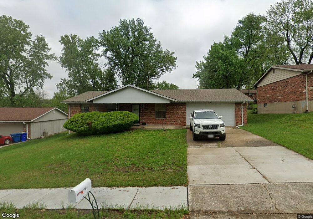
11553 Burgess Ave Bridgeton, MO 63044
Estimated Value: $249,074 - $285,000
3
Beds
2
Baths
1,160
Sq Ft
$233/Sq Ft
Est. Value
About This Home
This home is located at 11553 Burgess Ave, Bridgeton, MO 63044 and is currently estimated at $270,769, approximately $233 per square foot. 11553 Burgess Ave is a home located in St. Louis County with nearby schools including Bridgeway Elementary School, Pattonville Heights Middle School, and Pattonville High School.
Ownership History
Date
Name
Owned For
Owner Type
Purchase Details
Closed on
Sep 7, 2012
Sold by
Allen Doreen
Bought by
Allen Scottie Forrest
Current Estimated Value
Home Financials for this Owner
Home Financials are based on the most recent Mortgage that was taken out on this home.
Original Mortgage
$77,077
Interest Rate
3.25%
Mortgage Type
FHA
Purchase Details
Closed on
Jun 4, 2012
Sold by
Allen Scottie
Bought by
Allen Doreen
Purchase Details
Closed on
May 2, 2012
Sold by
Allen Doreen
Bought by
Allen Doreen and Allen Scottie
Create a Home Valuation Report for This Property
The Home Valuation Report is an in-depth analysis detailing your home's value as well as a comparison with similar homes in the area
Home Values in the Area
Average Home Value in this Area
Purchase History
| Date | Buyer | Sale Price | Title Company |
|---|---|---|---|
| Allen Scottie Forrest | -- | Insight Title | |
| Allen Doreen | -- | None Available | |
| Allen Doreen | -- | None Available |
Source: Public Records
Mortgage History
| Date | Status | Borrower | Loan Amount |
|---|---|---|---|
| Closed | Allen Scottie Forrest | $77,077 |
Source: Public Records
Tax History Compared to Growth
Tax History
| Year | Tax Paid | Tax Assessment Tax Assessment Total Assessment is a certain percentage of the fair market value that is determined by local assessors to be the total taxable value of land and additions on the property. | Land | Improvement |
|---|---|---|---|---|
| 2025 | $3,131 | $45,580 | $11,130 | $34,450 |
| 2024 | $3,131 | $38,580 | $9,410 | $29,170 |
| 2023 | $3,144 | $38,580 | $9,410 | $29,170 |
| 2022 | $2,733 | $30,230 | $7,700 | $22,530 |
| 2021 | $2,696 | $30,230 | $7,700 | $22,530 |
| 2020 | $2,751 | $29,950 | $7,700 | $22,250 |
| 2019 | $2,758 | $29,950 | $7,700 | $22,250 |
| 2018 | $2,472 | $24,740 | $5,130 | $19,610 |
| 2017 | $2,435 | $24,740 | $5,130 | $19,610 |
| 2016 | $2,252 | $22,480 | $5,130 | $17,350 |
| 2015 | $2,231 | $22,480 | $5,130 | $17,350 |
| 2014 | $2,370 | $23,790 | $6,230 | $17,560 |
Source: Public Records
Map
Nearby Homes
- 11525 Ivy Green Dr
- 11410 Essex Ave
- 11482 Essex Ave
- 11533 Old Saint Charles Rd
- 3202 Denmark Dr Unit C
- 3107 Garnette Dr Unit C12
- 3107 Garnette Dr Unit A7
- 3206 Denmark Dr Unit D
- 3106 Carnaby Ln Unit C
- 3137 Roger Williams Dr Unit A
- 3137 Roger Williams Dr Unit C
- 3142 Roger Williams Dr
- 3191 Donnycave Ln
- 11342 de Runtz Ave
- 3114 Edwards Place Unit 304
- 3623 Bridgeton Valley Cir
- 3108 Edwards Place Unit 201
- 3754 Red Hawk Ct
- 3151 Fort Samuel Ct
- 11140 Fort Samuel Dr
- 11549 Burgess Ave
- 11559 Burgess Ave
- 11546 Springford Ct
- 11550 Springford Ct
- 11537 Burgess Ave
- 11538 Springford Ct
- 11558 Springford Ct
- 11556 Burgess Ave
- 11563 Burgess Ave
- 11564 Burgess Ave
- 11548 Burgess Ave
- 11530 Springford Ct
- 11564 Springford Ct
- 11523 Burgess Ave
- 11540 Burgess Ave
- 11573 Burgess Ave
- 11574 Burgess Ave
- 11532 Burgess Ave
- 11539 Springford Ct
- 11547 Springford Ct