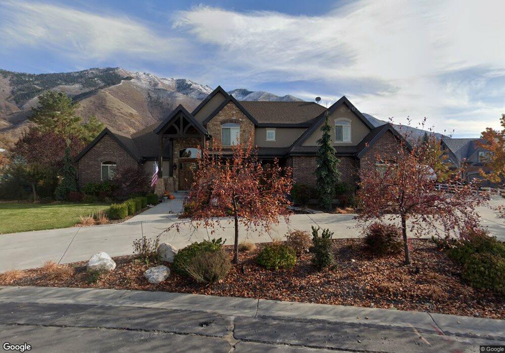
1156 Falcon Cir Unit 20 Mapleton, UT 84664
Estimated Value: $1,791,420 - $1,994,000
4
Beds
5
Baths
4,020
Sq Ft
$471/Sq Ft
Est. Value
About This Home
This home is located at 1156 Falcon Cir Unit 20, Mapleton, UT 84664 and is currently estimated at $1,892,710, approximately $470 per square foot. 1156 Falcon Cir Unit 20 is a home located in Utah County with nearby schools including Mapleton School, Mapleton Junior High School, and Maple Mountain High School.
Ownership History
Date
Name
Owned For
Owner Type
Purchase Details
Closed on
Aug 28, 2017
Sold by
Allan Jason D and Allan Kristin M
Bought by
Allan Jason and Allan Kristi
Current Estimated Value
Home Financials for this Owner
Home Financials are based on the most recent Mortgage that was taken out on this home.
Original Mortgage
$424,100
Outstanding Balance
$219,653
Interest Rate
3.96%
Mortgage Type
New Conventional
Estimated Equity
$1,673,057
Purchase Details
Closed on
Aug 14, 2012
Sold by
Ashman Tyler J and Ashman Tiffany P
Bought by
Allan Jason D and Allan Kristi M
Home Financials for this Owner
Home Financials are based on the most recent Mortgage that was taken out on this home.
Original Mortgage
$65,000
Interest Rate
3.56%
Mortgage Type
New Conventional
Purchase Details
Closed on
Sep 15, 2010
Sold by
Weeks Ronald D and Weeks Louise R
Bought by
Tiffany P Ashman Trust
Purchase Details
Closed on
Jan 9, 2009
Sold by
Ashman Tyler J and Ashman Tiffany P
Bought by
Weeks Ronald D and Weeks Louise R
Home Financials for this Owner
Home Financials are based on the most recent Mortgage that was taken out on this home.
Original Mortgage
$220,000
Interest Rate
5.97%
Mortgage Type
Seller Take Back
Purchase Details
Closed on
Mar 28, 2003
Sold by
Ashman Tyler J and Ashman Tiffany
Bought by
Ashman Tyler J and Ashman Tiffany P
Purchase Details
Closed on
Sep 11, 2001
Sold by
Hanshaw Timothy E and Hanshaw Rachelle A
Bought by
Ashman Tyler J and Ashman Tiffany
Home Financials for this Owner
Home Financials are based on the most recent Mortgage that was taken out on this home.
Original Mortgage
$110,000
Interest Rate
6.99%
Purchase Details
Closed on
Apr 30, 1999
Sold by
Sommerset Park Lc
Bought by
Hanshaw Timothy E and Hanshaw Rachelle A
Home Financials for this Owner
Home Financials are based on the most recent Mortgage that was taken out on this home.
Original Mortgage
$97,500
Interest Rate
6.98%
Create a Home Valuation Report for This Property
The Home Valuation Report is an in-depth analysis detailing your home's value as well as a comparison with similar homes in the area
Home Values in the Area
Average Home Value in this Area
Purchase History
| Date | Buyer | Sale Price | Title Company |
|---|---|---|---|
| Allan Jason | -- | Key Land Title | |
| Allan Jason D | -- | Inwest Title Services Inc | |
| Tiffany P Ashman Trust | -- | Accommodation | |
| Weeks Ronald D | -- | Title West Spanish Fork O | |
| Ashman Tyler J | -- | -- | |
| Ashman Tyler J | -- | Pro Title & Escrow Inc | |
| Hanshaw Timothy E | -- | Mountain West Title Co |
Source: Public Records
Mortgage History
| Date | Status | Borrower | Loan Amount |
|---|---|---|---|
| Open | Allan Jason | $424,100 | |
| Closed | Allan Jason D | $65,000 | |
| Previous Owner | Weeks Ronald D | $220,000 | |
| Previous Owner | Ashman Tyler J | $110,000 | |
| Previous Owner | Hanshaw Timothy E | $97,500 |
Source: Public Records
Tax History
| Year | Tax Paid | Tax Assessment Tax Assessment Total Assessment is a certain percentage of the fair market value that is determined by local assessors to be the total taxable value of land and additions on the property. | Land | Improvement |
|---|---|---|---|---|
| 2025 | $8,253 | $922,360 | -- | -- |
| 2024 | $8,253 | $808,515 | $0 | $0 |
| 2023 | $8,179 | $806,260 | $0 | $0 |
| 2022 | $7,959 | $1,380,400 | $630,700 | $749,700 |
| 2021 | $6,356 | $927,100 | $350,400 | $576,700 |
| 2020 | $6,224 | $880,100 | $325,600 | $554,500 |
| 2019 | $5,963 | $860,100 | $305,600 | $554,500 |
| 2018 | $5,830 | $803,100 | $290,800 | $512,300 |
| 2017 | $5,520 | $412,065 | $0 | $0 |
| 2016 | $4,916 | $364,760 | $0 | $0 |
| 2015 | $4,379 | $322,960 | $0 | $0 |
| 2014 | $2,473 | $179,120 | $0 | $0 |
Source: Public Records
Map
Nearby Homes
- 644 S 1330 E
- 4021 S Ironwood Ln Unit 428
- 4886 S Englemann Ln Unit 525
- 2254 715 S Unit 60
- 4013 S Ironwood Ln Unit 432
- 4014 S Ironwood Ln
- 4001 S Ironwood Ln Unit 438
- 2254 715 S
- 4012 S Ironwood Ln Unit 424
- 2042 715 S Unit 57
- 4019 S Ironwood Ln Unit 429
- 2042 715 S
- 1759 S Perry Dr
- 575 S 1560 E
- 753 Sierra View Dr
- 748 Sierra View Dr
- 1377 E Maple St
- 745 E Maple St
- 1974 S Preserve Dr Unit 56
- 1906 S Preserve Dr
- 1156 Falcon Cir
- 1171 E Falcon St Unit 16
- 1190 E Falcon St
- 1190 Falcon Cir
- 1112 Falcon Cir
- 1171 Falcon Cir
- 1117 Falcon Cir
- 1090 Falcon Cir
- 834 S 1250 E
- 875 S 1250 E
- 696 S 1200 E
- 1005 S 800 E
- 930 S 1250 E
- 905 S 1250 E
- 1086 Hawks Rest Dr
- 1086 Hawks Rest Dr
- 922 S 1000 E
- 1376 E 715 S
- 710 715 S
- 710 715 S Unit J201
Your Personal Tour Guide
Ask me questions while you tour the home.