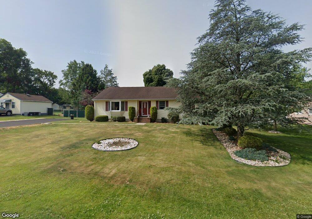
1156 Hawthorne Rd Bensalem, PA 19020
Estimated Value: $353,290 - $414,000
3
Beds
2
Baths
1,200
Sq Ft
$310/Sq Ft
Est. Value
About This Home
This home is located at 1156 Hawthorne Rd, Bensalem, PA 19020 and is currently estimated at $371,573, approximately $309 per square foot. 1156 Hawthorne Rd is a home located in Bucks County with nearby schools including School Lane Charter School, St. Ephrem School, and De La Salle Vocational School.
Ownership History
Date
Name
Owned For
Owner Type
Purchase Details
Closed on
Aug 26, 2025
Sold by
Shoudt William Phillip
Bought by
Litvinenko Lauren Ashley and Litvinenko Zachary
Current Estimated Value
Home Financials for this Owner
Home Financials are based on the most recent Mortgage that was taken out on this home.
Original Mortgage
$388,000
Outstanding Balance
$388,000
Interest Rate
6.74%
Mortgage Type
New Conventional
Estimated Equity
-$16,427
Purchase Details
Closed on
Aug 6, 1980
Sold by
Memis Billy S and Memis Kathleen F
Bought by
Shoudt William and Shoudt Judith
Create a Home Valuation Report for This Property
The Home Valuation Report is an in-depth analysis detailing your home's value as well as a comparison with similar homes in the area
Home Values in the Area
Average Home Value in this Area
Purchase History
| Date | Buyer | Sale Price | Title Company |
|---|---|---|---|
| Litvinenko Lauren Ashley | $400,000 | None Listed On Document | |
| Shoudt William | $48,500 | -- |
Source: Public Records
Mortgage History
| Date | Status | Borrower | Loan Amount |
|---|---|---|---|
| Open | Litvinenko Lauren Ashley | $388,000 |
Source: Public Records
Tax History Compared to Growth
Tax History
| Year | Tax Paid | Tax Assessment Tax Assessment Total Assessment is a certain percentage of the fair market value that is determined by local assessors to be the total taxable value of land and additions on the property. | Land | Improvement |
|---|---|---|---|---|
| 2025 | $2,096 | $9,600 | $2,840 | $6,760 |
| 2024 | $2,096 | $9,600 | $2,840 | $6,760 |
| 2023 | $2,037 | $9,600 | $2,840 | $6,760 |
| 2022 | $2,025 | $9,600 | $2,840 | $6,760 |
| 2021 | $2,025 | $9,600 | $2,840 | $6,760 |
| 2020 | $2,004 | $9,600 | $2,840 | $6,760 |
| 2019 | $1,960 | $9,600 | $2,840 | $6,760 |
| 2018 | $1,914 | $9,600 | $2,840 | $6,760 |
| 2017 | $1,902 | $9,600 | $2,840 | $6,760 |
| 2016 | $1,902 | $9,600 | $2,840 | $6,760 |
| 2015 | -- | $9,600 | $2,840 | $6,760 |
| 2014 | -- | $9,600 | $2,840 | $6,760 |
Source: Public Records
Map
Nearby Homes
- 4783 Meeting Rd
- 1100 Wayland Ave
- 953 Farley Rd
- 938 Ashton Rd
- 446 N Mount Vernon Cir Unit 446
- 435 N Mount Vernon Cir Unit 435
- 419 Rutgers Ct
- 393 Rutgers Ct Unit 393
- 389 Rutgers Ct Unit 389
- 580 S Mount Vernon Cir
- 5110 Bay Rd
- 1440 Atterbury Way
- 5107 Leeward Rd
- 5102 Lighthouse Ln
- 5217 Bay Rd
- 801 Cliff Rd
- 4744 Dunston Rd
- L:15 Dunston Rd
- 1881 Byberry Rd
- 1446 Gibson Rd Unit D50
- 1206 Hawthorne Rd
- 1152 Hawthorne Rd
- 1169 Hawthorne Rd
- 1169 Harwood Rd
- 1169 Harwood Rd
- 1138 Hawthorne Rd
- 1155 Hawthorne Rd
- 1212 Hawthorne Rd
- 1205 Hawthorne Rd
- 1167 Harwood Rd
- 1221 Hawthorne Rd
- 1211 Harwood Rd
- 1137 Hawthorne Rd
- 1233 Hawthorne Rd
- 1124 Hawthorne Rd
- 1220 Hawthorne Rd
- 1137 Harwood Rd
- 1215 Harwood Rd
- 1125 Hawthorne Rd
- 1146 Harwood Rd