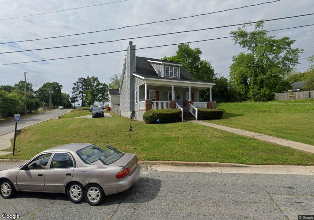
1156 Plant St Macon, GA 31201
Estimated Value: $139,467 - $212,000
2
Beds
2
Baths
1,512
Sq Ft
$117/Sq Ft
Est. Value
About This Home
This home is located at 1156 Plant St, Macon, GA 31201 and is currently estimated at $176,867, approximately $116 per square foot. 1156 Plant St is a home located in Bibb County with nearby schools including Ingram-Pye Elementary School, Southwest High School, and Cirrus Charter Academy.
Ownership History
Date
Name
Owned For
Owner Type
Purchase Details
Closed on
Mar 21, 2008
Sold by
The Housing Authority Of The & City Of M
Bought by
Rutherford Doris B
Current Estimated Value
Home Financials for this Owner
Home Financials are based on the most recent Mortgage that was taken out on this home.
Original Mortgage
$53,680
Outstanding Balance
$33,700
Interest Rate
5.97%
Mortgage Type
Purchase Money Mortgage
Estimated Equity
$143,167
Create a Home Valuation Report for This Property
The Home Valuation Report is an in-depth analysis detailing your home's value as well as a comparison with similar homes in the area
Home Values in the Area
Average Home Value in this Area
Purchase History
| Date | Buyer | Sale Price | Title Company |
|---|---|---|---|
| Rutherford Doris B | $88,000 | None Available |
Source: Public Records
Mortgage History
| Date | Status | Borrower | Loan Amount |
|---|---|---|---|
| Open | Rutherford Doris B | $53,680 |
Source: Public Records
Tax History Compared to Growth
Tax History
| Year | Tax Paid | Tax Assessment Tax Assessment Total Assessment is a certain percentage of the fair market value that is determined by local assessors to be the total taxable value of land and additions on the property. | Land | Improvement |
|---|---|---|---|---|
| 2025 | $874 | $50,135 | $4,445 | $45,690 |
| 2024 | $1,096 | $50,135 | $4,445 | $45,690 |
| 2023 | $1,095 | $50,135 | $4,445 | $45,690 |
| 2022 | $1,032 | $36,812 | $3,083 | $33,729 |
| 2021 | $1,069 | $35,126 | $3,083 | $32,043 |
| 2020 | $1,092 | $35,126 | $3,083 | $32,043 |
| 2019 | $1,101 | $35,126 | $3,083 | $32,043 |
| 2018 | $1,866 | $35,126 | $3,083 | $32,043 |
| 2017 | $1,054 | $35,126 | $3,083 | $32,043 |
| 2016 | $973 | $35,126 | $3,083 | $32,043 |
| 2015 | $1,378 | $35,126 | $3,083 | $32,043 |
| 2014 | $1,636 | $35,126 | $3,083 | $32,043 |
Source: Public Records
Map
Nearby Homes
- 1875 College Dr
- 1905 College Dr
- 1876 College St
- 1894 College St
- 1852 College St
- 1881 College St
- 1252 Sherwood Dr
- 1915 College Dr
- 1840 College St
- 1274 Sherwood Dr
- 0 College Dr Unit 7043581
- 0 College Dr
- 1925 College Dr
- 1865 College St
- 1849 College St
- 1835 College St
- 1905 College St
- 1917 College St
- 1945 College St
- 1300 Mercer University Dr