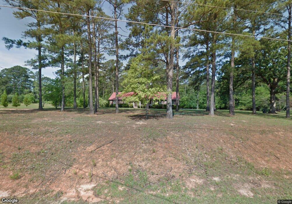
1156 Rainey Rd Macon, GA 31220
Estimated Value: $216,090 - $263,000
3
Beds
2
Baths
1,682
Sq Ft
$146/Sq Ft
Est. Value
About This Home
This home is located at 1156 Rainey Rd, Macon, GA 31220 and is currently estimated at $245,023, approximately $145 per square foot. 1156 Rainey Rd is a home located in Bibb County with nearby schools including Heritage Elementary School, Weaver Middle School, and Westside High School.
Ownership History
Date
Name
Owned For
Owner Type
Purchase Details
Closed on
May 25, 2017
Sold by
Petree Michael R
Bought by
Kelley Paul R and Kelley Mary Anne
Current Estimated Value
Purchase Details
Closed on
Nov 24, 2015
Sold by
Garnto Brenda
Bought by
Petree Michael R
Purchase Details
Closed on
Aug 28, 2015
Sold by
Garnto Travis
Bought by
Garnto Brenda
Purchase Details
Closed on
Aug 25, 2015
Sold by
Garnto Charles & Brenda By Admin
Bought by
Garnto Travis
Purchase Details
Closed on
Feb 11, 1994
Sold by
Dial Joe K
Bought by
Garnto Charles and Garnto Brenda
Create a Home Valuation Report for This Property
The Home Valuation Report is an in-depth analysis detailing your home's value as well as a comparison with similar homes in the area
Home Values in the Area
Average Home Value in this Area
Purchase History
| Date | Buyer | Sale Price | Title Company |
|---|---|---|---|
| Kelley Paul R | $108,000 | None Available | |
| Kelley Paul R | $108,000 | -- | |
| Petree Michael R | $75,000 | -- | |
| Garnto Brenda | -- | -- | |
| Garnto Travis | -- | -- | |
| Garnto Charles | $92,000 | -- |
Source: Public Records
Tax History Compared to Growth
Tax History
| Year | Tax Paid | Tax Assessment Tax Assessment Total Assessment is a certain percentage of the fair market value that is determined by local assessors to be the total taxable value of land and additions on the property. | Land | Improvement |
|---|---|---|---|---|
| 2025 | $1,535 | $62,479 | $7,212 | $55,267 |
| 2024 | $1,587 | $62,479 | $7,212 | $55,267 |
| 2023 | $1,281 | $50,433 | $5,245 | $45,188 |
| 2022 | $1,733 | $50,049 | $10,975 | $39,074 |
| 2021 | $1,902 | $50,049 | $10,975 | $39,074 |
| 2020 | $1,943 | $50,049 | $10,975 | $39,074 |
| 2019 | $1,665 | $50,049 | $10,975 | $39,074 |
| 2018 | $2,770 | $50,049 | $10,975 | $39,074 |
| 2017 | $1,934 | $51,607 | $9,223 | $42,384 |
| 2016 | $1,785 | $51,607 | $9,223 | $42,384 |
| 2015 | $1,916 | $51,607 | $9,223 | $42,384 |
| 2014 | $1,919 | $51,607 | $9,223 | $42,384 |
Source: Public Records
Map
Nearby Homes
- 1390 Royalwyn Dr
- 6591 Thomaston Rd
- 1129 Santa fe Trail
- 1422 Trails End Dr
- 1412 Johnson Rd
- 933 Chisholm Trail
- 2037 Greentree Pkwy
- 1396 King Arthur Dr
- 941 Galahad Cir
- 1369 King Arthur Dr
- 153 Montrose Dr
- 2268 Unaliyi Trail
- 109 Greentree Pkwy
- 2186 Natsihi Trail
- 1776 Bridle
- 103 Dorchester Ct
- 1751 Bridle Ln
- 1698 Greentree Pkwy
- 6806 Bay Point Dr
- 102 Fordham Ct
- 1176 Rainey Rd
- 6718 Thomaston Rd
- 1226 Rainey Rd
- 6686 Thomaston Rd
- 1511 Tudor Ct
- 1535 Tudor Ct
- 1217 Johnson Rd
- 1488 Royalwyn Ct
- 1437 Queen Anns Ln
- 6780 Thomaston Rd
- 1500 Tudor Ct
- 1551 Tudor Ct
- 1477 Queen Anns Ln
- 1528 Tudor Ct
- 1456 Royalwyn Ct
- 1473 Royalwyn Ct
- 1550 Tudor Ct
- 1155 Johnson Rd
- 1175 Johnson Rd
- 1426 Queen Anns Ln